The Northwest Territories — 1.35 million km² of boreal forest, tundra, and Arctic archipelago north of the 60th parallel — is one of the world’s last remaining frontier destinations: a jurisdiction of 45,000 people (half of them Indigenous, primarily Dene, Inuit, and Métis) spread across a territory larger than BC and Alberta combined, where the Mackenzie River (the second-longest in North America) drains a watershed the size of Western Europe to the Beaufort Sea, and where the aurora borealis illuminates winter nights with electromagnetic curtains of green, purple, and red that have made Yellowknife one of the world’s most recognized aurora viewing destinations. Travel to the Northwest Territories is an act of genuine commitment — most communities are accessible only by air or winter ice road — but the reward is a landscape of a scale and a wildness that is available nowhere else in North America: the Nahanni National Park Reserve’s Virginia Falls (twice the height of Niagara), the Mackenzie Delta’s labyrinth of channels and lakes, and the Thelon Wildlife Sanctuary’s barren ground caribou herds represent a natural world largely unchanged since the last ice age.
Yellowknife: The Aurora Capital
Yellowknife (21,000), the territorial capital on the north shore of Great Slave Lake, is the NWT’s only significant city and the gateway to the territory’s wilderness experiences. Founded as a gold mining town in the 1930s (the Giant and Con mines dominated the local economy for 50 years), Yellowknife has evolved into a government and mining services city where the territorial public service, the diamond mining industry (Ekati and Diavik mine offices), and the outdoor tourism economy coexist in a subarctic environment that tests and rewards its residents in equal measure. The city’s Old Town district (wooden heritage buildings on the rocky knolls above Great Slave Lake, the Back Bay houseboat community) and the modern downtown (the Prince of Wales Northern Heritage Centre, the Legislative Assembly Building with its igloo-inspired dome) reflect the tension between the gold rush past and the contemporary capital present. The frame Lake Trail (the urban walking/skiing loop around Frame Lake in the city centre) and the Great Slave Lake lakeshore provide immediate outdoor access that justifies the city’s “Life is Better Here” slogan for those who embrace the subarctic lifestyle.
Aurora Borealis: The World’s Best Display
Yellowknife sits directly under the auroral oval — the ring of electromagnetic activity that produces the most intense and frequent aurora borealis on earth:
- Aurora season: The aurora is visible from late August through mid-April when the sky is dark enough; the peak season for tour operators is January–March, when long nights and the highest frequency of aurora events coincide; clear skies are more frequent in the winter continental air mass over Yellowknife than in the coastal climates of Norway or Iceland
- Aurora viewing lodges: The Aurora Village (heated tepee complex 20 minutes from Yellowknife), the Blachford Lake Lodge (fly-in wilderness resort 100km east of Yellowknife on Blachford Lake), and the Prelude Lake Territorial Park cabins provide structured aurora viewing experiences with heated facilities; most tours include a 3-hour minimum viewing window on clear nights
- Japanese aurora tourism: Japan is the primary international market for Yellowknife aurora tourism; the city receives thousands of Japanese visitors annually who have planned their trips around specific aurora visibility requirements; the tourism infrastructure reflects this market, with Japanese-speaking guides and Japanese-food-option restaurants in several downtown establishments
- Aurora forecasting: Yellowknife’s aurora forecast services (SpaceWeatherLive, NOAA’s Space Weather Prediction Center) provide 1–3 day aurora probability forecasts useful for planning optimal viewing nights; the KP index (3+ for regular aurora, 5+ for displays extending to southern skies) determines the quality of the display

Nahanni National Park Reserve
Nahanni National Park Reserve (30,000km² in the Mackenzie Mountains of the western NWT) is Canada’s first UNESCO World Heritage Site — a canyon wilderness of exceptional geological drama and extreme remoteness:
- Virginia Falls: The South Nahanni River’s 96-metre plunge (twice the height of Niagara Falls, with four times the volume) is the centrepiece of the Nahanni experience; accessible by floatplane from Fort Simpson or Watson Lake (Yukon); canoe and whitewater raft trips descend the canyon below Virginia Falls to Nahanni Butte
- South Nahanni River canoe route: The 550km canoe route from Tungsten (Yukon) to Nahanni Butte — 3–4 weeks of wilderness paddling through Class IV whitewater canyons, hot springs (the Rabbitkettle tufa mounds and the Kraus Hot Springs), and the karst topography of the Nahanni Plateau — is considered one of the world’s great wilderness canoe trips; the remoteness (floatplane access only, no road) is absolute
- Wilderness access: Nahanni’s 30,000km² encompasses one of North America’s finest intact wilderness ecosystems; the park expansion of 2009 tripled the original park boundary to include headwater areas critical for woodland caribou, Dall’s sheep, and grizzly bear populations
Great Slave Lake and the Mackenzie Region
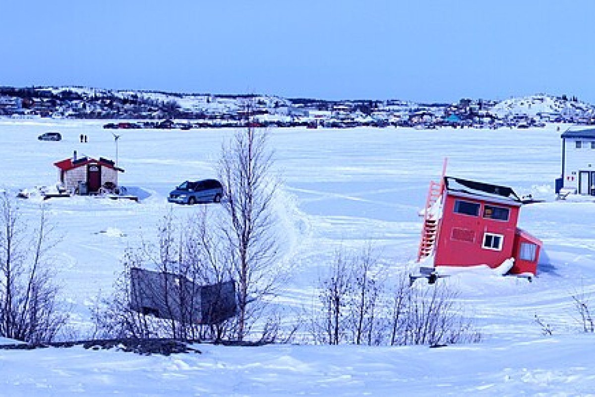
- Great Slave Lake: The deepest lake in North America (614m) and the tenth-largest lake in the world provides Yellowknife’s outdoor recreation foundation — lake trout fishing (world-record-class fish in the East Arm), northern pike, whitefish, and the ice road to communities on the far shore that operates as a highway in winter when the lake freezes to 1.5m
- Mackenzie River: The 4,241km river system from Great Slave Lake to the Beaufort Sea passes through Fort Simpson, Wrigley, Fort Providence, and the Mackenzie Delta communities; the Deh Cho Trail (the highway system paralleling the Mackenzie from Yellowknife to the Alberta border) provides road access to the river communities; the Mackenzie River Journey (paddling the river’s length) is one of Canada’s most ambitious wilderness experiences
- Dempster Highway: The gravel highway from Dawson City, Yukon to Inuvik, NWT (736km) crosses the continental divide and the Richardson Mountains before descending to the Mackenzie Delta; the Inuvik to Tuktoyaktuk Highway (140km, opened 2017 as Canada’s first all-season road to the Arctic Ocean) extends the system to Tuktoyaktuk on the Beaufort Sea — Canada’s only road to the Arctic Ocean
Frequently Asked Questions
What is Yellowknife and why is it the world’s premier aurora borealis destination?
Yellowknife (21,000 residents), the Northwest Territories’ capital on the north shore of Great Slave Lake, sits directly under the auroral oval — the ring of electromagnetic activity that produces the most intense and frequent aurora borealis on Earth. The aurora is visible from late August through mid-April when skies are dark; the peak season is January–March, when long nights and the highest frequency of aurora events coincide. Yellowknife’s continental winter climate produces clearer skies more frequently than the coastal climates of Norway or Iceland, making aurora sightings statistically more reliable. Japan is the primary international market for Yellowknife aurora tourism — thousands of Japanese visitors plan trips specifically to meet aurora visibility requirements. The Aurora Village (heated tepee viewing complex) and the Blachford Lake Lodge (fly-in wilderness resort) are the premier viewing experiences.
What is Nahanni National Park Reserve and why is it significant?
Nahanni National Park Reserve (30,000km² in the Mackenzie Mountains of the western NWT) was Canada’s first UNESCO World Heritage Site — a canyon wilderness of exceptional geological drama and absolute remoteness. Virginia Falls, on the South Nahanni River, plunges 96 metres — twice the height of Niagara Falls — in a remote canyon accessible only by floatplane from Fort Simpson. The South Nahanni River canoe route (550km from Tungsten, Yukon to Nahanni Butte — 3–4 weeks of wilderness paddling through Class IV whitewater canyons, hot springs including the Rabbitkettle tufa mounds, and karst topography) is considered one of the world’s great wilderness canoe journeys. The 2009 park expansion tripled the original boundary, protecting critical woodland caribou, Dall’s sheep, and grizzly bear habitat.
What does Great Slave Lake offer visitors?
Great Slave Lake — the deepest lake in North America at 614 metres and the world’s tenth-largest lake — provides Yellowknife’s outdoor recreation foundation. World-record-class lake trout inhabit the East Arm; northern pike, whitefish, and Arctic grayling complete one of Canada’s finest freshwater fishing environments. In winter, the lake freezes to 1.5 metres and becomes an ice road highway connecting Yellowknife to communities on the far shore — the Yellowknife to Dettah ice road is one of the world’s most photographed winter roads. The Ingraham Trail (the only highway north of Yellowknife) connects a series of territorial park lakes — Prelude, Hidden, and Reid — for summer canoeing and winter ice fishing within 30 minutes of the capital.
What is the Dempster Highway and what does it lead to?
The Dempster Highway, a 736km gravel road from Dawson City, Yukon to Inuvik, NWT, is one of North America’s great wilderness drives — crossing the continental divide and the Richardson Mountains before descending to the Mackenzie Delta, the highway passes through landscapes of permafrost tundra, boreal forest, and mountain scenery of extraordinary remoteness. In 2017, the Inuvik to Tuktoyaktuk Highway (140km, Canada’s first all-season road to the Arctic Ocean) extended the system to the Beaufort Sea — making Canada’s only road to the Arctic Ocean. Tuktoyaktuk, the endpoint, is the only place in Canada where you can drive to the Arctic Ocean. The Dempster is passable May through November with a high-clearance vehicle; two ferry crossings (the Peel and Mackenzie rivers) are required.
How do you travel to the Northwest Territories and what should you prepare for?
The Northwest Territories is genuinely frontier travel — 45,000 people spread across 1.35 million km², with most communities accessible only by air or winter ice road. Yellowknife is served by Air Canada and Canadian North from Edmonton and Calgary (2-hour flight); the Deh Cho Trail (Highway 1 from Edmonton through High Level, Alberta to Yellowknife) provides the only road access to the territorial capital — a 1,500km drive through the boreal forest. Nahanni National Park Reserve is floatplane-access only. The aurora season (January–March) requires booking 6–12 months in advance at the Aurora Village and Blachford Lake Lodge. Temperatures reach -40°C in January; proper Arctic clothing is non-negotiable. The territory’s remoteness, Indigenous communities, and wildlife require respectful and well-prepared visitors.