New Brunswick’s outdoor recreation is defined by the Bay of Fundy — the world’s highest tides (up to 16 metres at the head of the bay, in the Minas Basin and the inner reaches of Chignecto Bay) reshape the coastline twice daily through a cycle of exposure and flooding with no equivalent on any other open coast on Earth. The province’s outdoor identity reaches well beyond the Fundy shore: the Fundy Trail Parkway’s cliff-edge route, the Acadian Peninsula’s warm-water beaches and kayaking, the Appalachian Highlands of the interior, and the Saint John River’s 673-kilometre paddleable corridor from the Quebec–Maine headwaters to the Bay of Fundy. New Brunswick is a province where its signature adventures — walking on the ocean floor at Hopewell Rocks, kayaking between sea stacks at high tide, hiking the coastal cliffs of the Fundy Trail — come without the backcountry preparation that comparable wilderness would demand in British Columbia or the Yukon.
The Bay of Fundy: World’s Highest Tides
The bay’s tidal range comes from a resonance between its natural oscillation frequency and the Atlantic Ocean’s tidal rhythm — a geographic accident that produces the planet’s most extreme tides:
- Hopewell Rocks Provincial Park: New Brunswick’s busiest natural attraction — the flowerpot rock formations at Hopewell Cape, carved by the Fundy tides from the red Pennsylvanian sandstone of the upper bay; visitors walk on the ocean floor at low tide among towers 12 to 21 metres tall, then kayak between the same formations at high tide; the roughly 6-hour swing between low and high water makes for an oddly precise visiting schedule by Canadian standards
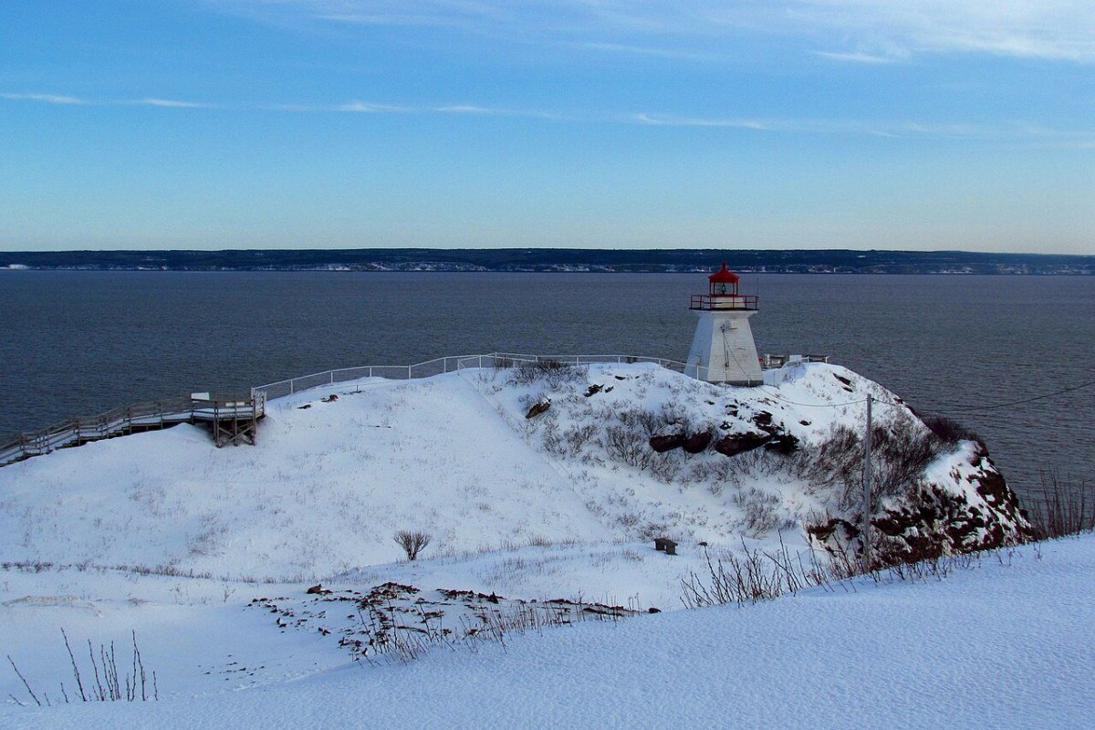
- Cape Enrage: A lighthouse headland on Chignecto Bay, about 45 minutes’ drive from Hopewell Rocks via Waterside; rappelling on the 46-metre cliff face, the 183-metre zip line across the lighthouse valley, and kayak tours on the Fundy shore (note: the site has periodically closed seasons — confirm current-year operations before travel); the flat exposed at low tide runs well over a kilometre seaward, and the interpretive centre lays out the geology behind the Fundy’s tides
- Mary’s Point: An internationally important shorebird staging ground on the upper Bay of Fundy; the mudflats bared at low tide concentrate semipalmated sandpipers and other species in numbers that once reached up to two million birds during the late July–August migration (recent counts have trended lower, but the site still holds a globally meaningful share of the population); the Mary’s Point Shorebird Reserve ranks among the province’s premier wildlife-watching spots
- Fundy Biosphere Reserve: This UNESCO reserve spans the upper Bay of Fundy ecosystem, including the Shepody Bay Ramsar wetlands and the Shepody National Wildlife Area
The Fundy Trail Parkway
The Fundy Trail Parkway — a 30-kilometre coastal scenic road with about 10 kilometres of pedestrian and bicycle trail running parallel to the cliffs between St. Martins and Big Salmon River — is New Brunswick‘s easiest doorway into true coastal wilderness:
- Big Salmon River: A steep descent stair-trail from the parkway drops to the heritage salmon camp at the river’s edge, where the estuary’s salmon pool is visible at low water; the river-mouth suspension footbridge (84 metres long) crosses to the far bank, though it has been closed for renovations during the 2025–2026 season — confirm its status before relying on it for the crossing; backcountry camping here is among the province’s hardest reservations to land
- Melvin Beach and Long Beach: Two sea-level beaches reached by trail descent from the cliff-top road; Long Beach offers the parkway’s best shore walking, with sea-polished rock formations and the cold, clear water of the outer Bay
- Fundy Footpath wilderness extension: Beyond Big Salmon River, the 41-kilometre Fundy Footpath carries on to Fundy National Park through some of Atlantic Canada’s wildest coastline — a 3-to-5-day route that demands stream crossings timed to the tides, off-trail navigation, and serious backcountry skill
- Cycling and the multi-use trail: The parallel path handles mountain biking on its cliff-top sections, while the road itself, with more than 20 lookout pull-offs, draws cycle-tourists for the climb

The Acadian Coast and Northumberland Strait
Northeastern New Brunswick’s Acadian Peninsula and Northumberland Strait coastline deliver the province’s warmest outdoor recreation — a sharp contrast to the cold Fundy shore:
- Parlee Beach Provincial Park: The Northumberland Strait beach at Pointe-du-Chêne near Shediac is widely regarded as Canada’s warmest saltwater swimming spot — the shallow, sun-warmed strait routinely reaches the low-to-mid 20s °C in July and August (with peak days climbing higher), the warmest ocean water north of the Carolinas on the Atlantic coast; wide sand and the Shediac Lobster Festival (early July) draw more summer visitors than any other beach in the province
- Miscou Island: A lighthouse marks the tip of the Acadian Peninsula, alongside a peat-bog boardwalk trail, warm Chaleur Bay swimming, and migratory-bird concentrations that turn Miscou into a noted shorebird and raptor watching site each autumn; its isolated character and single-bridge access give it a far-flung feel out of proportion to the short drive from Caraquet
- Chaleur Bay sea kayaking: The sheltered waters between the Acadian Peninsula and Quebec’s Gaspé Peninsula make for superb sea kayaking — warm water, tides far gentler than the Fundy, and the rugged Gaspé shoreline as backdrop; rentals and guided tours run from Bathurst and Caraquet
- Kouchibouguac National Park: A 238-square-kilometre park of barrier islands, lagoons, salt marshes, and Acadian forest on the Northumberland Strait south of Miramichi; paddlers thread the lagoon system, cyclists ride the Bog Trail boardwalk and the park’s wider 60-kilometre bike network, and grey-seal colonies along the 25-kilometre barrier-island chain are best seen by kayak or guided boat; the warm lagoon water gives this park a swimming experience unlike any other protected area in New Brunswick
Saint John River and Interior Adventures
- Saint John River paddling: Running 673 kilometres from the Quebec–Maine headwaters to the Bay of Fundy at Saint John, this river opens a multi-day paddling corridor through the agricultural heartland of New Brunswick; the broad, lake-like reaches above Fredericton and the Grand Lake system suit flat-water canoe and kayak touring, while the Reversing Falls Rapids (the tidal rapids where the river meets the bay) at the harbour mouth mark the dramatic tidal end of the route
- Mount Carleton Provincial Park: Set in the Appalachian Highlands of north-central New Brunswick, Mount Carleton (820 metres) is the highest peak in the Maritime provinces; the Sagamook Trail (about 8 kilometres return) and the summit trail climb through a subalpine setting unusual for Atlantic Canada; a lake-dotted interior and Dark Sky Preserve designation make this the province’s standout backcountry park
- International Appalachian Trail (IAT): This long-distance route runs from the US Appalachians through New Brunswick to Quebec’s Gaspé Peninsula; the New Brunswick leg crosses the interior highlands, linking Mount Carleton to the Quebec border through remote boreal forest and ridge terrain
- River Valley Scenic Drive: The Saint John River heritage drive from Edmundston to Fredericton follows the agricultural corridor through the Madawaska, Victoria, Carleton, and York county valleys — covered bridges (New Brunswick has 58 of them, the largest concentration in Canada), the Kings Landing Historical Settlement near Fredericton, and the Hartland Covered Bridge (the longest covered bridge in the world at 391 metres) supply the heritage and scenery for cycling and driving tourism
Frequently Asked Questions
Why is the Bay of Fundy New Brunswick’s defining natural experience?
The Bay of Fundy — the inlet separating New Brunswick from Nova Scotia — has the highest tidal range of any body of water on Earth, the result of a resonance between the bay’s natural oscillation frequency (about 12.4 hours) and the Atlantic Ocean’s tidal rhythm. Tides at the inner bay (the Minas Basin in Nova Scotia and the upper reaches of Chignecto Bay in New Brunswick) reach roughly 16 metres — a four-storey building rising and falling twice daily. The outdoor experiences this creates are genuinely rare. At Hopewell Rocks Provincial Park (Hopewell Cape, about 40 kilometres south of Moncton), visitors walk on the ocean floor at low tide among flowerpot rock towers 12 to 21 metres tall, carved from red Pennsylvanian sandstone, then kayak between the same formations at high tide — a sequence you can do in few other places in North America. Cape Enrage (a lighthouse headland on Chignecto Bay, roughly 45 minutes’ drive from Hopewell Rocks) has long offered rappelling and zip-lining on the Fundy cliffs and kayaking tours on the shore; the site has periodically closed seasons, so confirm current operations. The tidal bore — the leading wave of the incoming tide — travels up the Petitcodiac River into Moncton as a visible wave, viewable from Bore Park on the riverfront and counted among Canada’s stranger urban natural phenomena.
What can you do along the Fundy Trail Parkway?
The Fundy Trail Parkway is a 30-kilometre coastal scenic road along the Bay of Fundy cliffs between St. Martins and Big Salmon River, with about 10 kilometres of pedestrian and bicycle trail running parallel to the cliff edge and access to more than 20 marked lookouts. From the road and trail, visitors look down on the Fundy shore from cliff edges that approach 100 metres above the sea, taking in tidal flats bared at low tide and beaches you can reach only at low water. The Big Salmon River suspension footbridge (84 metres long) crosses to the historic fishing settlement at the river mouth and one of the province’s most remote vehicle-accessible beaches, though it has been closed for renovations during the 2025–2026 season — check its status before counting on the crossing. Beyond the parkway, the 41-kilometre Fundy Footpath (3 to 5 days, from Big Salmon River to Fundy National Park) is the toughest coastal trail in New Brunswick, calling for stream crossings, tidal timing, and wilderness navigation skills.
What is there to do at Fundy National Park?
Fundy National Park covers 206 square kilometres on the New Brunswick side of the Bay of Fundy, reached from the Trans-Canada Highway via Sussex (about 100 kilometres east of Saint John). It is the province’s most rounded national park experience: coastal hiking, freshwater lakes in the interior, and the Fundy shore’s tidal drama packed into a compact park with both developed and backcountry infrastructure. The Dickson Falls trail (1.5-kilometre loop, partially accessible, through old-growth Acadian forest to a series of tiered falls) draws more walkers than any other short trail here. The Coastal Trail (about 10 kilometres point-to-point between Herring Cove and Point Wolfe) pairs Fundy cliff scenery with easy walking better than anything else in the park. The Point Wolfe Covered Bridge, over the Point Wolfe River near the western boundary, is its most photographed landmark. At the eastern entrance, the Alma lobster-fishing community — self-described “lobster capital of the world,” and home to sticky buns from the Alma Lobster Shop that have become a pilgrimage in their own right — is the fullest-service village serving the park. Whale watching on the Bay of Fundy (humpback and finback whales, July to September, by charter boat from Alma) tops the list of guided activities.
Where are the best places to paddle and kayak in New Brunswick?
New Brunswick’s waterways — the Saint John River system, the Miramichi River, and the Bay of Fundy and Gulf of St Lawrence tidal coasts — offer paddling of extraordinary variety. The Saint John River (673 kilometres from the Quebec–Maine headwaters to the Bay of Fundy) is the province’s premier canoe route. You can paddle it in sections of 3 to 7 days from Grand Falls to Fredericton, camping on Crown-land islands, or run the full two-week corridor. The Miramichi River system ranks among North America’s most productive Atlantic salmon rivers for angling, drawing fly fishers from across Canada and the northeastern United States; its traditional salmon lodges carry the most storied angling heritage in Atlantic Canada. Sea kayaking on the Bay of Fundy demands respect for tidal forces that can throw up strong reversing currents in the upper bay; the Hopewell Rocks area and the lower Saint John River estuary are the gentlest Fundy environments for recreational paddlers. For warm water, protected bays, and the Northumberland Strait barrier islands, the Acadian Peninsula’s Gulf of St Lawrence coast gives the province its easiest flat-water sea kayaking.
What cycling and winter recreation does New Brunswick offer?
New Brunswick’s section of the Trans Canada Trail (roughly 900 kilometres from the Quebec border to the Nova Scotia border, including converted rail-trail sections such as the NB Trail) forms a near-continuous cycling and multi-use corridor across the province. The Confederation Trail on Prince Edward Island connects by way of the Confederation Bridge, stretching the regional network across the Northumberland Strait. Winter skiing centres on Crabbe Mountain (260 metres of vertical, central New Brunswick about 50 kilometres west of Fredericton — the largest vertical in the Maritimes) and Poley Mountain (near Sussex, the handiest alpine ski area for Saint John and Moncton). Snow in the central highlands — typically more than two metres a year — supports reliable mid-winter skiing from December through March. Along the Fundy coast, winter brings sea ice in the inner bay, frost smoke off the tidal flats at extreme low temperatures, and ice clinging to the sea cliffs — a cold-season landscape with few parallels in Atlantic Canada, for travellers ready to explore the Bay of Fundy in its harshest months.