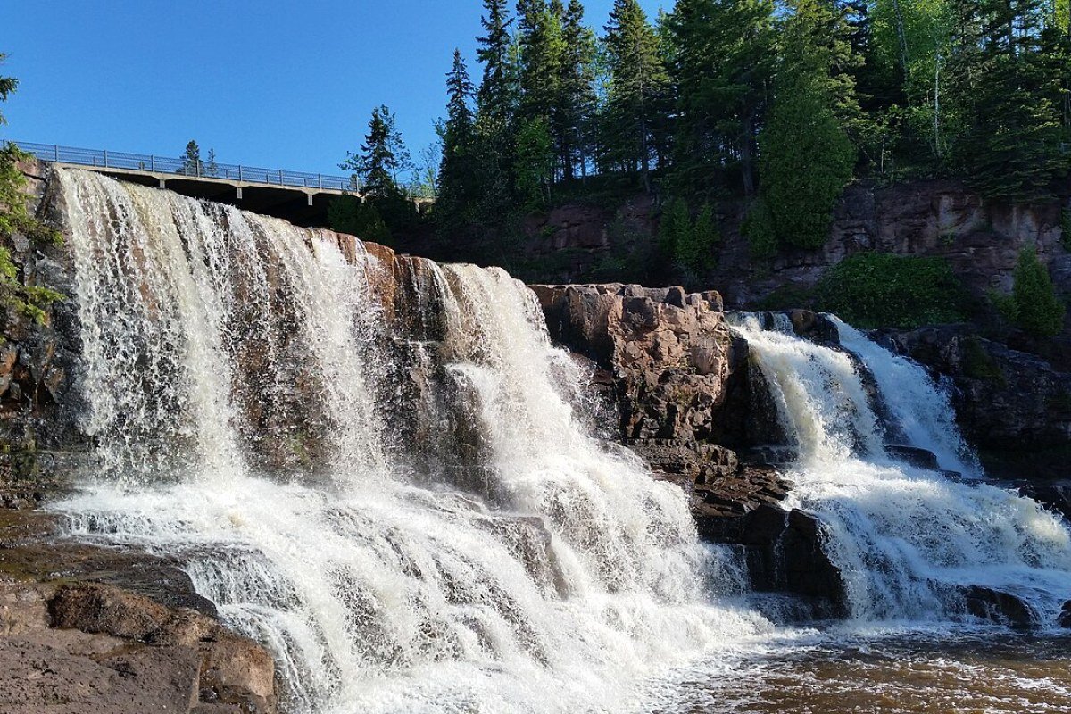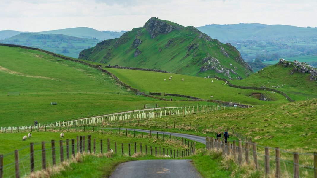
England‘s outdoor landscape is remarkable not for its scale or wildness — it is one of Europe’s most densely populated countries, with 56 million people in 130,000km² — but for its accessibility, its variety, and the extraordinary network of public rights of way, long-distance footpaths, and national parks that make the country’s wild places genuinely available to everyone. The Public Rights of Way network (some 140,000 miles of legal footpaths, bridleways, and byways across England and Wales) gives English walkers a freedom to roam that most countries’ private land ownership structures prohibit; the ten National Parks of England collectively protect 9% of England’s land area; and the National Trails system (2,700 miles of long-distance marked walking routes) provides the infrastructure for the country’s most ambitious walking. The terrain that results — the chalk downs of the South Downs and the North Downs, the moorlands of Dartmoor and the North York Moors, the limestone dales of the Peak District and the Yorkshire Dales, the craggy fells of the Lake District, the ancient woodland of the New Forest — is not the wild frontier of Canada or Patagonia, yet it is genuinely beautiful, properly accessible, and woven into the weekly lives of the millions of English people who walk it.
The Lake District: England’s Mountain World
The Lake District National Park (2,362km², Cumbria, UNESCO World Heritage Site 2017) is England’s best-loved landscape and its busiest national park — the glacially carved fells and lakes of the English uplands, where the literary landscape of Wordsworth (Grasmere), Ruskin (Brantwood, Coniston), and Beatrix Potter (Hill Top, Near Sawrey) meets the physical challenge of England’s highest ground.
- Scafell Pike: England’s highest point (978m) is accessed most directly from Wasdale Head (a six-mile round trip, 900m ascent, 4–6 hours) or from Borrowdale via Esk Hause (longer but more varied). The summit views — across the Western Fells, the Solway Firth, and on clear days across to the Isle of Man and Ireland — rank among England’s finest mountain panoramas
- Helvellyn and Striding Edge: The classic Lake District mountain experience — the ascent of Helvellyn (950m) via Striding Edge (a narrow, exposed ridge with significant scrambling in places) from Glenridding on Ullswater. The Swirral Edge descent closes a horseshoe widely held to be England’s most thrilling day walk
- Windermere and Coniston: England’s largest lake (Windermere, 18km long) is the place for sailing, kayaking, and wild swimming; Coniston Water (where Donald Campbell set his water speed record) offers the quieter, less-touristed alternative. Ullswater, the lake the Wordsworth tradition holds up as the loveliest of all, is the one walkers return to for its scenery
- Keswick and Derwentwater: The pick of the northern fells — the Catbells ridge walk above Derwentwater (reached from Keswick by ferry to Hawse End) wrings more drama from less effort than any walk in the Lake District, rewarding a moderate climb with views across the lake to Skiddaw

The Peak District: England’s First National Park
Designated in 1951 as the first national park in England, the Peak District (1,438km²) divides into two distinct landscapes: the Dark Peak (the northern gritstone moorlands, blanket bog, and wild edges — Kinder Scout, Bleaklow, the Derwent Valley) and the White Peak (the southern limestone dales, dry stone walls, and flowery meadows — Dove Dale, Monsal Dale, the Manifold Valley). Each half has its own character and its own walking tradition.
- Kinder Scout: The gritstone plateau above Hayfield (636m) carries more history than any other walking destination in England — the site of the 1932 Kinder Scout Mass Trespass, the act of civil disobedience by working-class Manchester ramblers that ultimately led to the creation of national parks and public rights of way legislation. The moorland plateau walks (the Pennine Way begins here) are wild and disorienting; navigation skills required in poor weather
- Dove Dale and the White Peak: The Dove Dale Stepping Stones (one of England’s most popular short walks, accessible from Ilam and Thorpe car parks) and the Tissington Trail (a former railway line converted to walking/cycling along the limestone plateau) represent the gentler White Peak experience
The South West Coast Path: England’s Greatest Walk
The South West Coast Path (630 miles, from Minehead in Somerset to Poole in Dorset, via Devon and Cornwall) is England’s longest-established National Trail and its most dramatic — traversing the Atlantic-facing cliffs of the West Country in a route of continuous coastal scenery for which there is no equivalent in England. The full trail takes 7–8 weeks; most walkers complete sections over multiple trips.
- North Cornwall: The Tintagel to Bude section — King Arthur’s castle (Tintagel, on a cliff stack above the Atlantic), the dramatic surf beaches of Fistral (Newquay), and the narrow wooded valleys of the north Cornwall coast — shows the trail at its most theatrical
- South Devon: The stretch from Salcombe to Dartmouth — the rias (drowned river valleys), golden beaches, and the National Trust coast of South Devon — runs gentler and more consistently lovely than anywhere else on the path
- Penwith and Land’s End: The far west of Cornwall — the granite headlands of Cape Cornwall, the Minack Theatre at Porthcurno, and Land’s End itself — offer the most elemental Atlantic experience of all
The Yorkshire Dales and Moors
Across 2,179km², the Yorkshire Dales National Park encompasses the limestone dales (Wharfedale, Wensleydale, Swaledale, Ribblesdale) and the Howgill Fells in a landscape of dry stone walls, field barns, and moorland that is quintessentially northern English. The Three Peaks walk (Pen-y-ghent 694m, Whernside 736m, Ingleborough 723m, 40km, done in a day by serious walkers), the Dales Way (81 miles, Ilkley to Windermere), and the walking in the Ingleton Waterfalls Trail and around Malham Cove (the 70-metre curved limestone cliff and the limestone pavement above it, used as a filming location for Harry Potter and the Deathly Hallows) leave the deepest impression. The North York Moors (1,434km²) — the heather moorland above Pickering and Whitby, with the scenic North Yorkshire Moors Railway connecting the two — is England’s largest expanse of heather moorland, turning vivid purple in August when the heather blooms.
Frequently Asked Questions
What does the Lake District offer as England’s premier outdoor destination?
The Lake District National Park — 2,362 square kilometres, Cumbria, designated UNESCO World Heritage Site in 2017 — is the best-loved landscape in England: the glacially carved fells and lakes of the English uplands, where Wordsworth (Grasmere), Ruskin (Brantwood, Coniston), and Beatrix Potter (Hill Top, Near Sawrey) established a literary and cultural mythology around the landscape that preceded the Victorian walking movement and still defines the Lake District’s international identity. Scafell Pike (978m, England’s highest mountain, reached most directly from Wasdale Head — a six-mile round trip with 900m of ascent, 4–6 hours) opens up England’s finest mountain summit views: across the Western Fells, the Solway Firth, and on clear days to the Isle of Man and Ireland. Helvellyn (950m) via Striding Edge — the narrow, exposed ridge with significant scrambling sections, climbed from Glenridding on Ullswater — is the most famous mountain walk in England, a horseshoe descent via Swirral Edge that pairs technical interest with a summit of real presence. The Wainwright Fells (214 individual fells documented in Alfred Wainwright’s Pictorial Guides to the Lakeland Fells, 1955–1966) have spawned a “bagging” tradition akin to Scotland’s Munros, drawing dedicated walkers who tick off all 214 over years of visits. Windermere (18km long, England’s largest natural lake) makes the gentlest introduction to the Lakes, with Bowness-on-Windermere drawing the most visitors annually.
Why is the Peak District England’s most accessible national park?
The Peak District National Park — 1,438 square kilometres, straddling the southern Pennines between Manchester and Sheffield, is one of Europe’s most visited national parks and England’s most accessible upland landscape, visited by more than 13 million people annually. The Dark Peak (the northern moorland, of millstone grit and blanket bog, including Kinder Scout at 636m — where the 1932 Mass Trespass established the right of ordinary people to walk on open moorland) and the White Peak (the southern limestone plateau, carved by the River Wye and the Derwent into dales of extraordinary beauty — Dovedale, Lathkill Dale, Monsal Dale) set two entirely different terrains within 50km of each other. The Pennine Way (431km, from Edale in the Peak District to Kirk Yetholm in Scotland) starts at Edale and ranks as England’s most demanding long-distance national trail. Chatsworth House (near Bakewell, seat of the Duke of Devonshire, holding one of the finest private art collections in England, its gardens laid out by Capability Brown) anchors the Peak District’s country-house heritage. The stone-walled villages of Bakewell, Castleton (with the Blue John Cavern and Peak Cavern), and Eyam (the plague village, where residents voluntarily quarantined themselves in 1665–1666) supply the human dimension.
What makes the South West Coast Path England’s greatest coastal walk?
The South West Coast Path — 1,014km from Minehead in Somerset to Poole Harbour in Dorset, the longest-established National Trail in England — strings together the boldest, most varied coastal scenery in the country: the sea cliffs of North Devon and Cornwall, the surfing beaches of Newquay and Perranporth, Land’s End (the most westerly point of mainland England), the Lizard Peninsula (the most southerly mainland point), the industrial heritage of the Cornish tin mining coast (a UNESCO World Heritage Site), the Dartmouth estuary, and the Jurassic Coast (the 95 miles of Dorset and Devon coast that exposes 185 million years of Earth history in its rock faces, a UNESCO World Heritage Site). Its showpiece stretches — Pentire Head to Padstow in North Cornwall, the Lizard headland circuit, and the Dorset Jurassic Coast around Lulworth Cove and Durdle Door — count among the most photographed shorelines in Europe. Walking the full path (typically 7–8 weeks) involves around 35,000m of ascent, close to four times the height of Everest from sea level. The easiest stretches to take on as day walks from seaside towns include St Ives to Zennor, the Lizard Peninsula circuit, and the Durdle Door and Lulworth Cove section.
What does the Yorkshire Dales and Moors offer for walking?
The Yorkshire Dales National Park — 2,179 square kilometres of limestone plateau, moorland, and glacially carved valleys — holds England’s finest limestone upland walking: Malham Cove (a 70m curved limestone cliff above which the limestone pavement provides the largest expanse of clint and gryke limestone pavement in England, used as a filming location for Harry Potter), Gordale Scar (an impossibly narrow limestone ravine with a scrambling route through twin waterfalls), and Pen-y-ghent (694m, one of the “Three Peaks” of Yorkshire — Whernside, Ingleborough, and Pen-y-ghent — whose circuit, the Yorkshire Three Peaks Challenge, 40km, 1,550m ascent, is the most popular mountain challenge walk in England). The Pennine Way traverses the Dales on its northern progress. The North York Moors National Park (1,434 square kilometres, east of the Yorkshire Dales, stretching to the North Sea coast) holds the largest single expanse of heather moorland in England and Wales — spectacular in August when the moor turns purple. The Cleveland Way (175km circuit of the North York Moors) and the Coast to Coast walk (Alfred Wainwright’s 190-mile route from St Bees on the Cumbrian coast to Robin Hood’s Bay on the North Yorkshire coast, opened as a full National Trail in March 2026) frame the northern Yorkshire walking landscape more completely than any other routes.
What outdoor recreation does the Cotswolds and the South Downs offer?
The Cotswolds — a 2,038 square kilometre National Landscape (the designation that replaced “Area of Outstanding Natural Beauty” in 2023) stretching across six counties from Chipping Campden to Bath — is England’s most visited rural landscape and the most complete surviving expression of the medieval English wool economy: honey-coloured limestone villages (Bourton-on-the-Water, Burford, Stow-on-the-Wold, Castle Combe), manor houses, and parish churches built with the wealth of the wool trade. The Cotswold Way (164km, Chipping Campden to Bath, a National Trail) ties the region together, running the escarpment above the Severn Vale with views to Wales. The South Downs National Park (1,627 square kilometres, from Winchester to Eastbourne, England’s newest national park, designated 2010) gives London its most accessible countryside: chalk downland of sweeping ridgelines, the Seven Sisters chalk cliffs (the boldest coastline in southeast England), and the South Downs Way (160km, Winchester to Eastbourne) — all within 90 minutes of central London by train. The Chilterns National Landscape (north of London, the beech woodlands of the chalk escarpment) offers the best woodland walking within 40 minutes of the capital, with the Ridgeway National Trail (139km from Overton Hill to Ivinghoe Beacon) following the ancient chalk trackway.