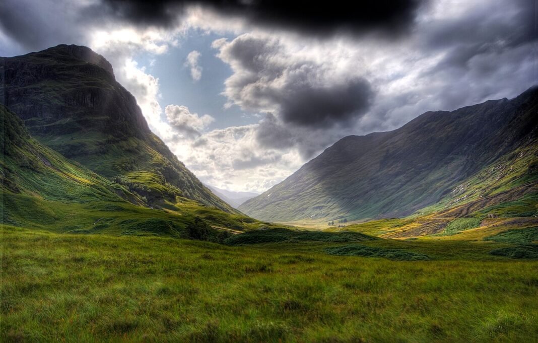
Scotland holds the grandest mountain and island scenery in the British Isles, and a fair claim to ranking among Europe’s great walking countries. The numbers tell part of the story: 282 Munros (mountains above 914 m), a 6,000 km coastline scattered with 790 islands, a national park built around highland terrain (Cairngorms National Park, 4,528 km²), and a legal framework — the Land Reform (Scotland) Act 2003 — that grants the public a right of responsible access to almost all land, private estates and farmland included, with no need for footpaths or designated rights of way. That access right, the most permissive in Europe, opens Scotland’s mountains, moorlands, forests, and shorelines to walkers, cyclists, and wild campers in a way that England and most of the Continent’s tighter land-ownership systems simply do not. The culture this produces runs deep: hillwalking, wild swimming, sea kayaking, and wild camping are not rare pursuits here but everyday habits for a large slice of the population.
Munro Bagging: Scotland’s Great Outdoor Tradition
A Munro is a Scottish mountain above 914 m (3,000 feet), a category drawn up by Sir Hugh Munro in 1891 — the tally stands at 282 Munros and 222 Corbetts (mountains of 762–914 m). Munro bagging, the attempt to climb all 282, has grown into a national pastime; more than 8,000 people have registered a full round (known as “compleating”), and hundreds of thousands more have climbed individual peaks.
- Ben Nevis: Britain’s highest mountain (1,345 m) and Scotland’s busiest Munro — the Mountain Track (the “tourist path”) from the Glen Nevis car park climbs 1,350 m over 17 km (5–7 hours return). The summit sits above cloud base for much of the year; reaching the full plateau — the cairn, the ruins of the Victorian Observatory, the sheer north-face cliffs that hold Britain’s premier winter climbing — calls for navigation skills and proper kit. On a clear day the view stretches to the Cairngorms, Ben More on Mull, and, in theory, Ireland
- The Black Cuillin, Skye: the hardest ridge in Britain — 12 km of gabbro carrying 11 Munros, with long stretches of exposed scrambling and several pitches that demand a rope. The full Cuillin Ridge Traverse (12–16 hours for an experienced team) is widely rated the toughest mountaineering challenge in the country. Single Munros on the ridge (Sgùrr Alasdair, Sgùrr nan Gillean, Sgùrr Dearg with its Inaccessible Pinnacle) reward anyone confident on rock with superb days out
- The Cairngorms: The high plateau above 1,000 m carries the closest thing Britain has to a true arctic environment — a sub-arctic ecosystem of reindeer, ptarmigan, dotterel, and mountain hare in habitats found nowhere else in the UK. Its four Munros (Cairn Gorm, Ben Macdui, Braeriach, Cairn Toul) start from the Cairngorm Mountain car park but ask for sure navigation across featureless ground in cloud
- Glencoe Munros: The Buachaille Etive Mòr (the “Great Shepherd of Etive,” the pyramid guarding the eastern mouth of Glencoe), Bidean nam Bian (the glen’s highest Munro, reached through the Three Sisters), and the Aonach Eagach (mainland Scotland’s tightest ridge traverse, all exposed scrambling along the glen’s north wall) deliver some of the most thrilling mountain days in the Highlands, barely 90 minutes from Glasgow

The Islands: Skye, the Outer Hebrides, and the Northern Isles
Scotland counts 790 islands, inhabited and not, ranging from Skye (1,656 km²) down to bare skerries of storm-washed rock, each with its own geology, culture, and bond with the surrounding sea.
- Isle of Skye: The most-visited of the Scottish islands — the Cuillin (the serrated gabbro range that draws mountaineers from across Britain), the Trotternish basalt cliffs (the Old Man of Storr, the Quiraing), the Neist Point lighthouse on Skye’s western tip above Atlantic cliffs, and the Fairy Pools (clear turquoise pools in the Cuillin foothills, perhaps the country’s most photographed natural feature) — sits a bridge away from the mainland, with a year-round ferry from Mallaig too. Visitor numbers have stretched the island’s infrastructure; arriving in shoulder season (May or September) beats the peak-summer crush
- Outer Hebrides (Western Isles): Lewis and Harris (one island, two regions), North Uist, Benbecula, South Uist, and Barra — 130 miles of island chain off the Atlantic coast, linked by causeways and ferry. The white-sand beaches (Luskentyre and Scarista on Harris rank among the country’s finest), the Callanish Standing Stones of Lewis, the Harris Tweed weaving sheds, the Gaelic-speaking communities, and above all the Atlantic light add up to one of Europe’s truly singular island experiences. Reach them from Inverness or Glasgow by ferry (Ullapool to Stornoway) or by air
- Orkney: The archipelago 16 km north of Caithness — 70 islands, around 22,000 residents, and the densest cluster of Neolithic monuments in Europe (the Ring of Brodgar, the Standing Stones of Stenness, Skara Brae, and Maeshowe — together a UNESCO World Heritage Site). The landscape is treeless and wind-scoured, green farmland and high sea cliffs rather than Highland peaks, but the archaeology and island identity are remarkable
- Shetland: The UK’s northern extreme (nearer Bergen than Edinburgh), with a Norse identity (the Up Helly Aa fire festival is Scotland’s grandest midwinter spectacle), bold cliff scenery, and large puffin and seabird colonies on the stacks of Noss and Sumburgh Head

Wild Swimming, Kayaking, and Water Sports
Scotland’s waters — from Highland lochs to the Atlantic-facing beaches of the Outer Hebrides — offer some of Europe’s best wild swimming and kayaking, cold enough to demand proper kit yet within easy reach for regular outings. Loch Lomond (Britain’s largest freshwater loch by surface area, 40 minutes from Glasgow) makes for easy swimming; the upland lochs (Loch Morlich in the Cairngorms, Loch an Eilein with its ruined island castle) are the most scenic; and Luskentyre Beach on Harris, along with the machairs (coastal grassland) of the Outer Hebrides, hold the finest Atlantic beach swimming in Britain. Sea kayaking along the west-coast sea lochs and the Sound of Sleat (between Skye and Knoydart) ranks with the best coastal paddling anywhere in the country; the Knoydart Peninsula — mainland Scotland’s “last wilderness,” reachable only by boat or a long walk — holds the most remote kayaking of all.

Frequently Asked Questions
What is Munro bagging and why does it define Scottish outdoor culture?
A Munro is a Scottish mountain above 914 m (3,000 feet), set out in Sir Hugh Munro’s original 1891 classification — the count today is 282 Munros and roughly 222 Corbetts (mountains of 762–914 m). Munro bagging, the goal of climbing all 282, has become one of the country’s signature outdoor traditions, with more than 8,000 people having registered a full round (called “compleating”) and hundreds of thousands more who have climbed individual peaks. Ben Nevis (1,345 m, Britain’s highest mountain) is the busiest Munro — its Mountain Track from the Glen Nevis car park (17 km return, 1,350 m ascent, 5–7 hours) takes tens of thousands of ascents a year. Ben Lomond (974 m, the southernmost Munro, looking over Loch Lomond, 90 minutes from Glasgow and the easiest to reach from Scotland’s central belt) is the usual first Munro for many walkers. The Cairngorms plateau (the largest area of high ground in Britain, where Ben Macdui at 1,309 m is the country’s second-highest mountain) makes for the toughest and most rewarding walking of all: remote navigation, arctic-alpine weather, and the chance of meeting ptarmigan, mountain hares, and the odd dotterel at altitude. The Land Reform (Scotland) Act 2003 — granting a public right of responsible access to almost all land — is the legal bedrock of the open hillwalking that keeps Munro bagging within reach across private estates and farmland, free of the path dependency that shapes walking in England.
Why is the West Highland Way Scotland’s premier long-distance walk?
The West Highland Way — 154 km (96 miles) from Milngavie (pronounced “Mull-guy”, 12 km north of Glasgow) to Fort William, 7–8 days, Scotland’s busiest long-distance trail — runs through the full range of Highland scenery, from lowland pasture to the raw mountain ground of Rannoch Moor and Glencoe. It tracks the eastern shore of Loch Lomond (Britain’s largest lake by surface area, 71 km²) for 30 km, the longest sustained lochside walking in the country. Rannoch Moor — the 130 km² high plateau of bog and lochan between Bridge of Orchy and Kingshouse, crossed by the Way in a 15 km stretch fully open to the weather — is the hardest single day on the trail and the most elemental Highland ground you will cross. The closing leg through Glencoe (past the Three Sisters and the Aonach Eagach ridge, mainland Britain’s hardest ridge walk and one for seasoned scramblers only) to the Kings House Hotel, then over the Devil’s Staircase to Kinlochleven, gives the Way its grandest finish. Accommodation books out from April to October, so plan months ahead for the peak season. The John Muir Way (215 km, Helensburgh to Dunbar), the Great Glen Way (125 km, Fort William to Inverness along the Caledonian Canal), and the Southern Upland Way (344 km, coast to coast, the longest of all) round out Scotland’s main long-distance network.
Where are the best places for sea kayaking and water adventures in Scotland?
Scotland’s 6,000 km coastline — broken up by sea lochs, tidal races, island passages, and sea caves — gives Europe its broadest and most varied sea kayaking terrain, free of the permit bureaucracy and crowds of comparable Norwegian fjord coasts. The Hebridean Paddle Trail (the unofficial route around the Outer Hebrides, roughly 800 km of coastline) is Europe’s most ambitious sea kayaking line. The Corryvreckan (the tidal race between Jura and Scarba, with a standing wave said to reach 9 m at spring tides, the world’s third-largest whirlpool) and the Falls of Lora (the tidal race at the mouth of Loch Etive, near Connel Bridge) are the west coast’s fiercest tidal features. Loch Morlich and the Speyside rivers offer approachable whitewater, while the Spean River and the Etive Gorge hold class IV rapids for experienced paddlers. Wild swimming — in the lochs, rivers, and sea lochs of the Highlands — has surged in popularity since 2019, helped along by the Land Reform Act’s access rights; the Fairy Pools on Skye, Loch Avon in the Cairngorms (a 10 km walk from the nearest road), and the sea pools at Brora and Machrihanish are the country’s best-loved swimming spots.
How does mountain biking in Scotland compare to other destinations?
Scotland has built the most acclaimed mountain biking network in the UK and one of the best in Europe, through the 7stanes scheme (seven trail centres across the Southern Uplands, developed from 2001 with Forestry Commission Scotland) and a later wave of Highland centres. The 7stanes sites (Ae Forest, Dalbeattie, Mabie, Kirroughtree, Glentrool, Newcastleton, and Glentress/Innerleithen) carry trails from family-friendly green routes to black-grade enduro descents, with Glentress (near Peebles, the busiest of the seven) a regular fixture among the UK’s top riding destinations. Wolftrax (near Laggan, in the Cairngorms) and the Nevis Range (Fort William, with a gondola-served downhill course) mark the Highland end of the spectrum. Fort William hosted a round of the UCI Mountain Bike World Cup Downhill almost every year from 2002, and it staged the 2023 World Championships; the World Cup last ran there in 2024, and the course remains one of the sport’s most storied gravity venues, with the iXS European Downhill Cup returning in 2026. The Cairngorms and Speyside hold the country’s most remote riding, forest and moorland singletrack that pairs with wild camping for multi-day trips. Under the Land Reform Act’s access rights, the whole of the Scottish countryside is legally rideable off-road, free of the bridleway limits that apply in England and Wales.
What wildlife can you watch in Scotland, and when is the best time?
Scotland holds the richest large-mammal and bird watching in the British Isles, with species missing from England and Wales recovered or re-established across a landscape that keeps much of the ecological connectivity of a fairly intact ecosystem. Red deer (around 400,000, the largest population in Europe) are visible year-round across the Highlands, but the rut (late September to mid-October, when stags roar and spar for hinds on open moor and glen) is the standout wildlife event in Britain. Red squirrels hold on across Scotland (gone from most of England, ousted by the introduced grey) in the Cairngorms pinewoods and the Red Squirrel Trail forests of the south. The osprey came back to Scotland in 1954 (after 38 years of extinction) and is now a reliable sight at the Loch Garten Osprey Centre (Strathspey, RSPB, April to August), among the world’s best-known osprey sites, with more than 2 million visitors over its history. White-tailed eagles (reintroduced from 1975 on the Isle of Rum, now spreading across the west coast and into Tayside) are the country’s most imposing raptor sighting. Golden eagles (508 territorial pairs at the most recent national survey, the largest population in the UK) range over the Cairngorms, the Western Highlands, and the bigger Hebridean islands. Basking sharks (the world’s second-largest fish) gather off the Isle of Coll and Tiree in late May and June, reached by boat from Oban and Tobermory.