Hawaii: America’s Most Extraordinary Destination
Hawaii occupies a category by itself among American travel destinations. The only US state located entirely outside North America, Hawaii is an archipelago of 137 islands scattered across 1,500 miles of the central Pacific Ocean — formed by volcanic activity, isolated by 2,400 miles of open water from the nearest continental landmass, and supporting ecosystems of rare diversity and fragility. The six main visitor islands (Hawaii/Big Island, Maui, Oahu, Kauai, Molokai, and Lanai) each have distinct characters, landscapes, and travel personalities, and no single island captures the full range of what Hawaii offers.

Understanding Hawaii as a destination means resisting the impulse to reduce it to its most-marketed images — the lei greetings, the hula performances, the generic “tropical paradise” packaging. The reality is richer: a living geological laboratory where volcanoes are actively building new land, coral reefs of remarkable biodiversity, the last living culture of one of the world’s great Pacific civilizations, and natural landscapes that range from the world’s tallest mountain (measured from its base on the ocean floor) to one of the wettest places on Earth.
Oahu: Where Most People Go — and Why
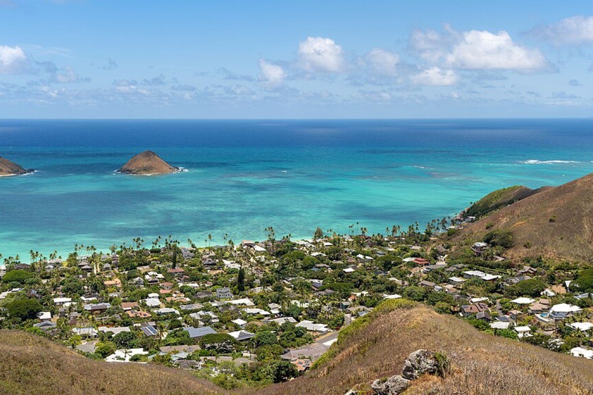
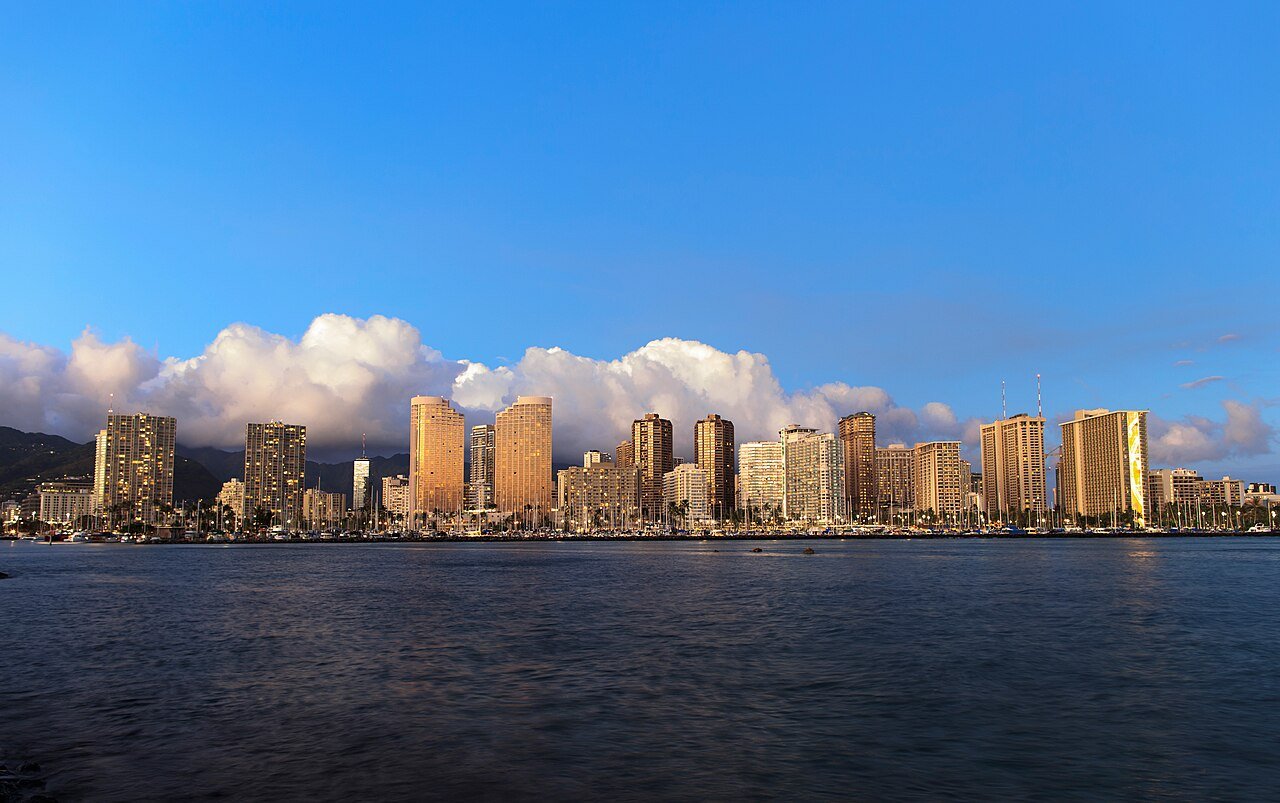
Oahu, home to Honolulu and Waikiki, receives roughly 60% of Hawaii‘s total visitor arrivals — and while the busiest Hawaiian island is also its most developed and crowded, it holds first-tier attractions that justify its place at the center of nearly every Hawaii itinerary.
Diamond Head State Monument, the extinct volcanic tuff cone that has become Honolulu’s signature landmark, offers a 1.6-mile round-trip hike through a tunnel in the crater rim to a summit with panoramic views of Waikiki, Honolulu, and the Waianae Range. The hike’s blend of accessibility (near the center of Honolulu’s tourist zone), history (the summit fortifications date to World War I), and visual payoff makes it the best short hike on Oahu.

Pearl Harbor National Memorial — the USS Arizona Memorial, USS Missouri Battleship, USS Bowfin Submarine Museum, and Pacific Aviation Museum — ranks among the most significant historical sites in the United States. The USS Arizona Memorial, which straddles the sunken battleship that lost 1,177 crew members in the December 7, 1941 attack, is a place of real solemnity and national weight. The museum on Ford Island provides military history interpretation that puts the attack and its consequences for the Pacific war in context.
The North Shore of Oahu, 45 minutes from Waikiki, hosts some of the best-known surf breaks anywhere — Banzai Pipeline, Sunset Beach, and Waimea Bay produce waves that serve as the proving ground of professional surfing. During the November–February high-surf season, waves at Pipeline can reach 30 feet, drawing the world’s best surfers and thousands of spectators. In summer, the same breaks calm into excellent swimming beaches that are, oddly, less crowded than Waikiki.
Maui: The Valley Isle
Maui is the second-most visited Hawaiian island, and the one that consistently tops visitor satisfaction surveys. Its appeal is built on variety. The Road to Hana threads a 64-mile scenic route through tropical rainforest, past dozens of waterfalls and along sheer coastal cliffs. Haleakalā National Park crowns the island with a 10,023-foot dormant volcano whose summit rises above the clouds, where catching the sunrise ranks among Hawaii’s signature experiences. From November through April, humpback whales breed in Maui’s waters in numbers that make it one of the Pacific’s most reliable whale-watching destinations. Add the beaches of West Maui and Wailea, and the result is a vacation that rewards travelers who want more than one kind of day.
.jpg?width=1280)
Kauai: The Garden Isle
Kauai is Hawaii’s oldest and most deeply eroded island — its 5-million-year geological age has carved the spectacular Nāpali Coast (17 miles of fluted sea cliffs rising 4,000 feet directly from the Pacific, reachable only by boat, helicopter, or the demanding Kalalau Trail), Waimea Canyon (the “Grand Canyon of the Pacific,” 14 miles long and 3,600 feet deep), and an interior so wet that Waiʻaleʻale Peak (annual rainfall averaging around 450 inches) ranks among the wettest places on Earth.
Kauai has deliberately limited its tourist infrastructure compared with Oahu and Maui — zoning permits no buildings taller than a palm tree, and the island’s rural character has been consciously preserved. For travelers after a quieter, more nature-oriented Hawaii, Kauai delivers on its reputation as the most beautiful of the main Hawaiian islands.
Big Island (Hawaii): Active Volcanoes and Diverse Landscapes
The Big Island of Hawaii is the youngest, largest, and most geologically active island in the chain — larger than all other Hawaiian islands combined and still growing as Kīlauea Volcano continues to add land along the island’s southern coast. Hawaiʻi Volcanoes National Park takes in the summits of Kīlauea and Mauna Loa (both active), the Kīlauea Caldera (with its Halemaʻumaʻu Crater, the site of repeated lava-fountaining episodes since the eruption that began in December 2024), and lava tube systems that run from summit to sea. The park is a UNESCO World Heritage Site and one of the few places on Earth where visitors can watch active land-building as it happens.
%20of%20Kilauea's%20December%202024%20eruption;%20200-meter%20fountain.jpg?width=1280)
The Big Island’s climate zones are the most varied of any island its size anywhere — a fact of geography rather than marketing, and the range is genuinely startling. Driving from Hilo (one of the wettest cities in the US) to Kona (dry and sunny on the western coast) to the summit of Mauna Kea (at 13,803 feet, one of the world’s premier astronomical observation sites, with about a dozen research telescopes near the summit) crosses climate zones from tropical rainforest to alpine desert within a few hours. The Big Island is the least uniform Hawaiian experience, and for that reason the one that surprises visitors most.
Frequently Asked Questions
What makes each Hawaiian island different and which one should you visit?
Hawaii’s six main visitor islands each have distinct characters. Oahu (Honolulu, Waikiki) is the most developed and receives about 60% of total visitor arrivals — home to Pearl Harbor, Diamond Head, and the North Shore’s world-famous surf breaks. Maui combines the Road to Hana (a 64-mile coastal drive through tropical rainforest past dozens of waterfalls), Haleakalā National Park (10,023-foot dormant volcano), and the best humpback whale watching in the Pacific (November–April). Kauai is the oldest and most eroded island, featuring the Nāpali Coast (17 miles of fluted sea cliffs rising 4,000 feet from the Pacific), Waimea Canyon (the “Grand Canyon of the Pacific,” 14 miles long and 3,600 feet deep), and limited tourist infrastructure by design — no buildings taller than a palm tree. The Big Island is the largest island (bigger than all others combined), still growing from active volcanic eruptions, and home to the widest ecological range: from tropical rainforest in Hilo to alpine desert at Mauna Kea’s 13,803-foot summit.
What makes Pearl Harbor a significant historical site to visit on Oahu?
Pearl Harbor National Memorial takes in the USS Arizona Memorial (which straddles the sunken battleship that lost 1,177 crew members in the December 7, 1941 attack), the USS Missouri Battleship (where Japan’s formal surrender was signed on September 2, 1945), the USS Bowfin Submarine Museum, and the Pacific Aviation Museum on Ford Island. The USS Arizona Memorial is a place of national solemnity — oil still seeps from the sunken ship — and its mix of historical weight and visual impact makes it one of the most moving memorial experiences in the United States. Free timed-entry tickets to the memorial are available from the Pearl Harbor Visitor Center and should be reserved in advance during peak season.
What makes Haleakalā National Park on Maui worth visiting?
Haleakalā’s 10,023-foot summit dominates Maui’s landscape and holds a volcanic crater that Mark Twain called “the sublimest spectacle I ever witnessed” — a depression roughly 7.5 miles long and 2.5 miles wide and up to 3,000 feet deep, with a moonscape of cinder cones in red, orange, and black. Watching sunrise from the summit is one of Hawaii’s most celebrated experiences, but it requires an advance timed-entry reservation (reservations open 60 days ahead and fill quickly). Sunset offers the same sweeping views with fewer logistics. The Sliding Sands Trail descends from the summit into the crater, passing volcanic formations across a landscape unlike any other hiking environment on Earth. Below the summit, the Kīpahulu coast section of the park holds the famous ʻOheʻo Gulch (“Seven Sacred Pools”) and the base of the Road to Hana.
What is the Nāpali Coast on Kauai and how do you experience it?
The Nāpali Coast is 17 miles of fluted sea cliffs rising 4,000 feet directly from the Pacific on Kauai’s northwest shore — the defining coastal landscape of Hawaii and one of the great landscapes of the United States. Access is limited by design: helicopter tours offer the fullest view; boat tours (seasonal, May–September) run the base of the cliffs, entering sea caves and sea arches; and the Kalalau Trail (11 miles one way) is the only land access, requiring a state camping permit to continue beyond Hanakāpīʻai Beach, the 2-mile mark. A permit from the Hawaii DLNR online reservation system is mandatory for the full trail and fills months in advance. Day hikers may proceed to Hanakāpīʻai Beach (2 miles each way) without a permit to experience the Nāpali landscape at trail level.
What makes Hawaiʻi Volcanoes National Park on the Big Island unique?
Hawaiʻi Volcanoes National Park takes in the summits of Kīlauea and Mauna Loa — both active volcanoes — and is one of the few places on Earth where visitors can watch active land-building as it happens. The park holds UNESCO World Heritage Site designation. Kīlauea has been highly active for decades; the eruption that began in December 2024 has produced a long series of lava-fountaining episodes at Halemaʻumaʻu Crater, visible from multiple park overlooks when fountaining is underway and paused between episodes. The Kīlauea Iki Trail (4-mile loop) crosses the solidified floor of the 1959 eruption’s lava lake, passing above still-cooling rock on a black, crackling crust. The Thurston Lava Tube (Nāhuku) offers a 500-foot illuminated walk through a historic lava tube. The park website tracks current lava viewing access in real time, since conditions change with eruption activity.