Virginia’s outdoor recreation spans a geographical range that few eastern states can match — the Appalachian Mountains in the west (Shenandoah National Park, the Blue Ridge Parkway, Mount Rogers at 5,729 feet), the rolling Piedmont foothills with their vineyard trails and river corridors in the center, and the Atlantic coast’s barrier islands and the Chesapeake Bay’s 3,600 miles of tidal shoreline in the east. The state contains 550 miles of the Appalachian Trail — the longest single-state segment of the entire trail — including 101 miles inside Shenandoah National Park, technically demanding mountain biking in the Roanoke Valley and on Massanutten Mountain, strong trout fishing in the New River and its tributaries, and the urban whitewater paddling of Richmond’s James River. Virginia’s outdoor culture is deepened by the proximity of most of the state’s population to multiple recreation categories — few states pack this much variety within a half-day’s drive for most residents.

Shenandoah National Park: The Blue Ridge Crown
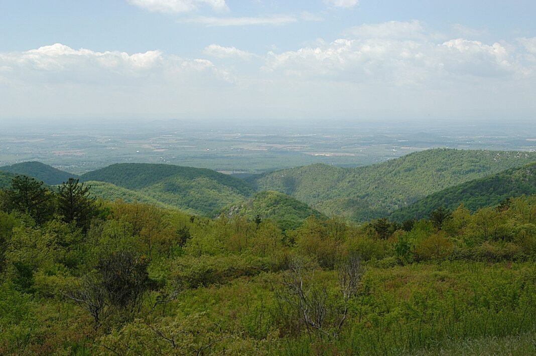
Shenandoah National Park’s 500+ miles of trails put serious, accessible hiking within two hours of Washington D.C. and three hours of Richmond, yet with genuine backcountry wilderness in the park’s 40% designated wilderness area. The signature hikes:
.jpg?width=1200)
- Old Rag Mountain (9 miles RT): Virginia’s signature day hike; a granite summit reached by a boulder scramble above treeline; day-use ticket required March 1 through November 30; views extend to the Blue Ridge and the Piedmont 2,000 feet below
- Dark Hollow Falls (1.4 miles RT): The most popular waterfall hike in the park; 70-foot cascade accessible from Skyline Drive; family-appropriate
- Stony Man (1.6 miles RT): The shortest above-treeline hike in the park; second-highest peak; panoramic Blue Ridge views with minimal effort
- Hawksbill Summit (2.8 miles RT): Highest peak in Shenandoah at 4,051 feet; nesting site for peregrine falcons; 360-degree summit views
.jpg?width=1200)
The Appalachian Trail in Virginia
Virginia contains 550 miles of the Appalachian Trail — the longest single-state segment of the trail’s 2,197-mile length, running from the Tennessee/Virginia border at Damascus in the south to the West Virginia/Virginia border near Harpers Ferry in the north. The Virginia AT passes through three distinct landscapes: the Mount Rogers High Country in the southwest (the only above-treeline AT segment in Virginia, with wild ponies grazing on the balds), the Blue Ridge crest through Shenandoah National Park in the center, and the northern Blue Ridge through the Roller Coaster section near the northern terminus. The Damascus Trail Days festival (held each May in Damascus, self-described “Trail Town USA”) is the largest AT hiker gathering in the country, drawing 20,000+ visitors for a long weekend of hiking, live music, and trail culture.
Mountain Biking: Roanoke and Massanutten
Virginia‘s mountain biking scene is anchored by two destination trail systems that draw riders from across the region:
- Roanoke Valley Trails: 300+ miles of singletrack in and around the Roanoke region (an IMBA Silver-Level Ride Center, the only such designation on the East Coast), including the Dragon’s Back at Explore Park (16 miles of technical singletrack), Carvins Cove Natural Reserve (60+ miles of varied terrain ranging from beginner to advanced), and the Roanoke River Greenway for easygoing recreation riding
- Massanutten Mountain (Shenandoah Valley): The Massanutten Resort area runs lift-assisted downhill biking in summer on the ski resort’s terrain, plus extensive cross-country trail networks through the George Washington National Forest
- Fountainhead Regional Park (Fairfax County): Accredited IMBA Epics-level trail system 30 minutes from Arlington; the most technically challenging mountain biking in Northern Virginia
Virginia Beach and Chesapeake Bay Water Recreation
Virginia’s coastal outdoor recreation divides between the Atlantic-facing resort beaches and the Chesapeake Bay’s more protected waters:
- First Landing State Park (Virginia Beach): 2,888 acres of maritime forest and Chesapeake Bay beach within the city of Virginia Beach; the most visited state park in Virginia; 19 miles of hiking and biking trails through cypress swamp and maritime forest
- Chincoteague National Wildlife Refuge: 14,000 acres of barrier island habitat on Assateague Island; wild Chincoteague Ponies; the best birding on Virginia’s Eastern Shore; beaches accessible by vehicle permit in summer
- Chesapeake Bay paddling: The Bay’s tidal creeks and river estuaries (particularly the Rappahannock, York, and James River mouths) make for exceptional sea kayaking; the Chesapeake Water Trail network connects launch points along the Bay’s western shore
- New River fishing: The New River (one of the oldest rivers on Earth geologically) through Giles County offers exceptional smallmouth bass fishing; the New River Trail State Park (57 miles of rail-trail along the river, a National Recreation Trail) opens cycling and hiking access to the entire corridor
Blue Ridge Parkway: America’s Favorite Drive
The Blue Ridge Parkway’s 217 Virginia miles — running from Shenandoah National Park’s southern entrance near Waynesboro to the North Carolina border near the Cumberland Knob visitor center — offer some of the best scenic driving in the eastern U.S., with steady ridgeline views, wildflower meadows, and access to overlooks, hiking trails, and historic mountain farm exhibits. The Parkway’s Virginia highlights include Humpback Rocks (a dramatic rock formation with panoramic views, reachable by a steep 1.4-mile trail), the Mabry Mill (the Parkway’s most-photographed structure, an operational 1910 grist mill and blacksmith shop in the meadows of Patrick County), and the Peaks of Otter (a Parkway lodge, lake, and two-peak hiking circuit near Bedford). The Parkway is managed by the National Park Service at no charge and remains one of the most traffic-free long-distance scenic drives in the region when traveled midweek outside peak foliage season.
Frequently Asked Questions
Why is Shenandoah National Park Virginia’s premier hiking destination?
Shenandoah National Park — 500+ miles of trails on the Blue Ridge crest, within 75 miles of Washington D.C. and 2 hours of Richmond — puts serious hiking within reach, with genuine backcountry wilderness (40% of the park is designated wilderness) within commuting distance of the Washington-Northern Virginia metro area. Skyline Drive (105 miles, running the Blue Ridge crest with 75 overlooks into both the Shenandoah Valley and the Virginia Piedmont) is the park’s primary vehicle access and one of the most scenic drives in the eastern United States, particularly in mid-October when the park’s hardwood forest produces fall foliage of exceptional color and density. Old Rag Mountain (9 miles round trip, about 2,400 feet elevation gain, scrambling route through granite boulders on the summit ridge) is one of the best-known day hikes in the East, requiring Shenandoah’s timed-entry day-use tickets, mandatory daily from March through November. Bearfence Mountain (short scramble to panoramic views), the Hazel Falls loop, and the Mary’s Rock summit are gentler alternatives for casual visitors. The park’s 101 miles of the Appalachian Trail (traversing the park’s Blue Ridge spine from south to north) provide through-hiker infrastructure and a backbone for multi-day backpacking trips.
What can you do along Virginia’s Blue Ridge Parkway and mountain region?
Virginia’s Blue Ridge Parkway (the southern extension of Skyline Drive, running 217 miles from the Shenandoah National Park boundary to the North Carolina border near Cumberland Knob) traverses the most sustained mountain scenery in Virginia outside Shenandoah. Roanoke (90 minutes southwest of Charlottesville on I-81, the Star City of the South) has built one of the East’s most respected mountain bike networks — the Roanoke Valley’s 300+ miles of purpose-built trail across Mill Mountain, Carvins Cove, and the ridgelines above the city provide technical riding of national reputation. Mount Rogers (5,729 feet, the highest point in Virginia, in the Mount Rogers National Recreation Area and reached from Grayson Highlands State Park, near the Tennessee-North Carolina border) holds the most remote backpacking in Virginia, with feral ponies (the Grayson Highlands feral pony herd, maintained on the highland meadows since the 1970s) and a subalpine environment found almost nowhere else in the region. The Appalachian Trail through the Mount Rogers-Grayson Highlands section (accessible from Marion and Damascus, “Trail Town USA”) is widely rated the finest AT stretch in the state, mixing open meadow walking with boreal forest transitions.
How does Richmond’s James River work as an urban outdoor destination?
Richmond’s James River — one of the only Class III–IV whitewater rivers running through the urban core of a major American city — gives Richmond an urban outdoor recreation asset with few rivals in the eastern United States. The Richmond Whitewater (Hollywood Rapids, the Z-Dam, and Pipeline Falls, all within 2 miles of downtown Richmond) supports one of the most active whitewater kayaking and stand-up paddleboarding communities of any inland American city. The Belle Isle (a 54-acre island in the James River, accessible by pedestrian bridge from downtown) draws swimmers to the river pools below the rapids, the ruins of a Civil War prison camp, and rock climbing on the granite boulders at the island’s western tip. The Virginia Capital Trail (52 miles, paved, from Richmond to Jamestown along Route 5 and the James River) is the most complete paved cycling route in Virginia and the primary connection between the state’s two most significant colonial history destinations. The James River Park System (600+ acres of parkland along both sides of the river through Richmond) packs hiking, mountain biking, bird watching, and swimming within the city limits of one of the South’s landmark colonial-era cities.
Where should you go for outdoor recreation on Virginia’s Atlantic coast?
Virginia’s Atlantic coast — from the Virginia Beach oceanfront resort to the Outer Banks-like barrier islands of the Eastern Shore — spans the widest variety of coastal recreation in the state. Virginia Beach (the most populous city in Virginia, 450,000 residents, with 28 miles of Atlantic Ocean beach) is the largest coastal resort city between New Jersey and Florida, with a 3-mile boardwalk, the Virginia Aquarium, and access to the Back Bay National Wildlife Refuge (Virginia’s premier coastal waterbird habitat). Chincoteague Island (on the Eastern Shore, accessible by causeway) and the adjacent Assateague Island National Seashore deliver the most distinctive Virginia coastal experience: the wild pony swim (the annual July swim of the Chincoteague wild ponies across the Assateague Channel to the Virginia mainland for the Pony Penning auction) is Virginia’s most photographed wildlife event. The Chesapeake Bay Bridge-Tunnel (17.6 miles of bridges and tunnels crossing the bay’s mouth, one of the most ambitious engineering structures in the world) connects the Eastern Shore to Hampton Roads. The 1,000 Islands of the Eastern Shore’s barrier beach system, accessible by kayak from Oyster and Chincoteague, provide wild coastal paddling of national significance.
What’s worth seeing in Virginia’s wine country and cavern region?
Virginia’s wine industry — the fifth largest by grape production in the United States, concentrated in the Piedmont foothills between Charlottesville and Leesburg (the Monticello American Viticultural Area) and the Shenandoah Valley (the Shenandoah Valley AVA) — produces Viognier, Cabernet Franc, and Petit Verdot of international quality that has transformed the state’s reputation from regional curiosity to significant wine region. Barboursville Vineyards (founded by Zonin, an Italian winery family, in 1976, the first to demonstrate Virginia’s potential for serious wine, with the Zonin-designed winery and the ruins of the 1814 Barboursville Mansion designed by Thomas Jefferson) and Trump Winery (at Kluge Estate, Charlottesville) represent the region’s benchmark properties. The Luray Caverns (the largest caverns in the eastern United States, with rooms reaching 10 stories high, stalactite and stalagmite formations of extraordinary size and color, and the Stalacpipe Organ — the world’s largest musical instrument, played by rubber mallets striking stalactites tuned to specific pitches) draw more visitors than any other Virginia cave, 100 miles west of Washington D.C. in the Shenandoah Valley. Natural Bridge State Park (the 215-foot natural limestone bridge that Thomas Jefferson once owned and described as “the most sublime of nature’s works”) is the state’s defining geological landmark.