Tasmania‘s outdoor recreation is the most concentrated in Australia — the Tasmanian Wilderness World Heritage Area (1.58 million hectares, almost a quarter of the island) contains alpine landscapes, ancient rainforests, wild rivers, and coastal wilderness of extraordinary rarity, accessed by a walking track network that ranges from easy two-hour circuit walks to the Overland Track’s 6–8 day wilderness traverse through the island’s dolerite peaks and buttongrass plains. What distinguishes Tasmania’s outdoor experience from the mainland is not just the quality of the landscapes but their density — no other state packs this concentration of UNESCO World Heritage wilderness, world-class surf beaches, marine reserves, and multi-day walking infrastructure into an area that can be driven across in four hours. The practical considerations — cold weather at elevation even in summer, rapid weather change, highly variable river levels, and the requirement for appropriate gear and navigation skills on the backcountry tracks — are genuine, not theatrical.
The Overland Track: Australia’s Greatest Walk
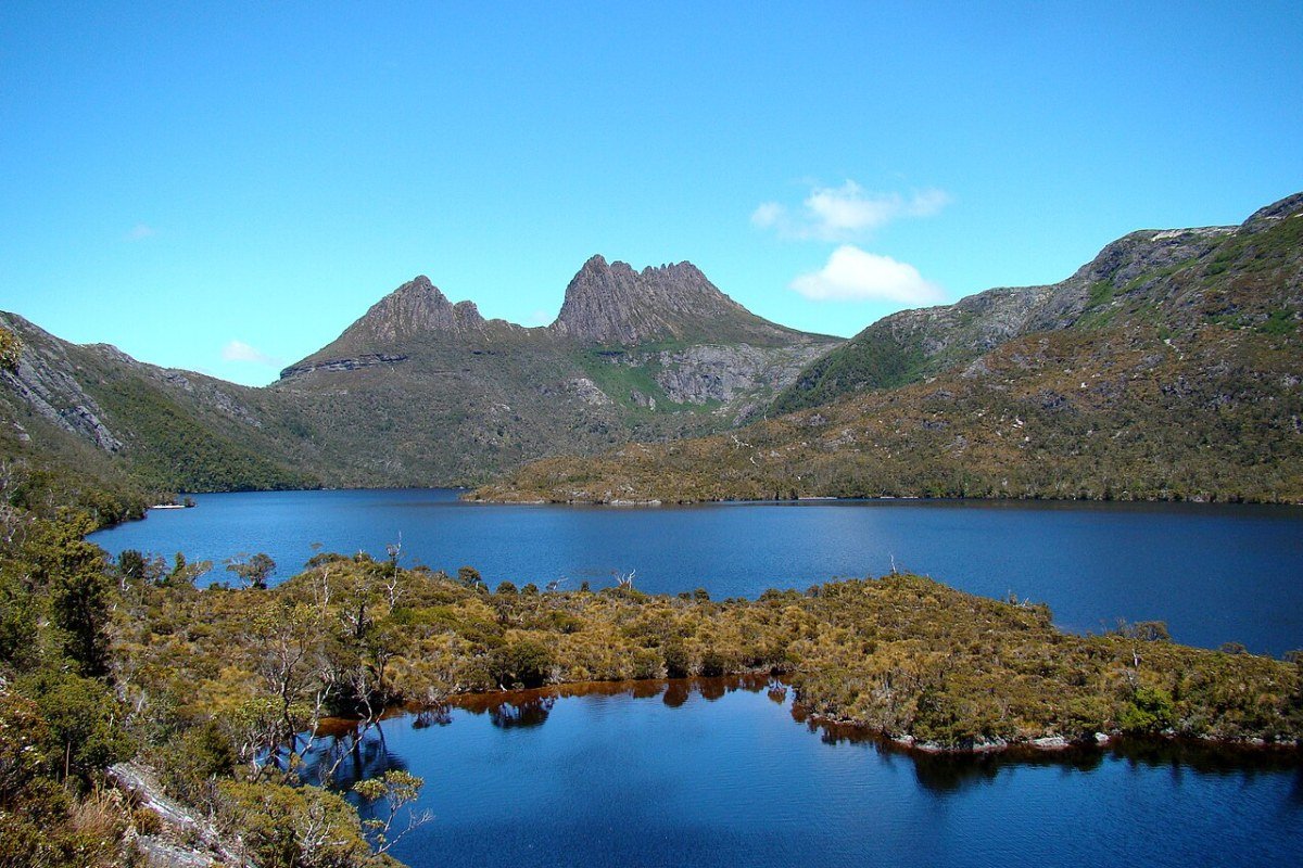
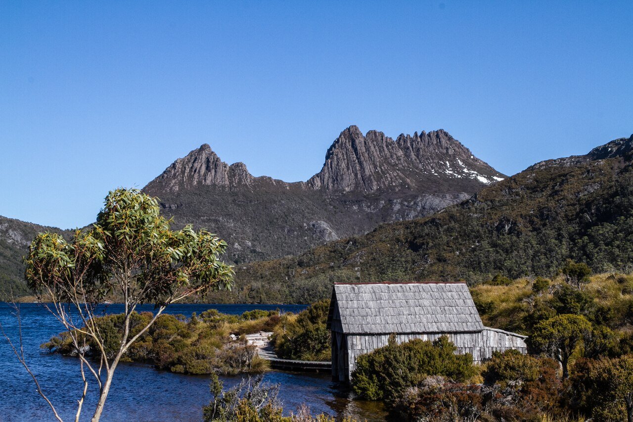
The Overland Track, 65km from Ronny Creek at Cradle Mountain to Narcissus Hut on the northern shore of Lake St Clair, is the most celebrated long-distance walking track in Australia — a 6–8 day traverse through the heart of the Tasmanian Wilderness World Heritage Area that passes beneath the island’s highest peaks, through ancient pencil pine and fagus forests, across alpine tarns and buttongrass plains, with a visual and ecological variety that no other Australian track can match. Practical details:

- Booking system: The track operates a permit and booking system (Tasmania Parks and Wildlife Service) from 1 October to 31 May; permits must be booked in advance; off-season (June–September) walking is possible without permits but huts cannot be relied upon and conditions are severe
- Track direction: The regulated walking direction is north-to-south (Cradle Mountain to Lake St Clair) to spread traffic and wildlife disturbance; lake ferry from Narcissus to Cynthia Bay completes the traverse (book separately with the Lake St Clair Lodge ferry)
- Hut system: Six public huts (self-registration) provide shelter along the route; sleeping platforms with mattresses provided; private tent camping in designated sites alongside huts; carrying a tent is strongly advised for weather contingency
- Side trips: Mount Ossa (Tasmania’s highest peak, 1,617m, 6km return from the Overland Track junction) and Barn Bluff (1,559m, 8km return) are the major summit diversions; both require good weather and navigation skills
- Day walk alternative: The Cradle Mountain circuit (12.5km, 6 hours) and the Dove Lake circuit (6km, 2 hours) deliver the iconic Cradle Mountain landscape without the full track commitment
Three Capes Track: Coastal Wilderness Hiking
The Three Capes Track, 48km across the Tasman Peninsula to Cape Pillar and Cape Hauy, is Tasmania’s flagship coastal long-distance walk — a 4-day, fully serviced track (purpose-built huts with cooking facilities, flushing toilets, and solar lighting) above the Southern Ocean. The dolerite sea cliffs at Cape Pillar (300m, the tallest sea cliffs in the Southern Hemisphere) and the Totem Pole sea stack at Cape Hauy (the best-known rock climbing objective in Australia) are the visual highlights; the third cape, Cape Raoul, is seen across the water and visited separately as a day walk from the western side of the peninsula. The track begins with a ferry from Port Arthur to the Denmans Cove trailhead, eliminating the return walk.
Freycinet and the East Coast

The Freycinet Peninsula’s walking and paddling landscape is Tasmania’s most popular outdoor destination after Cradle Mountain:
- Wineglass Bay Lookout: The 2.5km return walk to the saddle between the Hazards peaks; the Wineglass Bay view from the saddle is one of Australia’s most photographed landscapes; the further 3km descent to the beach adds 2 hours and a swim in the bay
- Freycinet Peninsula Circuit: 27km, 2–3 days; circumnavigation of the southern peninsula via Wineglass Bay, Hazards Beach, and Cooks Beach; camping at designated sites; the most complete Freycinet experience
- Sea kayaking (Coles Bay): The sheltered waters of Great Oyster Bay and the Freycinet Peninsula rank among Tasmania’s finest sea kayaking; guided tours from Coles Bay include wildlife encounters with dolphins, seals, and sea eagles
- Bay of Fires Walk: A guided 4-day, 3-night walk north of St Helens along the coast between Swimcart Beach and Mt William National Park; the walk uses a private lodge on the beach for the final two nights, the most polished and expensive multi-day walking trip on the island
Wild Rivers and Kayaking
Tasmania’s wild rivers — fed by the highest rainfall in continental Australia in the southwest wilderness — support multi-day rafting and kayaking of international quality:
- Franklin River: The wildest and most demanding whitewater river in Australia; the Franklin’s lower gorge is accessible only by raft or kayak (Class IV–V); the Wild Rivers Franklin expedition (10–14 days) is among the world’s great whitewater journeys and requires serious rafting experience and self-sufficiency
- Gordon River: The calm waters of Lake Pedder and the Gordon River below the Strathgordon dam offer a wilderness paddling alternative to the Franklin’s whitewater; the Gordon River cruise from Strahan (World Heritage Cruises) opens up the rainforest-lined river to visitors without paddling experience
- Pieman River: The Tarkine wilderness river; the Pieman River Cruise from Corinna (a tiny settlement on the Pieman estuary) is the easiest way to reach Tasmania’s northwestern rainforest wilderness
Cycling and Mountain Biking
The island’s trail network has expanded substantially in the 2020s, with the Blue Derby Mountain Bike Trails near Derby (north-east Tasmania) earning international recognition as one of Australia’s premier mountain biking destinations:
- Blue Derby Trails: 125km of purpose-built mountain bike trails through the Blue Tier rainforest near Derby; the Detonate trail (expert grade, Australia’s most technical natural-feature trail) and the Flickety Sticks flow trail (intermediate) attract riders from across Australia and internationally
- Rail Trail network: The Derwent Valley Rail Trail and the Lilydale-to-Scottsdale rail trail (partially developed) carry multi-day gravel cycling through Tasmania’s agricultural interior
- Bruny Island cycling: Car-free roads and the island’s gentle topography make Bruny Island one of Tasmania’s most pleasant day-cycling destinations; the Neck, South Bruny’s cape, and the island’s farming character make up a complete half-day circuit
Surfing and Ocean Swimming
South-facing beaches across the state receive the Southern Ocean’s unobstructed swells — the heaviest and most consistent surf in Australia reaches the Huon and D’Entrecasteaux Channel, the Bruny Island exposed coast, and the south-west wilderness. Clifton Beach (south of Hobart) and Goats Beach (Bruny Island) hold the best quality surf within easy reach of Hobart. The East Coast’s sheltered bays (Bicheno, Coles Bay, Swansea) offer warmer summer swimming in calmer waters. Ocean temperatures year-round require a wetsuit — Hobart’s summer water temperature peaks at 17–18°C, rising to 19–20°C in a warm year on the East Coast.
Frequently Asked Questions
What is the Overland Track and what do hikers need to know?
The Overland Track — 65km from Ronny Creek at Cradle Mountain to Narcissus Hut on Lake St Clair — is the most celebrated long-distance walking track in Australia: a 6–8 day traverse through the heart of the Tasmanian Wilderness World Heritage Area passing beneath the island’s highest peaks, through ancient pencil pine and fagus forests, across alpine tarns and buttongrass plains. The track operates a permit and booking system (Tasmania Parks and Wildlife Service) from 1 October to 31 May; permits must be booked in advance. Walking direction is regulated north-to-south (Cradle Mountain to Lake St Clair) to manage wildlife disturbance. Six public huts (self-registration) provide shelter, but carrying a tent is strongly advised for weather contingency. Side trips include Mount Ossa (Tasmania’s highest peak at 1,617m) and Barn Bluff (1,559m). The lake ferry from Narcissus to Cynthia Bay completes the traverse.
What is the Three Capes Track and what makes it distinctive?
The Three Capes Track (48km, 4 days, across the Tasman Peninsula to Cape Pillar and Cape Hauy) is Tasmania’s flagship fully serviced coastal long-distance walk — purpose-built huts with cooking facilities, flushing toilets, and solar lighting sit above the Southern Ocean. The dolerite sea cliffs at Cape Pillar stand 300 metres above the water — the tallest sea cliffs in the Southern Hemisphere. The Totem Pole sea stack at Cape Hauy is the best-known rock climbing objective in Australia. The third cape, Cape Raoul, is viewed across the water and visited separately as a day walk. The track begins by ferry from Port Arthur to Denmans Cove, eliminating the return walk. The combination of wilderness coastal scenery and five-star hut infrastructure makes Three Capes the easiest way into genuine wilderness coast in Tasmania.
What does Freycinet Peninsula and the East Coast offer for outdoor activities?
Freycinet Peninsula is Tasmania’s most popular outdoor destination after Cradle Mountain. The Wineglass Bay Lookout walk (2.5km return to the saddle between the Hazards peaks) reaches one of Australia’s most photographed landscapes; the further 3km descent to the beach adds swimming in the turquoise bay. The Freycinet Peninsula Circuit (27km, 2–3 days) circumnavigates the southern peninsula via Wineglass Bay, Hazards Beach, and Cooks Beach. Sea kayaking from Coles Bay through Great Oyster Bay and the peninsula’s sheltered waters brings wildlife encounters with dolphins, seals, and sea eagles. The Bay of Fires — orange-lichened granite boulders against white sand and turquoise water north of St Helens — is accessible independently or as the 4-day guided Bay of Fires Walk, the most indulgent of the state’s multi-day walking trips.
What wild river and kayaking adventures does Tasmania offer?
Tasmania’s wild rivers — fed by the highest rainfall in continental Australia in the southwest wilderness — provide multi-day rafting and kayaking of international quality. The Franklin River is the wildest and most challenging whitewater river in Australia: the Franklin’s lower gorge is accessible only by raft or kayak (Class IV–V), and the 10–14 day Wild Rivers Franklin expedition is among the world’s great whitewater journeys, requiring serious experience and self-sufficiency. The Gordon River (below Strathgordon dam) and Lake Pedder offer a calmer wilderness paddling alternative. The Gordon River Cruise from Strahan (World Heritage Cruises) opens up the rainforest-lined river to those without paddling experience. The Pieman River Cruise from Corinna is the easiest way to reach the northwestern Tarkine wilderness.
What mountain biking and cycling does Tasmania offer?
Blue Derby Mountain Bike Trails near Derby in northeast Tasmania — 125km of purpose-built trails through the Blue Tier rainforest — have established international recognition as one of Australia’s premier mountain biking destinations. The Detonate trail (expert grade, considered Australia’s most technical natural-feature trail) and the Flickety Sticks flow trail (intermediate) attract riders from across Australia and internationally. Bruny Island’s car-free roads and gentle topography make it one of Tasmania’s most pleasant day-cycling destinations — a complete half-day circuit covers the Neck, South Bruny’s cape, and the island’s farming character. The Derwent Valley Rail Trail carries multi-day gravel cycling through Tasmania’s agricultural interior. Ocean temperatures year-round require a wetsuit for surfing — Hobart’s summer water temperature peaks at 17–18°C.