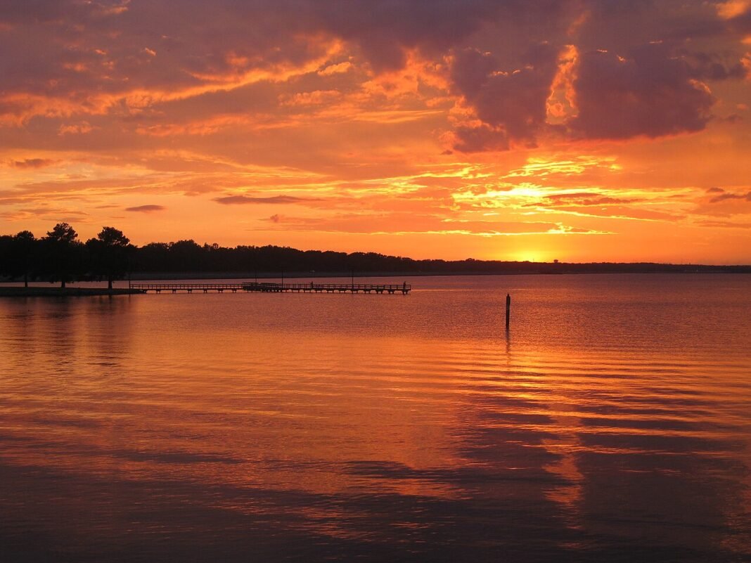
Mississippi‘s outdoor recreation is defined by water — the Mississippi River on the western boundary, the Pearl, Tombigbee, and Pascagoula Rivers flowing south through the state’s interior, the Ross Barnett Reservoir serving the Jackson area, the coastal marshes and barrier islands of the Gulf Coast, and the bayous and oxbow lakes of the Delta region. The state’s outdoor landscape is less dramatic than the mountain and desert environments of western states, but it delivers excellent fishing, paddling, and wildlife watching across ecological systems — bottomland hardwood forests, longleaf pine savannas, Gulf Coast marshes — that have grown scarce across the country and stay uniquely productive for specific pursuits. Mississippi’s outdoor culture is most authentic when engaged on its own terms rather than measured against landscapes it doesn’t possess.

The Natchez Trace Parkway
The Natchez Trace Parkway, a 444-mile national parkway running from Natchez, Mississippi to Nashville, Tennessee along the route of the historic Natchez Trace trail (a 10,000-year-old path used by Native Americans, then by European and American traders and travelers from the 1780s through the 1820s), gives Mississippi its most accessible and extensive outdoor corridor — a car-free (no commercial vehicles, no trucks) two-lane parkway with 50+ developed access points for hiking, cycling, and historical interpretation. Its Mississippi section (roughly 300 miles from Natchez to the Alabama border near Tishomingo) crosses pine forests, bottomland hardwood corridors, and the distinctive landscape of the Natchez-to-Jackson stretch that follows the original trace most closely.
For cyclists, the Trace is unmatched — the parkway’s smooth pavement, light traffic, and regular wayside areas make it ideal for long-distance riding. Multi-day tours of the full Mississippi section (2–3 days at typical touring pace) or shorter day rides from access points across the state open up a historically significant landscape on two wheels. The Jeff Busby site near French Camp offers free primitive camping midway along the Mississippi section; primitive camping is permitted at designated sites elsewhere on the parkway. Near Port Gibson, the Sunken Trace — a segment of the original path preserved in its 19th-century sunken-road form, worn deep into the loess soil by centuries of foot and hoof traffic — is the most evocative physical link to the historic trace available anywhere on the route.
Fishing: Catfish Country
Mississippi’s fishing culture centers on the catfish, bass, and crappie that the state’s river systems, reservoirs, and oxbow lakes turn out in abundance. The Ross Barnett Reservoir north of Jackson — 33,000 acres of impounded Pearl River — is the state’s premier large-lake fishery, yielding largemouth bass, crappie, white bass, and catfish that sustain a year-round sport fishing economy of tournaments, guide services, and recreational anglers. Its channel catfish and blue catfish populations, particularly in the deep water near the dam, produce fish that regularly exceed 20 pounds and occasionally reach trophy sizes that draw dedicated catfish anglers from across the South.
The Yazoo River backwaters and oxbow lakes of the Delta — including Moon Lake, Lake Lee, and the numerous unnamed oxbows throughout Sunflower, Humphreys, and Bolivar Counties — yield crappie and largemouth bass fishing that Delta residents rank among the best in the South. The shallow, warm water of these oxbows fishes especially well in spring and fall, when temperatures suit crappie activity near submerged timber — the ancient cypress trees that line many Delta oxbows form the structure that concentrates fish and makes the fishing as memorable to look at as it is productive.

Hiking: Tishomingo and DeSoto National Forest
Mississippi’s topography runs predominantly flat — the Delta’s alluvial plain, the coastal lowlands, and the rolling hills of the central and southern portions of the state leave little rugged hiking terrain. The major exception is northeastern Mississippi, where the southernmost extensions of the Appalachian foothills carve out rugged ground in Tishomingo State Park, the state’s most visited and most topographically striking park. The 1.9-mile Bear Creek Outcropping Trail through Tishomingo’s boulder fields and rock outcroppings, with its swinging suspension bridge over a rocky creek gorge, delivers a hiking experience unlike anything else in Mississippi — one that would stand out even in states with far more vertical relief.
To the south, the DeSoto National Forest in the longleaf pine region of southeastern Mississippi spreads across roughly 500,000 acres of managed forest with hiking, mountain biking, and horseback riding trails. The Longleaf Horse Trail (21 miles of multi-use loops for hiking, biking, and horseback riding) cuts through some of the largest surviving longleaf pine savanna in the South — an ecosystem that once covered 90 million acres of the southeastern United States and has since been reduced to less than 3% of its original extent. DeSoto’s scattered savannas, with their wiregrass understory, red-cockaded woodpecker populations, and the particular quality of light through the open pine canopy, offer an ecological experience few places in the country can match. The Paul B. Johnson State Park south of Hattiesburg adds more accessible day hiking and water access at the park’s 225-acre Geiger Lake (formerly Lake Shelby).
Gulf Coast Paddling and Wildlife
The Mississippi Gulf Coast’s back-bay system — the shallow water between the barrier islands and the mainland, connected by tidal passes and navigable by kayak and canoe — opens paddling access to some of the most ecologically productive estuarine water in the Gulf of Mexico. The marshes of the Pascagoula River drainage, the Grand Bay National Estuarine Research Reserve (about 18,000 acres of marsh, swamp, and upland habitat east of the Pascagoula, near the Alabama line), and the back bays behind Biloxi and Gulfport form paddling environments where bottlenose dolphins are regular companions, where brown pelicans have recovered from their near-extinction and now nest on barrier island spoil areas, and where the osprey and bald eagle populations that have rebounded throughout the Gulf Coast hunt the tidal flats.

The Pascagoula River — the largest unimpounded river drainage in the lower 48 states (the entire Pascagoula watershed has no major dams) — carries free-flowing paddling from the confluence of the Leaf and Chickasawhay Rivers above Merrill all the way to the Gulf Coast. Its bottomland hardwood swamps, particularly within the Pascagoula River Wildlife Management Area (nearly 37,000 acres of protected bottomland), route paddlers through old-growth cypress-tupelo swamp forest, some of the most intact bottomland hardwood habitat left in the Southeast. Spring migration funnels warblers, vireos, and flycatchers through the swamp in concentrations that rank the Pascagoula bottomlands among the finest spring birding in the state.
Frequently Asked Questions
What does the Natchez Trace Parkway offer outdoor visitors in Mississippi?
The Natchez Trace Parkway is a 444-mile national parkway running from Natchez, Mississippi to Nashville, Tennessee along the route of the historic Natchez Trace trail — a 10,000-year-old path used by Native Americans and American traders from the 1780s through the 1820s. The parkway’s Mississippi section (roughly 300 miles from Natchez to the Alabama border) gives the state its most extensive outdoor corridor — a car-free two-lane road with 50+ developed access points for hiking, cycling, and historical interpretation. It is Mississippi’s premier cycling destination: smooth pavement, light traffic, and regular wayside areas make multi-day tours ideal. Near Port Gibson, the Sunken Trace preserves a segment of the original path in its 19th-century sunken-road form — worn deep into the loess soil by centuries of foot and hoof traffic, it is the most evocative physical link to the historic trail anywhere on the parkway.
What fishing does Mississippi offer?
Mississippi’s fishing culture centers on the catfish, bass, and crappie that the state’s river systems, reservoirs, and oxbow lakes turn out in abundance. The Ross Barnett Reservoir north of Jackson — 33,000 acres of impounded Pearl River — is the state’s premier large-lake fishery, yielding largemouth bass, crappie, white bass, and catfish. Its channel catfish and blue catfish populations near the dam produce fish regularly exceeding 20 pounds. The Yazoo River backwaters and oxbow lakes of the Delta — including Moon Lake, Lake Lee, and numerous unnamed oxbows throughout Sunflower, Humphreys, and Bolivar Counties — yield crappie and largemouth bass fishing that Delta residents rank among the best in the South. These shallow, warm oxbows fish especially well in spring and fall, when temperatures suit crappie activity near submerged timber, and the ancient cypress trees lining many of them form the structure that concentrates fish and makes the fishing memorable to look at.
What makes Tishomingo State Park Mississippi’s most dramatic hiking destination?
Mississippi’s topography runs predominantly flat, which makes Tishomingo State Park in northeastern Mississippi — where the southernmost extensions of the Appalachian foothills carve out rugged ground — the state’s most visited and most topographically distinctive park. The 1.9-mile Bear Creek Outcropping Trail through Tishomingo’s boulder fields and rock outcroppings, with its swinging suspension bridge over a rocky creek gorge, delivers a hiking experience unlike anything else in Mississippi. To the south, the DeSoto National Forest spreads across roughly 500,000 acres of managed forest with hiking, mountain biking, and horseback riding. The Longleaf Horse Trail (21 miles) cuts through some of the largest surviving longleaf pine savanna in the South — an ecosystem that once covered 90 million acres of the southeastern United States and has since been reduced to less than 3% of its original extent, making DeSoto a nationally significant ecological destination.
What paddling and wildlife watching does Mississippi’s Gulf Coast offer?
Mississippi’s Gulf Coast back-bay system — the shallow water between the barrier islands and the mainland — opens paddling access to some of the most ecologically productive estuarine water in the Gulf of Mexico. The Grand Bay National Estuarine Research Reserve (about 18,000 acres of marsh, swamp, and upland habitat east of the Pascagoula, near the Alabama line) and the back bays behind Biloxi and Gulfport form paddling environments where bottlenose dolphins are regular companions, brown pelicans nest on barrier island spoil areas, and bald eagle populations hunt the tidal flats. Ship Island in the Gulf Islands National Seashore, reached by ferry from Gulfport, makes the most pristine Gulf Coast beach day-trip in Mississippi — white sand and clear green water that show the Gulf’s natural character before coastal development.
What makes the Pascagoula River significant for paddling and birding?
The Pascagoula River is the largest unimpounded river drainage in the lower 48 states — the entire Pascagoula watershed has no major dams, letting it flow free from the confluence of the Leaf and Chickasawhay Rivers to the Gulf Coast. Its bottomland hardwood swamps, particularly within the Pascagoula River Wildlife Management Area (nearly 37,000 acres of protected bottomland), route paddlers through old-growth cypress-tupelo swamp forest, some of the most intact bottomland hardwood habitat left in the Southeast. Spring migration funnels warblers, vireos, and flycatchers through the swamp in concentrations that rank the Pascagoula bottomlands among the finest spring birding in Mississippi. The river’s free-flowing character sustains a natural flood-pulse cycle that maintains the biological diversity of the bottomland forest and the fisheries of the lower Pascagoula basin.