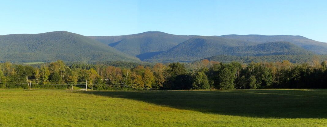
Massachusetts outdoor recreation is defined by a geographic diversity that is remarkable for a state of its size — roughly 7,800 square miles of land that span from the Atlantic barrier beaches of Cape Cod to the upland forests of the Berkshire Hills, with the river valleys of the Pioneer Valley, the rocky North Shore coast, and the inland hills of central Massachusetts in between. The state’s outdoor infrastructure is well-developed, with an exceptional state park system, extensive trail networks, and water access that ranges from the surf breaks of the outer Cape to the flatwater paddling of the Connecticut River. The payoff here goes to people who engage with these specific environments rather than chasing the dramatic extremes of the western states — subtler terrain, but genuine.

Hiking: From the Blue Hills to the Berkshires
The Blue Hills Reservation, 7,000 acres of forested hills immediately south of Boston in Milton and Quincy, is the most-used hiking destination in Massachusetts — a wilderness area within sight of Boston’s skyline that holds 125 miles of trails ranging from the easy Skyline Trail along the ridge to the more demanding summit scrambles on Great Blue Hill (635 feet, the highest point in the reservation and the tallest landform within 10 miles of the Atlantic coast between Maine and Florida). The summit, reachable on multiple trail routes of 2–4 miles round trip, opens onto panoramic views of Boston Harbor, the South Shore, and the city skyline that few metropolitan hikes can match. The Blue Hills serve as the introduction to Massachusetts hiking for the vast majority of Boston-area residents and as the easiest year-round outdoor destination to reach in the metro.
Its northern counterpart, the Middlesex Fells Reservation in Medford, Stoneham, and Winchester — 2,575 acres immediately north of Boston — packs more than 100 miles of hiking trails through rocky woodlands above the Spot Pond reservoir. The Skyline Trail through the Fells follows a ridge of glacially scoured granite that yields good views east toward Boston and west toward the Blue Hills. The Fells run gentler in elevation than the Blue Hills but stay just as easy to reach from the inner suburbs, with a network of interconnected trails that repays multiple visits and varying route choices.
Farther west, the Quabbin Reservation in central Massachusetts — a managed watershed that supplies drinking water to Greater Boston through the 412-billion-gallon Quabbin Reservoir, the largest inland body of water in Massachusetts — covers 56,000 acres of largely undeveloped forest with 35 miles of hiking trails. The Quabbin is unique among Massachusetts outdoor destinations for its wilderness character: the reservoir was created in the 1930s by the flooding of four Swift River Valley towns, and the surrounding forest has regrown for nearly 90 years in isolation from suburban development. Bald eagle populations, which have reestablished at the Quabbin after their near-extinction in the 1970s, make the reservoir one of the best eagle-watching destinations in the Northeast — particularly in winter when up to 30 eagles can sometimes be observed from the reservoir’s dikes and overlooks.
The Appalachian Trail in Massachusetts
Massachusetts’s 90-mile section of the Appalachian Trail crosses the state from the Connecticut border at Sages Ravine (a steep, waterfall-cut gorge section shared with Connecticut) through the Berkshire Hills to the Vermont border near North Adams. The Massachusetts AT holds some of the finest walking on the entire 2,190-mile trail — it crosses Mount Greylock (3,491 feet, the highest point in Massachusetts and among the most distinctive peaks in the Northeast) on a route that passes through old-growth balsam fir and spruce forest near the summit, past Bascom Lodge (a stone lodge built by the Civilian Conservation Corps in the 1930s that offers bunkroom lodging and meals to AT hikers), and emerges onto the summit’s memorial tower with views extending to New Hampshire, Vermont, New York, and Connecticut on clear days.
The southern Berkshire sections of the Massachusetts AT rank as the toughest in the state, with significant elevation change in the area around Jug End and Mount Everett (2,602 feet) that delivers a workout disproportionate to its modest elevation compared to White Mountain standards. Day hikes of 8–15 miles run from trailheads throughout the Berkshire section; the Greylock summit day hike from Cheshire (approximately 9 miles round trip) or from the North Adams side is one of the most rewarding full-day hikes in New England.

Sea Kayaking and Paddling
Massachusetts sea kayaking centers on three distinct environments, each a different kind of day on the water. Cape Cod Bay, the sheltered body of water between Cape Cod’s inner (bay-side) shore and the Massachusetts mainland, is the gentlest paddling in the state — protected from the Atlantic swell by the Cape’s arm, with warm water in summer, extensive tidal flats that expose at low tide, and the chance to spot harbor seals, ospreys, and the seasonal whale populations that feed in the bay from spring through fall. Launches from Wellfleet Harbor, Barnstable Harbor, and the sandy beaches of Sandy Neck in Barnstable open multiple entry points for day paddles along the bay shore.
The North Shore’s Essex River and Ipswich River estuary systems open flatwater paddling through the Great Marsh — one of the largest salt marshes on the Northeast coast, stretching from Gloucester to Newburyport and supporting populations of herons, egrets, glossy ibis, and the sharp-tailed sparrows that nest in the marsh grass. Essex is the center of North Shore kayak culture, with several outfitters offering rentals and guided tours through the estuary. At high tide, the marsh’s inner channels grant intimate access to an ecosystem that is otherwise reachable only by birds and paddlers.
The Connecticut River in the Pioneer Valley is the state’s finest river paddling — a wide, gentle river whose flatwater character suits canoes and recreational kayaks, with access points throughout its Massachusetts length from Northampton to the Connecticut border. The Barton Cove section in Gill, behind a hydroelectric dam, creates a calm paddling pond where bald eagles nest and where the sunset views across the water to the Sugarloaf Mountain ridge rank among the finest in western Massachusetts. The annual Connecticut River Canoe and Kayak race, one of the region’s longest-running paddling events, uses this section of river.
Cycling: Urban Paths to Mountain Trails
Massachusetts has built out some of the best cycling infrastructure in the Northeast, anchored by an extensive network of rail trails that convert abandoned railroad corridors to car-free cycling and pedestrian paths. The Minuteman Bikeway — 10 miles from Cambridge’s Alewife MBTA station through Arlington and Lexington to Bedford — is the most-used rail trail in the state, passing through the communities where the first battles of the American Revolution were fought and pairing historical significance with cycling utility that is unique in American trail design. The trail is wide, paved, and open year-round; it serves both utilitarian commuter cycling and recreational rides, with the Battle Road section through Lexington carrying interpretive markers that explain the April 19, 1775 events that unfolded on this terrain.
The Shining Sea Bikeway on Cape Cod runs 10.7 miles from Woods Hole (where the ferries to Martha’s Vineyard depart) through Falmouth to North Falmouth, with views of Vineyard Sound and Buzzards Bay that make it one of the most scenic rail trails on the Cape. The Cape Cod Rail Trail runs about 25 miles from Dennis through Harwich, Brewster, Orleans, Eastham, and Wellfleet, threading the pine barrens and kettle ponds of the National Seashore — a flat, paved route ideal for families and casual cyclists. The Berkshires hold the state’s mountain biking terrain, with the Pittsfield State Forest and the NEMBA (New England Mountain Biking Association) trail networks on the Berkshire Hills laying out technical singletrack built for experienced riders.
Winter Sports
Massachusetts winter sports are modest by New England standards — the state lacks the elevation and snowfall of Vermont or New Hampshire — but they put easy skiing and snowshoeing within reach of the Greater Boston population that doesn’t want to drive three hours to Vermont. Wachusett Mountain in Princeton, 50 miles from Boston, is the closest ski area to the city — a small but genuinely skiable mountain with a 1,000-foot vertical drop and snowmaking that keeps terrain open through variable-snowfall New England winters. Wachusett’s proximity makes it the first-time skiing destination for thousands of Boston families annually, and its season pass prices stay reasonable by regional standards.
The Berkshire hills hold the state’s most serious winter terrain: Jiminy Peak in Hancock (1,150-foot vertical), Bousquet Mountain in Pittsfield (750-foot vertical), and Catamount Ski Area on the Massachusetts-New York border (1,000-foot vertical) deliver legitimate skiing within the state. Snowshoeing and cross-country skiing on the state park trail systems — particularly in the Berkshires at Pittsfield State Forest and October Mountain State Forest (the largest state forest in Massachusetts at 16,500 acres) — open winter outdoor access for those who prefer human-powered snow sports to lift-served skiing. The state’s snowshoe trail network, while less developed than Vermont or Maine, gives winter hikers a silence and solitude that the summer season rarely matches.
Whale Watching and Marine Wildlife
Stellwagen Bank National Marine Sanctuary, an 842-square-mile federally protected marine area between Cape Ann and Cape Cod, ranks as one of the most productive whale-feeding grounds on the East Coast — a submarine plateau where upwelling nutrients concentrate the small fish and krill that humpback, finback, minke, and North Atlantic right whales feed on from late spring through fall. Whale watch boats departing from Boston (Long Wharf), Gloucester, Plymouth, and Provincetown carry hundreds of thousands of visitors annually to observe feeding whales at close range — the humpback populations that return to Stellwagen year after year are individually identified by researchers and show the behavior patterns of animals that are habituated to the whale watch boats. The North Atlantic right whale, the most endangered large whale species with fewer than 400 individuals remaining, is occasionally seen in the sanctuary — one of the more sobering wildlife encounters available in any New England outdoor experience.
Frequently Asked Questions
What hiking does the Blue Hills Reservation offer near Boston?
The Blue Hills Reservation, 7,000 acres of forested hills immediately south of Boston in Milton and Quincy, is the most-used hiking destination in Massachusetts — a wilderness area visible from the city skyline with 125 miles of trails. Great Blue Hill (635 feet) is the highest point in the reservation and the tallest landform within 10 miles of the Atlantic coast between Maine and Florida. Its summit, reached via multiple trail routes of 2–4 miles round trip, opens onto sweeping views of Boston Harbor, the South Shore, and downtown that few city-edge hikes can rival. The trail network ranges from easy paths to demanding summit scrambles, making the reservation the natural starting point for Boston-area residents getting into the sport. Year-round access, transit proximity, and that web of interconnected trails make it the most practical outdoor resource the Greater Boston population has.
What does the Appalachian Trail in Massachusetts offer hikers?
Massachusetts’s 90-mile section of the Appalachian Trail crosses the state from the Connecticut border through the Berkshire Hills to Vermont near North Adams. The Massachusetts AT ranks as one of the most beautiful sections of the entire 2,190-mile trail — it crosses Mount Greylock (3,491 feet, the highest point in Massachusetts) through old-growth balsam fir and spruce forest near the summit, past Bascom Lodge (a stone lodge built by the Civilian Conservation Corps in the 1930s that offers bunkroom lodging and meals to AT hikers), and emerges onto the summit tower with views extending to New Hampshire, Vermont, New York, and Connecticut on clear days. The day hike to the summit from Cheshire (approximately 9 miles round trip) is one of the most rewarding full-day outings in New England. The southern Berkshire sections cross Jug End and Mount Everett (2,602 feet), where steep elevation change delivers a workout out of proportion to the modest height.
What sea kayaking and paddling does Massachusetts offer?
Massachusetts sea kayaking centers on three distinct environments. Cape Cod Bay, the sheltered body of water between Cape Cod’s inner shore and the mainland, holds the gentlest sea kayaking in the state — protected from Atlantic swell, warm in summer, with tidal flats exposing at low tide and chances to spot harbor seals, ospreys, and the seasonal whales that feed there from spring through fall. The North Shore’s Essex River and Ipswich River estuary systems open flatwater paddling through the Great Marsh — among the largest salt marshes on the Northeast coast, supporting herons, egrets, glossy ibis, and sharp-tailed sparrows. For river paddling, the Connecticut River in the Pioneer Valley is the state’s finest — the Barton Cove section in Gill, behind a hydroelectric dam, creates a calm pond where bald eagles nest and the sunset views toward Sugarloaf Mountain rank among the best in western Massachusetts.
What cycling trails does Massachusetts offer?
Massachusetts has built out some of the best cycling infrastructure in New England, anchored by rail trails converting abandoned railroad corridors to car-free paths. The Minuteman Bikeway — 10 miles from Cambridge’s Alewife MBTA station through Arlington and Lexington to Bedford — is the most-used rail trail in the state, passing through the communities where the first battles of the American Revolution were fought and combining historical significance with cycling utility unique in American trail design. The Shining Sea Bikeway on Cape Cod covers 10.7 miles from Woods Hole through Falmouth to North Falmouth, with views of Vineyard Sound and Buzzards Bay. The Cape Cod Rail Trail extends about 25 miles from Dennis through Harwich, Brewster, Orleans, Eastham, and Wellfleet, threading the pine barrens and kettle ponds of the National Seashore. For off-road riding, the Berkshires hold mountain biking terrain through Pittsfield State Forest and the NEMBA trail networks.
What whale watching does Stellwagen Bank National Marine Sanctuary offer?
Stellwagen Bank National Marine Sanctuary, an 842-square-mile federally protected marine area between Cape Ann and Cape Cod, ranks as one of the most productive whale-feeding grounds on the East Coast — a submarine plateau where upwelling nutrients concentrate the small fish and krill that humpback, finback, minke, and North Atlantic right whales feed on from late spring through fall. Whale watch boats departing from Boston’s Long Wharf, Gloucester, Plymouth, and Provincetown carry hundreds of thousands of visitors annually to observe feeding whales at close range. The humpback populations that return to Stellwagen year after year are individually identified by researchers and show behavior patterns of animals habituated to the boats. The North Atlantic right whale — the most endangered large whale species with fewer than 400 individuals remaining — is occasionally seen in the sanctuary, making it one of the most sobering wildlife encounters available in New England.