Georgia Outdoors: Mountains, Coast, and Everything Between
Georgia’s outdoor recreation covers a range that is unusual for a Southern state: the southern Appalachian Mountains in the far north, where the Appalachian Trail begins at Springer Mountain; barrier island wilderness on the Atlantic coast; whitewater rivers that have produced multiple Olympic kayaking champions; vast National Forest lands in the northern and eastern parts of the state; and urban parks and greenways in Atlanta that rival the best city trail systems in the country. The state’s geography — running from sea level to nearly 4,800 feet at Brasstown Bald — supports ecosystems and outdoor experiences that most visitors associate with states hundreds of miles away.
North Georgia Mountains: Hiking and Waterfalls
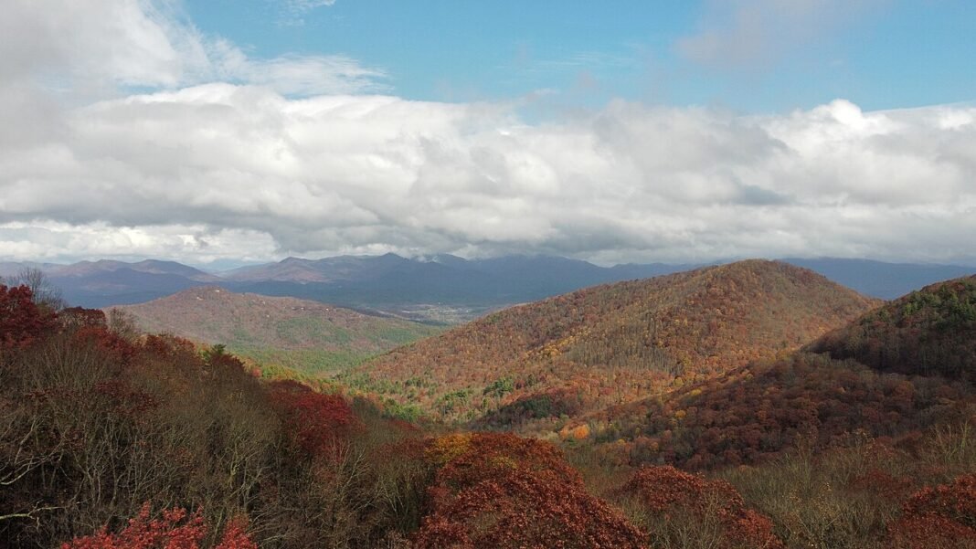
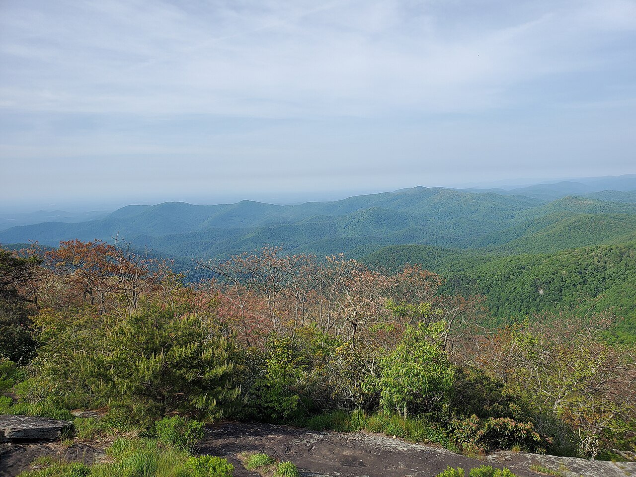
The Blue Ridge Mountains of north Georgia are the southernmost stretch of significant Appalachian terrain, and they hold hiking, waterfall, and mountain scenery that is striking for the latitude. The southern Appalachians in Georgia catch some of the highest rainfall of any region in the eastern United States — rivaling the Pacific Northwest in places — which drives heavy plant diversity and feeds hundreds of waterfalls reachable from the highway network.

Amicalola Falls State Park: The 729-foot Amicalola Falls is the tallest cascading waterfall in the Southeast and the southern approach to the Appalachian Trail at Springer Mountain (8.5 miles by trail from the park). The falls draw visitors via a steep 0.4-mile trail, and the park serves as the main staging point for AT through-hikers setting off on the approach trail each spring. The park’s lodge and cottages sit on the ridge above the falls, looking out over the Etowah River Valley.
Tallulah Gorge State Park: Tallulah Gorge — 1,000 feet deep over 2 miles of length — is the most dramatic geological formation in Georgia, carved by the Tallulah River through quartzite rock into a series of waterfalls and pools. The park’s rim trail looks down into the gorge; a limited-permit floor trail descends to the base of several falls and requires crossing the river on suspension bridges. In the 1890s, Tallulah Gorge was a major tourist destination — “the Niagara of the South” in the contemporary descriptions.

Raven Cliff Falls and Smithgall Woods: The White County area near Cleveland holds some of Georgia’s finest mountain hiking. Raven Cliff Falls drops in four stages over 100 feet through a slot canyon reached by a 5-mile round-trip trail. Smithgall Woods State Park protects one of the best sections of the Chattahoochee River and offers single-angler access to first-rate trout fishing in its designated fly-fishing-only corridor.
Appalachian Trail in Georgia
The Appalachian Trail begins (or ends, depending on direction of travel) at Springer Mountain in the Chattahoochee-Oconee National Forest. The 78.6-mile Georgia section of the AT is the most hiked stretch of the trail — tens of thousands of through-hikers begin their northbound journeys from Springer Mountain each year between February and April, making the Georgia AT among the most active and social parts of the entire 2,197.9-mile route.
The trail in Georgia passes over Blood Mountain (4,458 feet, the high point of the Georgia AT and the site of the oldest standing shelter on the trail) and a run of peaks and gaps that deliver steady mountain scenery and the kind of ridge-walking that the southern Appalachians do at their most approachable. Blood Mountain works as a day hike (4.2 miles round trip from the Vogel State Park approach) without the long trek required to reach Springer Mountain.
Paddling: Chattooga Wild and Scenic River
The Chattooga River, which forms the Georgia-South Carolina border for most of its length in the Chattahoochee National Forest, is one of the premier whitewater rivers in the eastern United States. Designated a National Wild and Scenic River, the Chattooga runs through undisturbed mountain gorge terrain with Class I-V whitewater across its four sections. Section IV — Bull Sluice to Lake Tugalo — holds the most technical whitewater, including Woodall Shoals (one of the most dangerous rapids in the Southeast) and Seven Foot Falls. The Chattooga gained national notoriety as the filming location for “Deliverance” (1972), though its real character — wild, beautiful, and genuinely demanding — differs considerably from the film’s portrayal.

Georgia Coast: Cumberland Island and Beyond
Georgia’s barrier island coast is the most ecologically intact of any Atlantic coast state. The mix of private ownership, federal protection at Cumberland Island National Seashore, and the Georgia state park system at Jekyll and Little St. Simons islands has preserved more than 100 miles of relatively undeveloped barrier island shoreline that supports nesting loggerhead sea turtles (Georgia’s beaches rank among the most important loggerhead nesting grounds on the U.S. Atlantic coast), manatees in the warmer months, right whales in winter, and remarkable shorebird and wading bird populations year-round.
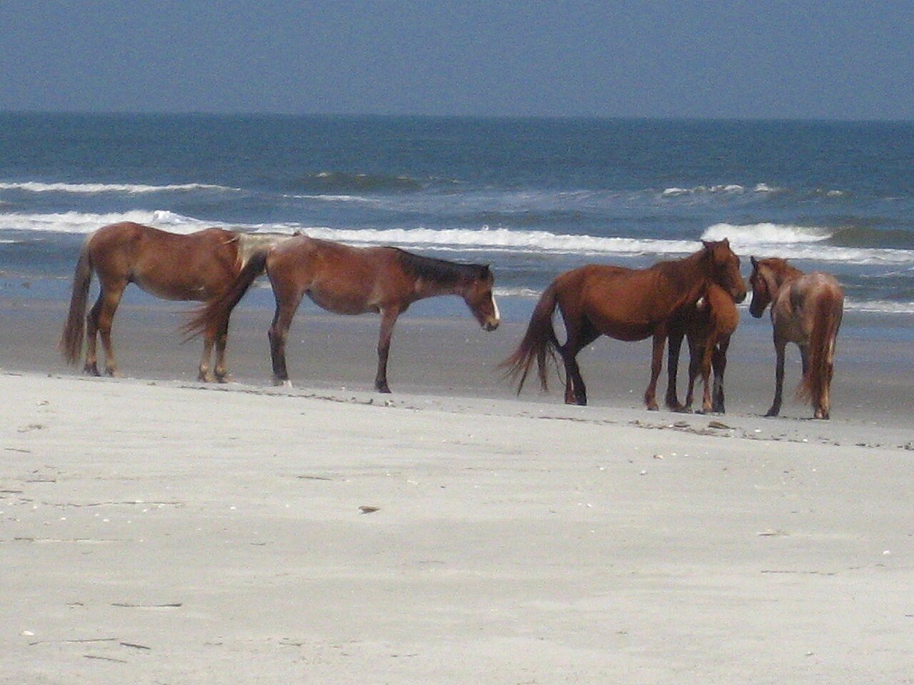
Little St. Simons Island is reachable only by boat and takes a maximum of 32 guests at a time, making it among the most private island stays on the entire East Coast. The island’s wide beach, strong birding (250+ species recorded), and guided nature programs make it a destination of real distinction for nature-minded travelers willing to pay the premium for seclusion.
Atlanta BeltLine: Urban Outdoor Recreation
The Atlanta BeltLine — a 22-mile loop of repurposed railroad corridors wrapping the city’s urban core — is one of the most significant urban park and trail projects in the United States. The Eastside Trail, its most developed and most heavily used segment, runs from the Old Fourth Ward through Ponce City Market to Piedmont Park and links dozens of restaurants, shops, and cultural venues along a continuous multi-use path. The BeltLine’s ongoing build-out — additional trail sections, parks, affordable housing, and transit — is reshaping Atlanta’s intown neighborhoods in ways that are making the city far more walkable, bikeable, and livable than at any earlier point in its history.
Georgia’s outdoor recreation mirrors the state’s geographic spread: the experiences packed into Georgia span four or five states’ worth of terrain, from Appalachian mountain wilderness to undeveloped barrier islands to in-town urban trail systems, all within a day’s drive of one another. For outdoor travelers, that range of options in a single state is hard to match.
Frequently Asked Questions
What are Georgia’s best waterfalls and where are they?
Amicalola Falls in Dawson County is the centerpiece of Georgia’s waterfall landscape — at 729 feet, it is the tallest cascading waterfall in the Southeast, reached via a steep 0.4-mile trail to the base or a longer loop to the summit overlook at Amicalola Falls State Park. The park also serves as the approach trail access to the Appalachian Trail’s southern terminus at Springer Mountain (8.5 miles by trail). Tallulah Gorge State Park features a 1,000-foot-deep gorge carved by the Tallulah River through quartzite, with rim trail views and a limited-permit floor trail descending to the base of several falls via suspension bridges. Raven Cliff Falls in White County drops in four stages through a slot canyon (5-mile round trip). The heavy rainfall in north Georgia’s Blue Ridge Mountains feeds hundreds of additional waterfalls reachable from the highway network.
What makes the Appalachian Trail in Georgia significant for hikers?
The Appalachian Trail’s southern terminus is at Springer Mountain in the Chattahoochee-Oconee National Forest — the starting (or ending) point for every northbound through-hiker attempting all 2,197.9 miles to Maine. The Georgia section (78.6 miles) is the most hiked stretch of the entire trail: tens of thousands of through-hikers begin northbound journeys between February and April each year, creating a social and supportive atmosphere unlike any other section. Blood Mountain (4,458 feet) is the high point of the Georgia AT and the site of the oldest standing shelter on the trail, reachable as a day hike (4.2 miles round trip from Vogel State Park) without the 8.5-mile approach hike to Springer Mountain. The Georgia AT runs through steady mountain terrain with ridge-walking that defines the southern Appalachian experience.
What makes the Chattooga River one of the Southeast’s best white water experiences?
The Chattooga River forms most of the Georgia-South Carolina border through the Chattahoochee National Forest and is a designated National Wild and Scenic River with some of the most challenging and undisturbed whitewater in the eastern United States. Its four sections offer Class I-V difficulty ranges. Section IV (Bull Sluice to Lake Tugalo) holds the most technical whitewater, including Woodall Shoals (one of the most dangerous rapids in the Southeast) and Seven Foot Falls. The river runs through remote mountain gorge terrain with no road access along most of its length, creating true wilderness whitewater. The Chattooga was made famous as the filming location for “Deliverance” (1972), though the river’s real character — wild, beautiful, and demanding — differs from the film’s portrayal. Commercial rafting outfitters operate on Sections III and IV from the Georgia-South Carolina border area.
What does Georgia’s barrier island coast offer outdoor visitors?
Georgia’s barrier island coast is the most ecologically intact of any Atlantic coast state. Cumberland Island National Seashore (reachable only by ferry from St. Marys) preserves about 17 miles of undeveloped Atlantic beach, maritime forest, and salt marsh alongside Carnegie estate ruins and feral horses that have roamed the island since the 1700s. Georgia’s beaches rank among the most important loggerhead sea turtle nesting grounds on the U.S. Atlantic coast, with nesting running June through August — and Cumberland records the most nests of any beach in the state. Manatees frequent the coastal estuaries in warmer months, and right whales winter in Georgia’s offshore waters, part of the species’ only known calving ground, off the coasts of Georgia and northern Florida. Little St. Simons Island, reachable only by boat and taking a maximum of 32 guests at a time, offers 250+ recorded bird species and guided nature programs in an undeveloped barrier island setting. Jekyll Island provides 10 miles of relatively undeveloped beach alongside its Gilded Age history.
What is the Atlanta BeltLine and how has it changed outdoor recreation in the city?
The Atlanta BeltLine is a 22-mile loop of repurposed railroad corridors wrapping Atlanta’s urban core — one of the most ambitious urban park and trail projects in the United States. The Eastside Trail (the most developed and heavily used segment) runs from the Old Fourth Ward through Ponce City Market to Piedmont Park, passing dozens of restaurants, shops, and cultural venues on a continuous multi-use path. The full loop links roughly 45 previously disconnected neighborhoods and provides non-automotive access across much of intown Atlanta. Planned additions include more trail sections, parks, affordable housing, and an eventual BeltLine transit line. The project has made Atlanta measurably more walkable and bikeable, and has earned national recognition as a model for urban trail-driven neighborhood revitalization.