Connecticut Outdoors: Hiking, Paddling, Coastline, and Fall Foliage
Connecticut may be the third-smallest state in the continental United States, but it packs a surprising density of outdoor recreation into its 5,543 square miles. The state runs 110 state parks and 32 state forests, more than 700 miles of designated hiking trails (including a 52-mile stretch of the Appalachian National Scenic Trail), 253 miles of coastline on Long Island Sound, and river and lake paddling across a landscape that ranges from the pastoral Litchfield Hills in the northwest to the tidal marshes of the Connecticut River estuary in the southeast. For a state that many people pass through rather than explore, the Connecticut outdoors reward anyone willing to slow down and look.

Hiking: Connecticut’s State Parks and Trails
Sleeping Giant State Park (Hamden): One of Connecticut’s most popular hiking parks, Sleeping Giant rises as a traprock ridge above the suburbs north of New Haven, its profile resembling a recumbent human figure when seen from a distance. The park’s 32 miles of trails run from easy walk-in routes to the demanding Blue/Yellow traverse of the full ridge. A stone tower crowns the Giant’s “head” at the end of the Tower Path (1.6 miles each way), and its observation deck opens up the broadest easily reached views in southern Connecticut — Long Island Sound, New Haven, and the Quinnipiac River Valley spread out below.

Appalachian Trail in Connecticut: The AT covers 52 miles of Connecticut terrain, threading the most remote and varied country in the state. The stretch through the Kent area — following the west bank of the Housatonic River past Bull’s Bridge and climbing through the Schaghticoke and Ten Mile River sections — counts among the prettiest in New England. The trail’s high point in Connecticut, Bear Mountain (2,316 feet), opens onto views of Massachusetts and New York on clear days.

Talcott Mountain State Park (Simsbury): The traprock ridge of Talcott Mountain climbs above the Farmington River Valley northwest of Hartford, with the 1914 Heublein Tower at its summit framing one of the best-known outlooks in central Connecticut — the Hartford skyline, the Connecticut River, and the Berkshire Hills on clear days, all visible from the observation deck. The 1.25-mile Tower Trail is a steady, leg-burning climb, and it sits within 20 minutes of Hartford’s suburbs.
Chatfield Hollow State Park (Killingworth): One of Connecticut’s finest family hiking parks, Chatfield Hollow gathers a lake, a stream, and forested ridge trails into a valley setting that turns especially beautiful in spring and fall. Swimming at the lake beach in summer and leaf-peeping on the ridge in October make it one of the most versatile parks in the state.
Paddling: Rivers, Reservoirs, and the Sound
Connecticut’s rivers deliver first-rate paddling, with the Housatonic, Connecticut, and Farmington offering everything from gentle flatwater suitable for families to technical Class II–III rapids for experienced paddlers.
The Connecticut River is the state’s signature paddle — a broad, slow-moving waterway in its lower reaches that turns into a tidal estuary near Old Saybrook, where the meeting of fresh and salt water creates one of the most ecologically productive natural areas in the Northeast. The Connecticut River Birding Trail strings together more than 100 miles of paddling routes through the lower river, with chances to see bald eagles, osprey, great blue herons, and the shorebird flocks that work the tidal marshes.

The Farmington River in northwestern Connecticut holds a federally designated Wild and Scenic section and runs the state’s most consistent whitewater — Class II–III rapids at moderate water levels — through a forested corridor near New Hartford and Canton that stays largely undeveloped despite its suburban surroundings. The American Whitewater organization has worked extensively across the Farmington watershed to protect and improve access for paddlers.
Coastal Recreation on Long Island Sound
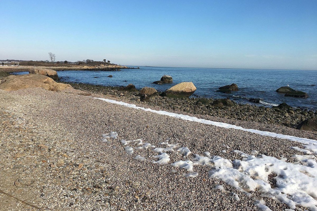
Connecticut’s Long Island Sound coast is one of the Northeast’s richest coastal environments, both historically and ecologically. The Sound itself — sheltered from the open Atlantic by Long Island — holds calm-water conditions that support kayaking, sailing, and motorboating at a scale impossible on the exposed southern New England coast. The tidal creeks and salt marshes lining much of the shore rank among the most productive wildlife habitats on the East Coast: ospreys nest on platforms throughout the marshes, egrets and herons stalk the shallows, and horseshoe crabs come ashore on full-moon nights in May and June to spawn, a ritual that has played out unchanged for 300 million years.
Hammonasset Beach State Park, Connecticut’s largest public beach and its most-visited state park, draws more than three million visitors a year to its two-mile sand beach, tidal marshes, and campground. Rocky Neck State Park makes a smaller, less crowded alternative. The kayak launch at Barn Island Wildlife Management Area near Stonington opens onto some of the best paddling on the Connecticut coast — a maze of tidal channels, barrier beaches, and salt ponds prized for its birding and wildlife viewing.
Fall Foliage: Connecticut’s Peak Season
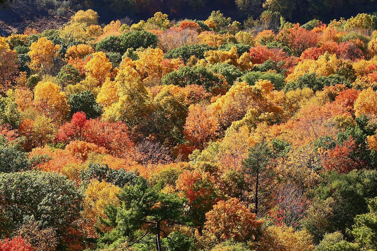
Connecticut’s fall color is the real draw — a deciduous forest of oak, maple, birch, beech, and hickory layered over glacially sculpted terrain produces foliage displays that peak in mid-October and supply the best reason of any season to get outdoors here. The Litchfield Hills northwest of Waterbury, the Connecticut River Valley, and the Quiet Corner of Windham County each deliver a distinct color experience, from the bold hillside palette of the Taconic range to the mirror-still river reflections along the Connecticut in low fall light.
The Mohawk Trail along Route 2 in Massachusetts, just north of the Connecticut border, extends the foliage drive, and many Connecticut residents treat the run from Kent through Norfolk to the Massachusetts line as a fall ritual — picking up cider and apples at farm stands along the way, pausing at covered bridges and waterfalls, and soaking up the kind of New England fall that has drawn travelers to the region for two centuries.
Connecticut rewards travelers who take their time with it — the state’s compact size packs unusual variety into short distances, and a weekend that opens with coastal kayaking, runs through Mystic, and closes with a hike in the Litchfield Hills is easily within reach. That much good outdoor and cultural experience inside a small state is Connecticut’s most underrated asset.
Frequently Asked Questions
What are Connecticut’s best hiking destinations and what makes each one distinctive?
Sleeping Giant State Park in Hamden is one of Connecticut’s most popular hiking parks — a traprock ridge north of New Haven whose 32 miles of trails run from easy walks to full ridge traverses. The Tower Path (1.6 miles each way) climbs to a stone tower at the summit with sweeping views of Long Island Sound, New Haven, and the Quinnipiac Valley. Talcott Mountain State Park near Simsbury holds the 1914 Heublein Tower on a traprock ridge above the Farmington River Valley, framing Hartford skyline views after a steady 1.25-mile climb within 20 minutes of the suburbs. Bear Mountain (2,316 feet, Connecticut’s highest summit) on the Appalachian Trail in the Litchfield Hills opens onto Massachusetts and New York on clear days. The Appalachian Trail covers 52 miles of Connecticut, with the Kent-area segment through the Schaghticoke and Ten Mile River sections among the prettiest in New England.
What paddling opportunities does Connecticut offer?
The Farmington River’s federally designated Wild and Scenic section near New Hartford and Canton carries Connecticut’s most consistent whitewater — Class II–III rapids at moderate levels in a forested corridor that stays largely undeveloped. The Connecticut River in its lower reaches turns into a tidal estuary near Old Saybrook, creating one of the most ecologically productive natural areas in the Northeast; the Connecticut River Birding Trail strings together more than 100 miles of paddling routes through the lower river, with bald eagles, osprey, and great blue herons visible throughout. Barn Island Wildlife Management Area near Stonington opens onto sea kayaking through tidal channels and salt ponds with standout birding. The Housatonic River in the Litchfield Hills holds flatwater stretches well suited to beginner kayaking.
What is Connecticut’s Long Island Sound coastline like for outdoor recreation?
Connecticut’s 253-mile Long Island Sound coastline offers calm water — sheltered from the open Atlantic — that supports kayaking, sailing, and motorboating year-round. The tidal marshes lining much of the shore rank among the most productive wildlife habitats on the East Coast: ospreys nest on platforms throughout, egrets and herons stalk the shallows, and horseshoe crabs spawn on full-moon nights in May and June — a ritual unchanged for 300 million years. Hammonasset Beach State Park, Connecticut’s largest public beach and its most-visited state park, draws more than three million visitors a year with its two-mile beach, tidal marshes, and campground. The kayak launch at Barn Island Wildlife Management Area near Stonington reaches a labyrinth of tidal channels and salt ponds with exceptional wildlife viewing.
When is fall foliage in Connecticut and where is it best?
Connecticut’s fall foliage typically peaks in mid-October, when the mix of oak, maple, birch, beech, and hickory over glacially sculpted terrain puts on a genuine show. The Litchfield Hills in the northwest — particularly the drive from Kent through Norfolk along Routes 7, 44, and 272 — carry the boldest color in the state, with farm stands selling cider and apples, covered bridges (West Cornwall is among the most photographed in New England), and the hillside palette of the Taconic range. Talcott Mountain State Park and the Connecticut River Valley each offer a distinct experience: valley reflections on the river and color-lit ridgelines across the state’s central hills. The Appalachian Trail through the Kent area makes an outstanding fall hike, with full leaf color in late October.
What wildlife can be found in Connecticut’s outdoors?
Connecticut’s position in the Atlantic Flyway makes it one of the best birding states in New England relative to its size, with more than 450 species recorded statewide. Osprey have recovered dramatically from their DDT-era near-collapse — nesting platforms along the coast now host dozens of pairs. Bald eagles winter along the Connecticut River, particularly around Haddam where open water persists. The tidal marshes of the Connecticut River estuary and the Long Island Sound shore support breeding glossy ibis, snowy egrets, and little blue herons through summer. Black bear numbers in Connecticut’s northwestern hills have climbed sharply over the past decade. The horseshoe crab spawn in Long Island Sound each May and June — drawing feeding shorebirds — mirrors the more famous Delaware Bay event on a smaller scale.