Nebraska may be the most underestimated state in the country. Coastal travelers write it off as flat fly-over country, yet the state holds some of the continent’s most dramatic natural landscapes, a 500-mile stretch of the defining migration route of American westward expansion, and a city — Omaha — whose arts and dining scenes outshine their size and media profile. The Sandhills, 20,000 square miles of grass-stabilized dunes, form the largest sand dune formation in the Western Hemisphere and one of the best-preserved prairie ecosystems left in North America. Wagon ruts from the Oregon, California, and Mormon Trails still scar the soil in dozens of places, offering as tangible a link to 19th-century westward migration as you’ll find anywhere. And in Omaha, the Gene Leahy Mall, the Durham Museum, and a roster of chefs who chose the city on purpose reward anyone willing to drop the flyover assumption.

Omaha: The Unexpected City
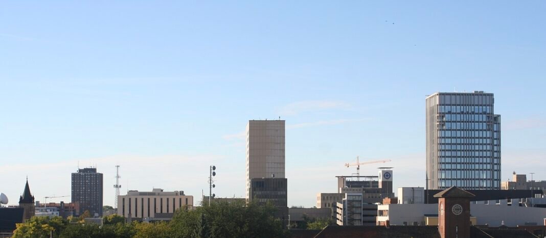
Omaha’s two-decade renaissance is one of the quieter success stories in American urban development. The city rebuilt its downtown around the redesigned Gene Leahy Mall — a 9.6-acre park with an outdoor amphitheater, a splash pad, and a trail system connecting the Missouri River waterfront to the Old Market entertainment district — alongside the CHI Health Center arena and a restaurant scene drawing national attention. The Old Market itself, a five-block warehouse district of redbrick buildings now full of restaurants, galleries, shops, and bars, is the most walkable urban core between Chicago and Denver, and the clearest case for what boosters mean when they call Omaha “the city that works.”
Set inside the restored Union Pacific Railroad depot — a 1931 Art Deco landmark and one of the finest surviving stations in the country — the Durham Museum tells Nebraska’s story with the scale and polish of any state historical society. Nearby, the Joslyn Art Museum reopened in 2024 after a $100-million expansion by the Norwegian firm Snøhetta (which added to Norman Foster’s 1994 Scott Pavilion). Its collection runs deep in American Western art: the Maximilian-Bodmer Collection, documenting the 1832–34 expedition up the upper Missouri, is the most significant visual record of pre-reservation Plains Indian life. Then there is the Henry Doorly Zoo, routinely ranked among the top three in the world, home to the Desert Dome — the world’s largest indoor desert — and the Lied Jungle, one of the largest indoor rainforests anywhere. The zoo alone justifies the drive.
The Oregon Trail Corridor
The Oregon Trail — the 2,170-mile emigrant route from Missouri to Oregon, walked by roughly 400,000 migrants between 1843 and 1869 — cut across Nebraska for nearly 500 miles, tracing the Platte River valley from the Missouri border to Fort Laramie in Wyoming. Nowhere along the route do the historic sites, surviving ruts, and interpretive centers cluster so thickly. Chimney Rock National Historic Site, near Bayard in the western panhandle, anchors the lot: a spire of volcanic ash and clay rising 300 feet above the valley floor, it appears in more emigrant diaries than any other feature on the trail.
Scotts Bluff National Monument, 23 miles west of Chimney Rock, preserves the massive sandstone-and-clay bluffs that pushed the trail south around their base through Mitchell Pass — where wagon ruts are still cut deep into the rock — until travelers began using the summit route in 1851. The visitor center holds the William Henry Jackson paintings that documented the trail, and a 1.6-mile drive (or hiking path) climbs to summit views stretching 100 miles down the North Platte valley. Farther east, Fort Kearny State Historical Park near Kearney sits where the various Missouri River departure points funneled into a single trail. The fort was the first major resupply point for westward emigrants; today an interpretive center and a reconstructed sod fort fill in the history.
The Sandhills: America’s Hidden Prairie
The Nebraska Sandhills arc across the north-central part of the state, from the South Dakota line down to the Platte. At a glance they read as rolling grassland, but the hills are an ancient dune field held in place by a mat of native grasses — and they sit atop the most productive groundwater recharge zone in the Great Plains. The Ogallala Aquifer, the largest underground freshwater formation in North America, is replenished largely through the Sandhills’ porous sandy soil. The grass-covered dunes that look like nothing, in other words, sustain agriculture across eight states.

This is cattle country. The thin, sandy soil grows grass but not row crops, so ranching has been the dominant land use here for 150 years — and the result is a landscape essentially unchanged from the pre-European Great Plains: vast, grass-covered, and alive with white-tailed and mule deer, pronghorn, coyotes, prairie dogs, and the raptor migrations that follow the Platte corridor. For wildlife, head to the Crescent Lake National Wildlife Refuge in the western Sandhills or the Valentine refuge in the center, where dozens of alkaline lakes pooled in the interdune valleys draw migrating waterbirds each spring and fall. To simply take the country in, drive the Sandhills Journey Scenic Byway, which runs Nebraska Highway 2 for 272 miles between Grand Island and Alliance.
The Platte River Crane Migration
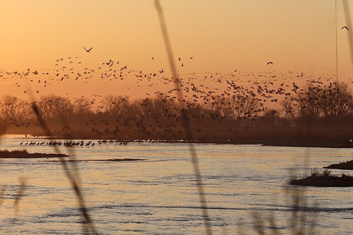
From late February through April, the central Platte valley near Kearney stages one of North America’s great wildlife spectacles: some 500,000 to 600,000 sandhill cranes — roughly 80 percent of the world’s population — gather along a 75-mile stretch of river to fatten up before pushing north to their Arctic nesting grounds. The birds roost in the Platte’s shallow, braided channels and feed by day on waste grain left in the surrounding cornfields. At dawn and dusk, hundreds of thousands lift off the river at once in a wall of sound and motion that regular visitors struggle to describe. The best vantages are the Rowe Sanctuary near Gibbon, which runs guided blinds for close viewing, and the road bridges spanning the Platte. It is Nebraska’s signature natural event, and few wildlife experiences anywhere in the U.S. rival it.
Frequently Asked Questions
What is the Nebraska Sandhills and why is it ecologically significant?
The Nebraska Sandhills — covering 20,000 square miles of north-central Nebraska — are the largest sand dune formation in the Western Hemisphere, an ancient dune field stabilized by native grasses rooted in the most productive groundwater recharge zone in the Great Plains. The Ogallala Aquifer, the largest underground freshwater formation in North America and the source sustaining agriculture across eight states, is recharged primarily through the Sandhills’ permeable sandy soil. The thin sandy soil supports grass but not row crops, making ranching the primary land use for 150 years — producing a landscape essentially unchanged from the pre-European Great Plains, populated by white-tailed and mule deer, pronghorn antelope, coyote, prairie dogs, and spectacular raptor migrations. The Crescent Lake and Valentine National Wildlife Refuges provide the best wildlife access.
What is the Platte River crane migration?
From late February through April, the central Platte River valley near Kearney hosts one of the most spectacular wildlife events in North America — roughly 500,000 to 600,000 sandhill cranes (roughly 80 percent of the world population) gather along a 75-mile stretch of the river, staging for their spring migration north to Arctic nesting grounds. The cranes roost in the Platte’s shallow braided channels and feed in surrounding cornfields. At dawn and dusk, hundreds of thousands rise from the river at once in a spectacle of sound and motion. The best vantages are the Rowe Sanctuary near Gibbon (which offers guided blind access for close viewing) and the road bridges over the Platte. It is Nebraska’s signature natural event.
What are the Oregon Trail landmarks in Nebraska?
The Oregon Trail ran through Nebraska for nearly 500 miles along the Platte River valley, giving the state the densest concentration of trail sites anywhere on the route. Chimney Rock National Historic Site near Bayard is its most recognizable landmark — a spire of volcanic ash and clay rising 300 feet above the valley floor that appears in more emigrant diaries than any other trail feature. Scotts Bluff National Monument, 23 miles west, preserves massive sandstone and clay bluffs where wagon ruts are still cut deep into the rock at Mitchell Pass, with summit views stretching 100 miles down the North Platte valley. Fort Kearny State Historical Park near Kearney marks where the various Missouri River departure points converged into a single trail.
What makes Omaha worth visiting?
Omaha has undergone a significant urban renaissance anchored by: the Henry Doorly Zoo (routinely ranked among the top three zoos in the world, home to the world’s largest indoor desert — the Desert Dome — and the Lied Jungle, one of the largest indoor rainforests anywhere); the Joslyn Art Museum (reopened in 2024 after a $100-million Snøhetta expansion, particularly strong in Western American art — the Maximilian-Bodmer Collection is the most significant visual record of pre-reservation Plains Indian life); and the Durham Museum (in a beautifully restored 1931 Art Deco Union Pacific Railroad depot, one of the finest surviving railroad stations in the country). The Old Market — a five-block historic warehouse district of redbrick buildings converted to restaurants, galleries, and bars — is the most walkable entertainment district between Chicago and Denver.
What is Nebraska’s best scenic driving?
The Sandhills Journey Scenic Byway (Nebraska Highway 2, running 272 miles between Grand Island and Alliance) is the easiest introduction to the Sandhills landscape. The Nebraska Panhandle Scenic Byway links the Oregon Trail landmarks of Chimney Rock, Scotts Bluff, and Fort Robinson — where Crazy Horse of the Oglala Lakota was killed in 1877. The Niobrara National Scenic River, a 76-mile designated stretch near Valentine in the north-central Sandhills, is Nebraska’s most popular canoeing and tubing river, known for its spring-fed clarity and the meeting of Great Plains, eastern deciduous forest, and Rocky Mountain plant communities along its banks. The Toadstool Geological Park near Crawford offers striking badland formations with virtually no crowds.