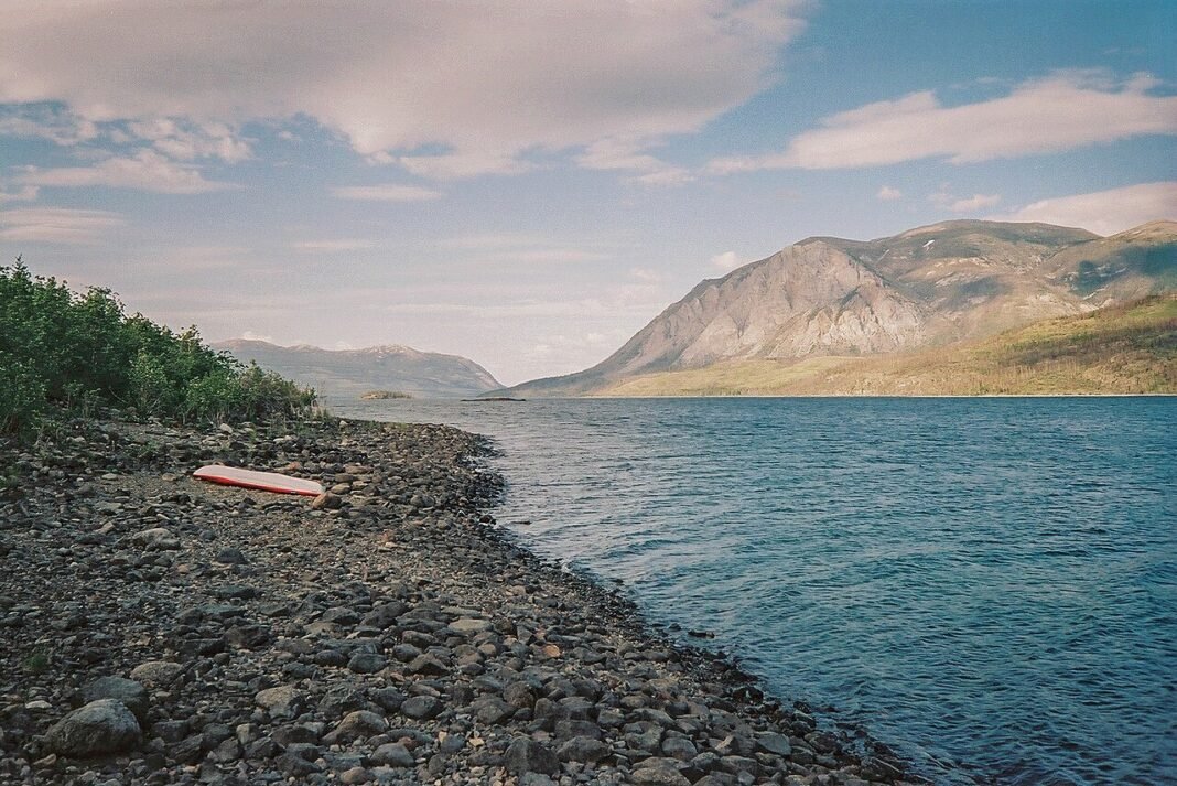
Boreal forest, subarctic tundra, and alpine wilderness meet across the Yukon in a geography shaped by ice ages, gold rushes, and First Nations who have lived on this land for thousands of years. The range of what you can do here is wide: easy day hikes and float trips near Whitehorse, drive-up wildlife viewing along the Dempster Highway, and full-expedition journeys through Kluane’s icefields or down the Yukon, Tatshenshini, and Alsek rivers to the Gulf of Alaska. Outdoor life here is a daily habit rather than a tourist add-on, and Yukon residents tend to treat the backcountry as an extension of home — a practical culture that rewards visitors willing to engage with the territory on its own terms.
Kluane National Park: Glaciers, Peaks, and Dall’s Sheep

Kluane National Park and Reserve (22,013km², southwestern Yukon, part of the Kluane/Wrangell-St. Elias/Glacier Bay/Tatshenshini-Alsek World Heritage Site) protects the largest non-polar icefields on Earth. The St. Elias Mountains anchor the park, rising to Mount Logan (5,959m), Canada’s highest peak, and feeding glaciers that pour off the icefield in every direction — a landscape of ice, granite, and extreme vertical relief.
- Thechàl Dhâl (Sheep Mountain): The Sheep Mountain ridge above Kluane Lake — roughly 73km north of Haines Junction on the Alaska Highway, about an hour’s drive — ranks among the most reliable Dall’s sheep viewing in Canada, with the white sheep often visible on the open ridgelines in spring and autumn; the trail from the Thechàl Dhâl visitor centre climbs to wide viewpoints over the lake and valley
- Slims River (East) Trail: The multi-day backcountry route following the former course of the Slims River (which abruptly shifted its delta after a 2016 glacier retreat event — one of the most striking hydrological changes recorded in recent Canadian history) reaches the outwash plain and views of the Kaskawulsh Glacier
- Mount Logan and mountaineering: Climbing Mount Logan demands expedition permits, serious high-altitude experience, and three to four weeks on the mountain. Most ascents follow the King Trench or East Ridge routes; the summit plateau at 5,959m is one of the largest high-altitude plateaux on Earth, and extreme cold, altitude, and isolation make Logan a far harder objective than its height alone suggests
- Flightseeing: Fixed-wing floatplane and ski-plane flightseeing tours from Haines Junction or Burwash Landing over the Kluane icefields provide the closest views of the St. Elias icescape; tours range from 30-minute overflights ($250–$350/person) to extended glacier landings ($400–$600/person)
The Yukon River: Gold Rush Paddling
The Yukon River runs about 3,190km from its source near Atlin Lake in British Columbia to the Bering Sea, with the river proper beginning at Marsh Lake just south of Whitehorse. It carried the traffic of the Klondike Gold Rush and remains one of North America’s great wilderness paddling rivers. The classic trip is the Whitehorse-to-Dawson-City float (roughly 715km), which most paddlers cover in 12 to 16 days of steady going. The route threads the heart of Yukon history — past the Five Finger Rapids, where stampeders had to line their boats through the river’s rock pillars; the Pelly confluence at Fort Selkirk, a fur-trade and gold-rush ghost town; and the Stewart River confluence — before reaching Dawson City’s riverfront. It is well-documented and self-guided, needing only a canoe or kayak, camping gear, and food for two weeks, and it suits paddlers of moderate experience looking for a long backcountry journey in Canada.
Tombstone Territorial Park: The Yukon’s Cathedral
Tombstone Territorial Park (2,200km², in the Ogilvie Mountains along the Dempster Highway, about 70km north of Dawson City) is among the Yukon’s most celebrated landscapes — jagged granite peaks rising above tundra valleys that turn gold and orange in autumn. It is heavily photographed and deeply significant to the Na-Cho Nyäk Dun and Tr’ondëk Hwëch’in First Nations, on whose traditional territories the park sits.
- Tombstone Mountain: The park’s signature peak is a 2,192m granite monolith that towers over the Tombstone Valley. The easiest viewpoint is the Tombstone Interpretive Centre at km 72 of the Dempster, where the peak fills the view across the Tombstone River valley
- Autumn colours: Late August into September brings one of Canada’s great autumn displays, as the tundra’s bearberry, Labrador tea, and sedge turn crimson, orange, and gold — a show that draws photographers and hikers from across the continent
- Wildlife: Grizzly bears (especially active during the late-summer berry season), Dall’s sheep on the high ridges, moose in the willow thickets, and wolverine in the remote backcountry all range here; the Tombstone area ranks among the best roadside grizzly viewing in Canada
- Hiking: The Grizzly Lake Trail (12km return to Grizzly Lake at the foot of the Tombstone peaks), the Goldensides Trail (day hike to alpine tundra views above the treeline), and the multi-day backcountry routes into the park’s interior provide a range of experiences from gentle to expeditionary
The Dempster Highway: Canada’s Arctic Road Trip
The Dempster Highway (736km from Dawson City to Inuvik, NWT) is the signature road trip of the Canadian north — the only all-season public road in Canada to cross the Arctic Circle, running through the Ogilvie and Richardson Mountains across tundra and boreal forest with no real equivalent elsewhere on the continent’s road network. The Yukon portion stretches roughly 465km to the territorial border and crosses several mountain ranges; Eagle Plains, about midway, is the only fuel and accommodation stop until you reach Inuvik.
- Vehicle preparation: Two full-size spare tires (the gravel surface is aggressive), a high-clearance vehicle, extra fuel, and a wilderness emergency kit are standard Dempster preparation. Breakdowns are slow and expensive to recover from
- River ferries: Two free government-run ferries cross the Peel River (near Fort McPherson) and the Mackenzie River at the Arctic Red River confluence (Tsiigehtchic) from roughly June to mid-October; ice crossings replace them in deep winter. During spring break-up and fall freeze-up, neither ferry nor ice road operates, closing the crossings for two to four weeks
- Aurora viewing: The Dempster’s first 70–100km from Dawson City (before the artificial light of Dawson’s small community disappears) provides excellent aurora viewing conditions in late August through mid-April — the dark skies of the Tombstone area are among the clearest in the Yukon
Wildlife Viewing and Hunting
The Yukon supports wildlife of national and continental significance — the Porcupine Caribou Herd (estimated at around 143,000 animals in the 2025 photocensus, one of North America’s largest), a substantial Dall’s sheep population, healthy grizzly and black bear numbers, wolves, wolverines, and the full range of boreal and subarctic species. For Yukon residents with hunting licences, the territory offers demanding big-game hunting — moose, caribou, Dall’s sheep, mountain goat, and grizzly bear are all available under the Yukon’s wildlife management framework. For non-resident visitors, guided wildlife-viewing tours run from Whitehorse, Dawson City, and Kluane, led by guides who know both the animals and the country they move through.
Frequently Asked Questions
What makes Kluane National Park one of Canada’s greatest wilderness destinations?
Kluane National Park and Reserve (22,013km², southwestern Yukon) protects the largest non-polar icefields in the world — the St. Elias Mountains’ icefield system includes Canada’s highest peak (Mount Logan, 5,959m) and several of the continent’s longest glaciers, creating a landscape of ice, granite, and extreme vertical relief that is part of the Kluane/Wrangell-St. Elias/Glacier Bay/Tatshenshini-Alsek UNESCO World Heritage Site. For visitors not attempting mountaineering, Kluane offers exceptional non-technical experiences: Thechàl Dhâl (Sheep Mountain) above Kluane Lake delivers some of the most reliable Dall’s sheep viewing in Canada — the white sheep are often visible on the open ridgelines from the Alaska Highway in spring and autumn. The Slims River (East) Trail follows the former course of the Slims River (which abruptly shifted after a 2016 glacier retreat event — one of the most remarkable hydrological changes recorded in recent Canadian history) to views of the Kaskawulsh Glacier. The ascent of Mount Logan — Canada’s highest summit and one of the world’s great mountaineering objectives — requires expedition permits, experienced high-altitude skills, and 3–4 weeks on the mountain.
What are the best hiking and paddling experiences near Whitehorse?
Whitehorse (approximately 38,000 residents, about 80% of the Yukon’s population) is surrounded by exceptional outdoor terrain reachable from the city. The Yukon River — the historic highway of the Klondike Gold Rush — flows directly through Whitehorse, and multi-day canoe trips downstream to Carmacks (5–7 days) or the full Whitehorse-to-Dawson paddling route (roughly 715km, about 12–16 days through history and wilderness) are premier paddling experiences. The Miles Canyon section near Whitehorse is a striking introduction to the river’s character. The Yukon Conservation Society’s trail network offers day hikes from the city. The Grey Mountain summit road (reachable by 4WD) provides panoramic Whitehorse valley views. The Carcross Desert — roughly 2.6km² (about one square mile) of sand dunes left by the drained glacial Lake Bennett, near Carcross 70km south of Whitehorse — is often called the world’s smallest desert and a striking anomaly in subarctic terrain. The Emerald Lake viewpoint on the South Klondike Highway provides one of the most photographed landscapes in the Yukon.
What does the Dempster Highway offer as an outdoor and wilderness driving experience?
The Dempster Highway — 736km of mostly unpaved gravel road from Dawson City to Inuvik, Northwest Territories, crossing the Arctic Circle — is among the finest wilderness road journeys anywhere, running through the Ogilvie Mountains, the Richardson Mountains, Peel River country, and the Mackenzie Delta to reach Inuvik. Two free ferries cross the Peel River and the Mackenzie River (at the Arctic Red River confluence) in summer; ice crossings replace them in deep winter; and the route closes during freeze-up and break-up when neither is available. The Tombstone Territorial Park stretch holds the boldest mountain scenery — the jagged granite peaks of the Tombstone Range standing over tundra that supports Dall’s sheep, caribou, grizzly bears, and wolves. The highway reaches the Arctic Circle near the 405km mark, just beyond Eagle Plains, the only fuelling stop between Dawson City and Inuvik. Wildlife along the route is abundant, with grizzly bears, black bears, Dall’s sheep, caribou, and moose all commonly sighted.
What are the best experiences in and around Dawson City?
Dawson City (approximately 1,600 permanent residents), at the confluence of the Yukon and Klondike Rivers, is the Yukon’s most historically significant community — the centre of the 1896–1899 Klondike Gold Rush that brought 100,000 people to the Yukon and transformed the Canadian north. The Klondike National Historic Sites (managed by Parks Canada) preserve the dredges, stampeder cabins, and gold rush infrastructure across the Dawson area; Dredge No. 4 — the largest wooden-hull gold dredge in North America — is open for tours. The Tr’ondëk Hwëch’in First Nation’s Dänojà Zho Cultural Centre gives the definitive account of the Indigenous people whose territory this gold rush violently disrupted. The midnight sun (continuous daylight for approximately 6 weeks around the solstice) creates the famous atmosphere of Dawson’s summer — readings, music, and outdoor events under perpetual daylight at the Dawson City Music Festival (July) and the Klondike Institute of Art and Culture. The Top of the World Highway crossing to Alaska via the Yukon-Alaska border at Poker Creek is one of the most scenic border crossings in North America.
What river expeditions are available in the Yukon beyond the standard Whitehorse-to-Dawson canoe route?
The Yukon offers some of Canada’s most significant wilderness river expeditions beyond the classic Whitehorse-to-Dawson paddle. The Tatshenshini-Alsek River system — running from the Yukon’s Tatshenshini River through the Tatshenshini-Alsek Wilderness Park (British Columbia) and Glacier Bay National Park (Alaska) to the Gulf of Alaska — is regarded as one of the world’s great river journeys: 10 to 14 days through a World Heritage landscape of icefields, glaciers calving into the river, and a valley never accessed by road. Commercial rafting outfitters operate the Tatshenshini-Alsek in summer; the trip requires significant logistical planning but is manageable for paddlers without advanced whitewater skills on the upper sections. The Bonnet Plume River (reached by floatplane from Whitehorse) traverses remote country through the Bonnet Plume valley with Dall’s sheep on the canyon walls. The Firth River in the Ivvavik National Park (the Arctic coast of the northern Yukon) is a remote whitewater river in the calving grounds of the Porcupine caribou herd, reached by floatplane from Inuvik.