Nevada’s outdoor recreation is defined by contrasts that most visitors don’t anticipate — a state associated primarily with urban entertainment actually contains some of the most dramatic and varied desert wilderness in the American West, from the Calico sandstone canyons of Red Rock Canyon minutes from the Las Vegas Strip to the ancient bristlecone pine forests of the Snake Range in Great Basin National Park to the alpine terrain of the Ruby Mountains in the remote northeast. The state’s vast interior — the Great Basin, which covers the majority of Nevada’s 110,572 square miles — stays genuinely remote and largely unvisited, offering solitude and a wilderness experience in a region that most Americans treat as flyover territory between California and Colorado. Nevada rewards the outdoor visitor who looks past the Strip.

Red Rock Canyon: Las Vegas’s Outdoor Backyard
Red Rock Canyon National Conservation Area, 17 miles west of the Las Vegas Strip on Charleston Boulevard, is the most reachable world-class outdoor destination from any major American city — a geological showcase where the Calico Hills’ red and cream Aztec Sandstone formations rise 3,000 feet above the Mojave Desert floor, offering hiking, rock climbing, mountain biking, and canyon exploration within 30 minutes of the world’s largest concentration of hotel rooms. The 13-mile scenic loop drive introduces the canyon’s major geological features — the Calico Hills, the White Rock Hills, the Keystone Thrust fault where ancient gray limestone was pushed over younger red sandstone by tectonic forces 65 million years ago — and any vehicle can manage it without committing to a hike. From October 1 through May 31, a timed-entry reservation is required for the scenic drive between 8 a.m. and 5 p.m.; book ahead through Recreation.gov to guarantee a slot.
The hiking within Red Rock’s 195,819 acres ranges from short canyon walks to full-day ridge scrambles. The Calico Tanks trail (2.5 miles round trip, 400 feet of gain) climbs through Calico Hills to a natural tinaja — a water-carved rock basin — above the formation with Las Vegas Strip views from an unlikely sandstone perch. The Turtlehead Peak trail (4 miles round trip, 1,968 feet of gain) is the most demanding popular route in the conservation area, ascending the obvious summit above the Calico Hills to views across the Spring Mountain Range and the Las Vegas valley. The Ice Box Canyon trail (2.6 miles, moderate) follows a shadowed canyon cut into the Calico Hills where year-round water and a seasonal waterfall create a microclimate distinctly cooler than the surrounding desert. For rock climbers, Red Rock is one of the premier sport and traditional climbing destinations in the American West — the Sandstone Bluffs, Rainbow Wall, and Calico Hills hold hundreds of routes across all difficulty levels, and the Las Vegas climbing community trains here year-round.

Great Basin National Park
Great Basin National Park, near Baker in White Pine County on the Nevada-Utah border, is one of the least-visited and most rewarding national parks in the lower 48 — a park that holds Nevada’s highest point entirely within the state, a remarkable cave system, ancient bristlecone pine forests, and a night sky free from light pollution, all in a setting of true Great Basin solitude. Wheeler Peak (13,063 feet), Nevada’s second-highest summit after Boundary Peak, is the park’s dominant feature and the destination for its most demanding hike: the Wheeler Peak Summit Trail (8.6 miles round trip, 3,100 feet of gain) climbs through subalpine meadows, past Stella Lake and Teresa Lake, to the summit pyramid for views across 100 miles of Great Basin desert. The Alpine Lakes Loop (2.7 miles, moderate) visits three subalpine lakes beneath Wheeler Peak’s north face — one of the finest short hikes in Nevada, particularly in late July and August when wildflowers bloom across the meadows.
The Lehman Caves, a limestone cave system beneath the park’s lower slopes, hold cave formations that include the rare cave shield — found in few cave systems anywhere in the world — alongside stalactites, stalagmites, helictites, and cave bacon that represent 550 million years of limestone formation. Guided tours (the only way to enter the caves) run throughout the day during peak season; the Grand Palace Tour (90 minutes) covers the widest stretch of the system. The bristlecone pine grove reached from the Wheeler Peak trailhead contains individuals more than 3,000 years old — older than the oldest sequoias, and survivors of rocky, thin soil and brutal wind that would kill most tree species. Great Basin’s remoteness (Baker is 4.5 hours from Las Vegas, 5 hours from Salt Lake City) keeps even summer weekends uncrowded. The park’s International Dark Sky designation makes its night sky one of the darkest in the continental United States — the Milky Way shows up to the naked eye on most clear nights through the year.
Lake Tahoe and the Sierra Nevada
Lake Tahoe, straddling the Nevada-California border in the Sierra Nevada, sits as close to Reno (45 minutes over Mount Rose Highway in summer conditions) as it does to Sacramento or the Bay Area, which makes it the anchor of northern Nevada’s outdoor recreation. The Nevada side of Tahoe — less developed than the California side and anchored by the communities of Incline Village and Crystal Bay — offers beach access, hiking, and water recreation with somewhat less congestion than the South Lake Tahoe California corridor. Sand Harbor State Park (Nevada) on the east shore is among the most photographed beaches in the Sierra Nevada, where granite boulders create clear-water swimming and snorkeling coves of a quality you’d never expect in a mountain lake at 6,225 feet elevation.
The Sierra Nevada ski resorts reachable from Reno — Heavenly (90 minutes, straddling the Nevada-California border at South Lake Tahoe), Northstar (70 minutes), and Palisades Tahoe (formerly Squaw Valley, 90 minutes) — deliver some of the finest alpine skiing in North America, with annual snowfall depths that frequently exceed California resort averages thanks to Sierra elevation. The Mount Rose Ski Tahoe resort (45 minutes from Reno, with an 8,260-foot base elevation — the highest base in the Tahoe region) is the most convenient Reno-area option, with consistent snow conditions through the winter season and less weekend traffic than the South Lake Tahoe resorts. Diamond Peak, the ski resort on the north shore above Incline Village, frames Lake Tahoe views from its runs that are unmatched among Sierra Nevada ski areas.
Valley of Fire and the Mojave
Valley of Fire State Park, 50 miles northeast of Las Vegas along Interstate 15 and Lake Mead Boulevard, is Nevada’s oldest state park and one of its most visually dramatic — a landscape of ancient Aztec sandstone formations in brilliant red, orange, and purple that predate the nearby Calico Hills by millions of years. The Fire Wave, a swirling multi-colored sandstone formation reached by a 1.5-mile trail from the White Domes parking area, has become the park’s signature photo destination; the Fire Wave and White Domes trails close annually from mid-May through September 30 because of extreme heat, so plan a fall-through-spring visit and arrive before 8 a.m. to beat both the warmth and the crowds. The White Domes loop (1.2 miles) threads a narrow sandstone slot canyon and circles the eroded cream and white formations of the park’s western section. The Rainbow Vista overlook opens the broadest panorama of the park’s geological diversity. The Atlatl Rock petroglyph panel — rock art left by Ancestral Puebloan and earlier peoples over the past two to four thousand years — is the most accessible indigenous carving site in southern Nevada.

Lake Mead National Recreation Area, the reservoir created by Hoover Dam on the Colorado River, puts water recreation within an hour of the Las Vegas Strip — boating, fishing, and swimming in the largest reservoir in the United States by capacity (when full). The lake’s water levels have dropped sharply over years of sustained drought across the Colorado River Basin; during low-water periods, formerly submerged features re-emerge, including historical structures and, in a few widely reported cases, human remains tied to the lake’s past. The recreation area spans 1.5 million acres of Mojave Desert terrain with its own hiking, backcountry camping, and kayaking beyond the lake itself.
The Ruby Mountains and Remote Nevada
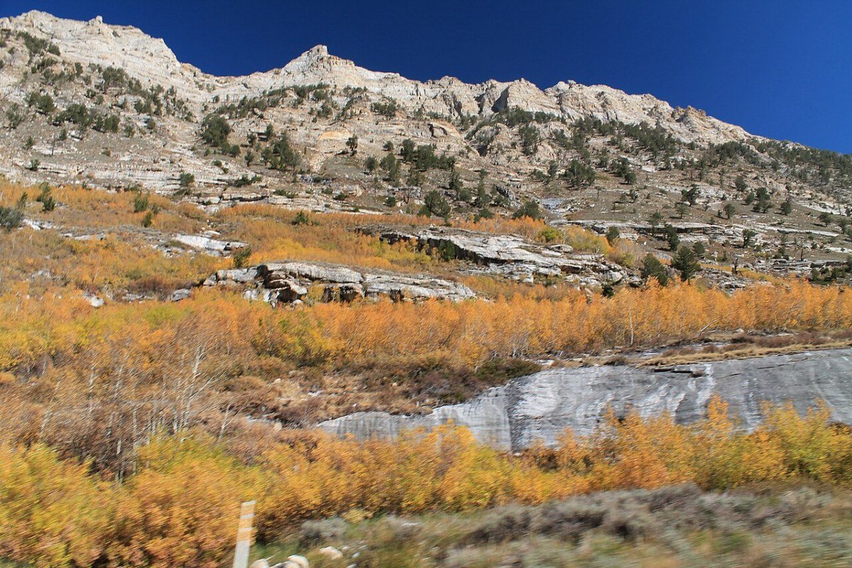
The Ruby Mountains in Elko County in northeastern Nevada — locally called “the Rubies” — rank among the great little-known alpine ranges in the American West, a fault-block range that climbs to 11,387 feet at Ruby Dome and shelters the 16-mile-long Ruby Lake National Wildlife Refuge (one of the most important waterfowl habitats in the Great Basin), glacially carved cirques reached by the Ruby Crest National Recreation Trail, and heli-skiing terrain run by Ruby Mountain Heli-Experience that pulls powder skiers from across the region. The Ruby Mountains Scenic Drive from Lamoille south to the Overland Lake trailhead opens terrain that sees fewer annual visitors than most Colorado fourteeners, despite comparable alpine quality. For Nevada residents willing to invest the drive from Las Vegas (5 hours) or Reno (4 hours), the Rubies deliver real wilderness adventure without the crowds that define more famous western ranges.
Hoover Dam and the Colorado River
Hoover Dam, 35 miles southeast of Las Vegas on the Nevada-Arizona border, is one of the most significant engineering achievements in American history — a 726-foot concrete arch-gravity dam built between 1931 and 1936 that created Lake Mead and supplied the Colorado River water and hydroelectric power that made the modern American Southwest possible. The dam draws 7 million visitors a year, ranking among the Southwest’s busiest attractions, and guided tours of the power-generation facilities give a real sense of the scale of the construction. The Black Canyon Water Trail below Hoover Dam — a guided or self-guided kayak run through Black Canyon along the Colorado River — gives the dam tour an outdoor counterpart, threading basalt canyon walls past natural hot springs that seep through the rock.
Frequently Asked Questions
What does Red Rock Canyon offer outdoor visitors near Las Vegas?
Red Rock Canyon National Conservation Area, 17 miles west of the Las Vegas Strip, is the most reachable world-class outdoor destination from any major American city — a geological showcase where the Calico Hills’ red and cream Aztec Sandstone formations rise 3,000 feet above the Mojave Desert floor. The 13-mile scenic loop drive reaches major geological features including the Keystone Thrust fault, where ancient gray limestone was pushed over younger red sandstone by tectonic forces 65 million years ago. Hiking ranges from the Calico Tanks trail (2.5 miles, natural tinaja with Las Vegas Strip views) to the demanding Turtlehead Peak trail (4 miles, 1,968 feet of gain). Ice Box Canyon holds a shadowed slot with year-round water and a seasonal waterfall. For rock climbers, Red Rock is one of the premier sport and traditional climbing destinations in the American West — the Sandstone Bluffs, Rainbow Wall, and Calico Hills hold hundreds of routes across all difficulty levels. A timed-entry reservation is required for the scenic drive from October 1 through May 31 between 8 a.m. and 5 p.m.
What makes Great Basin National Park one of the most rewarding national parks in the lower 48?
Great Basin National Park, near Baker in White Pine County on the Nevada-Utah border, is one of the least-visited and most rewarding national parks in the lower 48 — holding Nevada’s highest point entirely within the state, a remarkable cave system, ancient bristlecone pine forests, and a night sky among the darkest in the continental United States. Wheeler Peak (13,063 feet), Nevada’s second-highest summit after Boundary Peak, offers the Wheeler Peak Summit Trail (8.6 miles round trip, 3,100 feet of gain), climbing through subalpine meadows and past Stella Lake and Teresa Lake to views across 100 miles of Great Basin desert. The Lehman Caves hold rare cave shields — found in few cave systems anywhere in the world — alongside stalactites, stalagmites, and helictites representing 550 million years of formation. The bristlecone pine grove near Wheeler Peak contains individuals more than 3,000 years old. The park’s International Dark Sky designation makes its Milky Way visible to the naked eye on most clear nights. Its remoteness (4.5 hours from Las Vegas) keeps even summer weekends uncrowded.
What does Lake Tahoe’s Nevada side offer outdoor visitors?
Lake Tahoe, straddling the Nevada-California border in the Sierra Nevada, sits 45 minutes from Reno over Mount Rose Highway, making it northern Nevada’s most significant outdoor recreation asset. The Nevada side — less developed than the California side and anchored by Incline Village and Crystal Bay — offers beach access, hiking, and water recreation with somewhat less congestion than the South Lake Tahoe California corridor. Sand Harbor State Park on the east shore ranks among the most photographed beach environments in the Sierra Nevada, where granite boulders create clear-water swimming coves of a quality you’d never expect in a mountain lake at 6,225 feet elevation. Diamond Peak ski resort above Incline Village frames Lake Tahoe views from its runs unmatched among Sierra Nevada ski areas. Mount Rose Ski Tahoe (45 minutes from Reno, 8,260-foot base elevation — the highest base in the Tahoe region) is the most convenient Reno-area option, with consistent snow conditions through winter.
What does Valley of Fire State Park offer near Las Vegas?
Valley of Fire State Park, 50 miles northeast of Las Vegas, is Nevada’s oldest state park — a landscape of ancient Aztec sandstone formations in brilliant red, orange, and purple. The Fire Wave, a swirling multi-colored sandstone formation reached by a 1.5-mile trail from the White Domes parking area, is the park’s signature photo destination; the Fire Wave and White Domes trails close annually from mid-May through September 30 because of extreme heat, so visit in the cooler months and arrive before 8 a.m. to beat the crowds. The White Domes loop (1.2 miles) threads a narrow sandstone slot canyon and circles eroded cream and white formations. The Atlatl Rock petroglyph panel — rock art left by Ancestral Puebloan and earlier peoples over the past two to four thousand years — is the most accessible indigenous carving site in southern Nevada. Valley of Fire makes an ideal day trip from Las Vegas, pairing geological drama with cultural history in a landscape that represents Nevada’s desert character at its most striking.
What are the Ruby Mountains and what makes them significant for outdoor recreation?
The Ruby Mountains in Elko County in northeastern Nevada — locally called “the Rubies” — rank among the great little-known alpine ranges in the American West, a fault-block range climbing to 11,387 feet at Ruby Dome. The range holds glacially carved cirques reached by the Ruby Crest National Recreation Trail (40 miles through the heart of the range), the 16-mile-long Ruby Lake National Wildlife Refuge (one of the most important waterfowl habitats in the Great Basin), and heli-skiing terrain run by Ruby Mountain Heli-Experience that pulls powder skiers from across the region. The Ruby Mountains Scenic Drive from Lamoille south to the Overland Lake trailhead opens terrain that sees fewer annual visitors than most Colorado fourteeners, despite comparable alpine quality — an extraordinary chance for solitude in a range that most Americans have never heard of.