The name is not marketing — Arkansas genuinely is a natural state in the most literal sense. The Ozark and Ouachita highlands together form the only significant mountain terrain between the Rockies and the Appalachians, and the rivers that drain these uplands have carved landscapes of striking beauty through more than 400 million years of geological history. Arkansas has no ocean coastline and no marquee national park to anchor its outdoor identity, but what it does have — vast national forest, clear rivers, old-growth timber, and a trail network that stays largely uncrowded — delivers the kind of experience that outdoor recreationists increasingly have to travel far from the popular parks to find.
Hiking: The Best Trails in Arkansas
Whitaker Point (Hawksbill Crag) — Upper Buffalo Wilderness: The most photographed spot in Arkansas, Whitaker Point juts from the edge of a 200-foot sandstone bluff above a forest-filled canyon near the Buffalo National River. The trail runs 2.9 miles round trip from the upper parking area — accessible, but the final stretch requires picking your way across loose rock with some exposure. The reward is a viewpoint over sweeping Ozark canyon country, best at sunrise for soft light and minimal crowds.

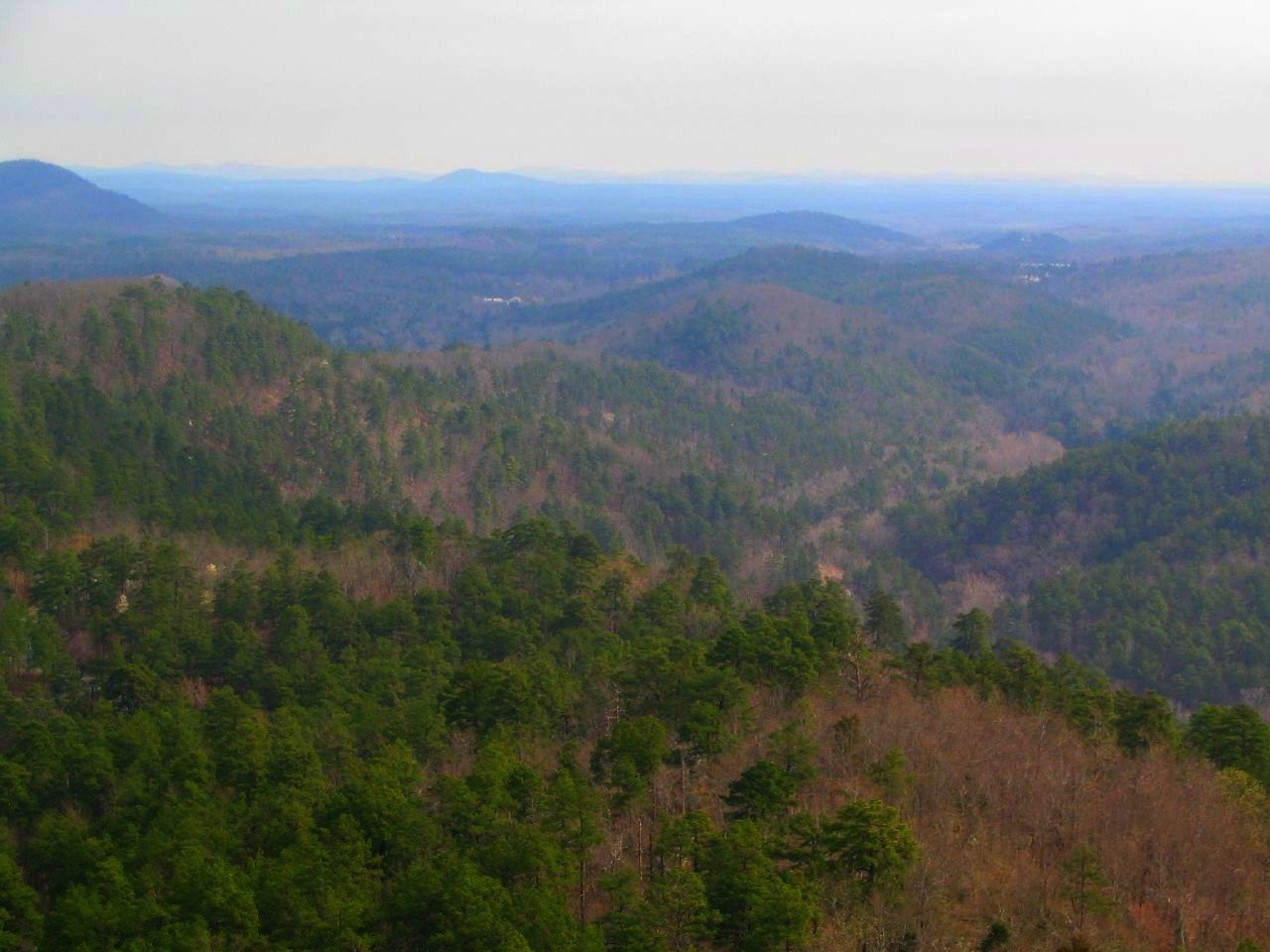
Ouachita Trail — Talimena State Park to Pinnacle Mountain: At 223 miles, the Ouachita Trail is the longest hiking trail in Arkansas and one of the premier long-distance routes in the central United States. It traverses the ridgelines and valleys of the Ouachita National Forest from its western terminus at Talimena State Park, just across the Oklahoma line, to Pinnacle Mountain State Park west of Little Rock, with roughly 177 of its miles falling inside Arkansas. Section hiking is common — the trail is typically broken into day-trip and overnight segments reachable from numerous trailheads along its length.

Ozark Highlands Trail: The Arkansas portion of the Ozark Highlands Trail covers more than 200 miles through the Boston Mountains and surrounding Ozark National Forest terrain. Sections near the Buffalo River and the upper War Eagle Creek corridor offer multi-day backpacking through country that surprises hikers expecting flat Midwestern landscapes — the Boston Mountains rise to over 2,500 feet and hold rugged canyon terrain that rivals anything east of the Rockies.
Pinnacle Mountain State Park (Little Rock area): The most accessible challenging hike near Arkansas’s capital, Pinnacle Mountain rises to a 1,011-foot summit above the surrounding Arkansas River Valley in a near-perfect cone visible from much of western Little Rock. The 1.5-mile East Summit Trail is steep, rocky, and involves scrambling in its upper section — an honest workout that rewards hikers with 360-degree views spanning the river valley, the Maumelle watershed, and the western edge of the Ouachitas.
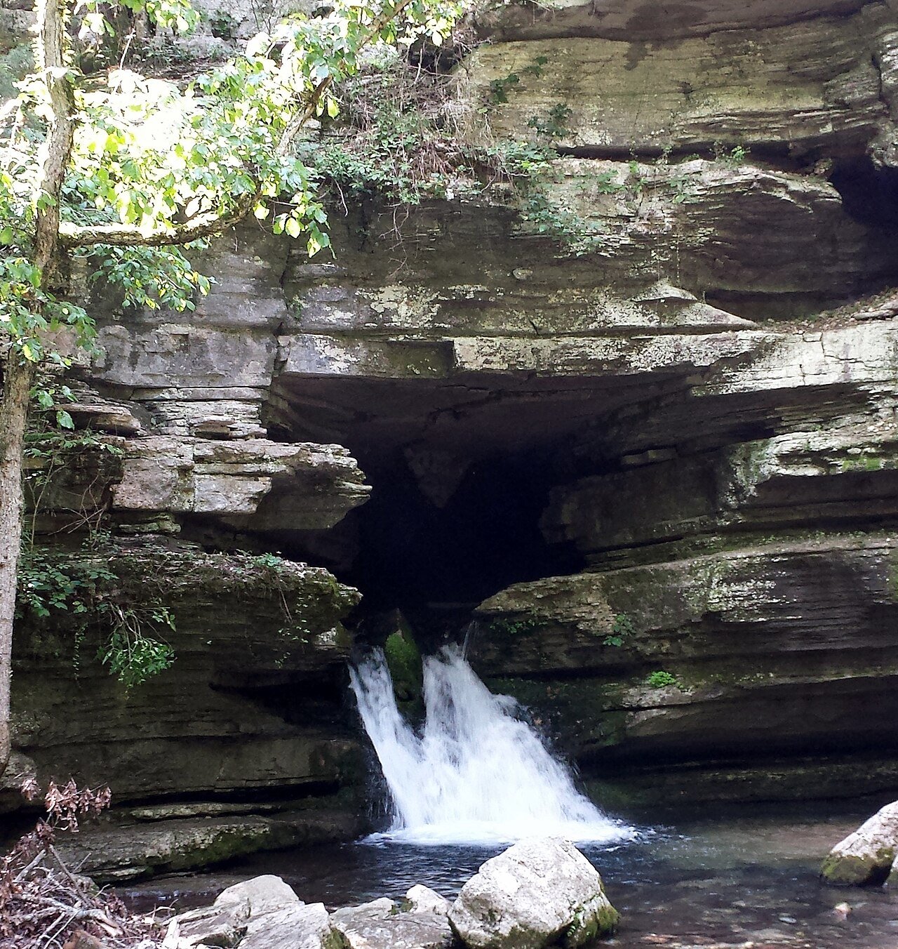
Paddling: Arkansas’s World-Class Rivers
Arkansas may be the best paddling state in the mid-South. The mix of clear, cold mountain streams in the Ozarks and Ouachitas, the free-flowing Buffalo National River, the spring-fed rivers of the central highlands, and the massive Mississippi and Arkansas rivers along the state’s eastern and southern borders adds up to a paddling environment of unusual range.
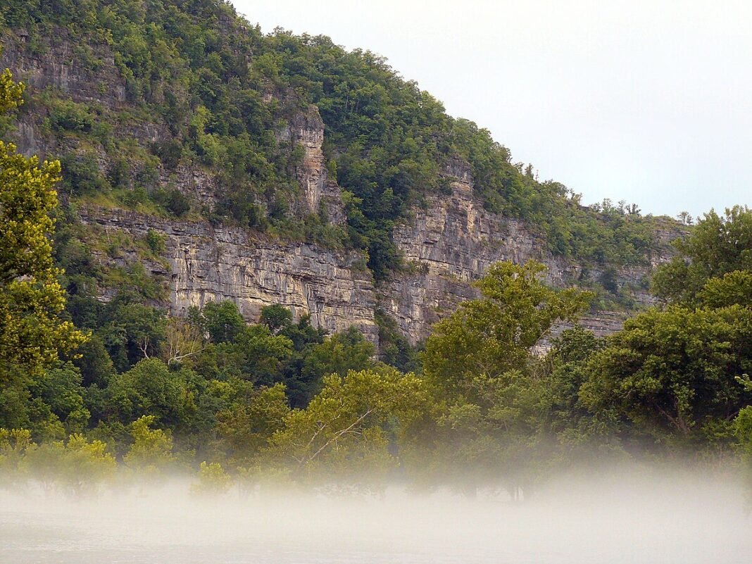
Buffalo National River: The signature Arkansas paddle — 135 miles of free-flowing, federally protected water through some of the finest canyon scenery in the mid-continent. Multi-day trips from Boxley Valley to Rush, or on to the river’s confluence with the White River, combine first-rate camping, dramatic bluffs, diverse wildlife (including the elk herd reintroduced in 1981), and water that stays clear even in mid-summer, when most Ozark streams drop.
Cossatot River: The most technically demanding river in Arkansas, the Cossatot on the Ouachita National Forest serves up Class IV-V whitewater during peak flows in late winter and spring. The “Cossatot Falls” section — actually a steep, ledge-filled rapid rather than a single waterfall — is a national benchmark for advanced paddlers. The surrounding Cossatot River State Park-Natural Area protects the corridor and provides access points for both technical paddling and swimming on the calmer stretches.

Spring River and Eleven Point River: Both spring-fed rivers in northeast Arkansas and southern Missouri run at a constant 55–60°F year-round, which makes for ideal summer tubing and float camping. The Spring River in particular — a favorite with families and casual floaters — offers a gentle, clear-water experience with little portaging over most of its accessible length.
Mountain Biking: Northwest Arkansas’s Trail Revolution
Northwest Arkansas has built one of the strongest mountain bike trail networks in the United States over the past 15 years, driven by Walton family investment and a community commitment to cycling infrastructure that stands out by any regional standard. The network now includes over 400 miles of singletrack across the Bentonville, Fayetteville, and Springdale areas, ranging from beginner-friendly flow trails to expert-level technical terrain.
The Slaughter Pen trail system in downtown Bentonville, running north from Compton Gardens near the Crystal Bridges Museum, is the flagship — a carefully designed network of flow trails, tech lines, and jump features built on Walton family land and donated to the city. The Back 40 trail in Bentonville’s north end pushes into rougher backcountry. Coler Mountain Bike Preserve offers a quieter alternative with excellent technical features. The Razorback Regional Greenway ties these urban systems together via 40 miles of paved path.
Fishing: Exceptional Trout and Bass Waters
Arkansas’s cold tailwaters below Beaver, Bull Shoals, and Greers Ferry reservoirs produce some of the finest trout fishing in the country. The White River below Bull Shoals Dam is regularly ranked among the top five trout streams in the United States — the dam’s cold, clear releases create ideal habitat for rainbow and brown trout that grow to outsized proportions in the nutrient-rich water.
Bass fishing across Arkansas’s reservoirs — Lake Ouachita, Beaver Lake, Lake Dardanelle, Lake Greeson — is first-rate, with largemouth and spotted bass populations supported by clean water and plentiful structure. Lake Ouachita stands out for its clarity (visibility past 20 feet in places) and for the big smallmouth bass that hold in its rocky coves and points.
Arkansas is a state that rewards the traveler who comes looking for real outdoor experience rather than Instagram moments at famous landmarks. Its trails, rivers, and forests reward unhurried days outdoors — quiet, authentic, and more beautiful than most people expect.
Frequently Asked Questions
What are Arkansas’s best hiking trails?
Whitaker Point (Hawksbill Crag) near the Buffalo National River is the most photographed spot in Arkansas — a 200-foot sandstone bluff jutting above a forest-filled canyon, reachable on a 2.9-mile round-trip trail from the upper parking area. The reward is a sweeping view of Ozark canyon country, best at sunrise for soft light and minimal crowds. The Ouachita Trail (223 miles) is the longest hiking trail in Arkansas, running from its western terminus at Talimena State Park just across the Oklahoma line to Pinnacle Mountain State Park west of Little Rock, with about 177 miles inside Arkansas, along the ridgelines and valleys of the Ouachita National Forest. The Ozark Highlands Trail covers more than 200 miles through the Boston Mountains (over 2,500 feet, holding rugged terrain that rivals anything east of the Rockies) in the surrounding Ozark National Forest. Pinnacle Mountain State Park near Little Rock offers the most accessible challenging hike near the capital — a 1.5-mile East Summit Trail to a 1,011-foot summit, with scrambling in the upper section and 360-degree views over the Arkansas River Valley.
Why is the Buffalo National River one of the premier paddling destinations in the US?
The Buffalo National River is the signature Arkansas paddle — 135 miles of free-flowing, federally protected water (the first national river in the US, designated in 1972) through some of the finest canyon scenery in the mid-continent. Limestone bluffs rise hundreds of feet above the clear water, and multi-day trips from Boxley Valley to Rush or to the river’s confluence with the White River combine first-rate camping, dramatic bluffs, diverse wildlife (including the elk herd reintroduced in 1981), and water that stays clear into mid-summer. For tougher paddling, the Cossatot River on the Ouachita National Forest serves up Class IV-V whitewater during peak flows in late winter and spring — the “Cossatot Falls” section (actually a steep, ledge-filled rapid) is a national benchmark for advanced paddlers. The Spring River and Eleven Point River in northeast Arkansas and southern Missouri run at a constant 55–60°F year-round, fed by springs, making ideal conditions for summer tubing and float camping.
What has made Northwest Arkansas a world-class mountain biking destination?
Northwest Arkansas has built one of the strongest mountain bike trail networks in the United States over the past 15 years, driven by Walton family investment and a community commitment to cycling infrastructure that stands out by any regional standard. The network now includes over 400 miles of singletrack across the Bentonville, Fayetteville, and Springdale areas, ranging from beginner-friendly flow trails to expert-level technical terrain. The Slaughter Pen trail system in downtown Bentonville, running north from Compton Gardens near the Crystal Bridges Museum, is the flagship — a carefully designed network of flow trails, tech lines, and jump features built on Walton family land and donated to the city. The Back 40 trail at Bentonville’s north end pushes into more rugged terrain. Coler Mountain Bike Preserve offers a quieter alternative with excellent technical features. The Razorback Regional Greenway connects these urban systems via 40 miles of paved path — making the NWA metro one of the most bicycle-integrated regions in the United States.
What makes Arkansas’s trout and bass fishing exceptional?
Arkansas’s cold tailwaters below Beaver, Bull Shoals, and Greers Ferry reservoirs produce some of the finest trout fishing in the country. The White River below Bull Shoals Dam is regularly ranked among the top five trout streams in the United States — the dam’s cold, clear releases create ideal habitat for rainbow and brown trout that grow to outsized proportions in the nutrient-rich water. The Norfork River below Norfork Dam is a complementary tailwater fishery of comparable quality. Bass fishing across Arkansas’s reservoirs — Lake Ouachita, Beaver Lake, Lake Dardanelle, Lake Greeson — is first-rate, with largemouth and spotted bass populations supported by clean water and plentiful structure. Lake Ouachita stands out for its clarity (visibility past 20 feet in some areas) and for the big smallmouth bass that hold in its rocky coves. Arkansas has no saltwater but remains one of the premier freshwater fishing states in the South.
What makes Arkansas’s outdoor scene different from better-known states?
Arkansas earns its “Natural State” designation. The Ozark and Ouachita highlands together form the only significant mountain terrain between the Rockies and the Appalachians — the Boston Mountains top 2,500 feet and hold canyon country that surprises hikers expecting flat Midwestern landscapes. Blanchard Springs Caverns in the Ozark National Forest is one of the most spectacular cave systems in North America, with a natural waterfall entrance and miles of living stalactite and stalagmite formations. Without a marquee national park, the state draws far smaller crowds, yet its national forests, clear rivers, old-growth timber, and lightly used trail network deliver a deeply immersive day outdoors. The White River, the Buffalo River, and the Ouachita Trail corridor stand up to any standard.