Western Australia‘s outdoors runs to a scale that takes some grasping — the state is roughly the size of Western Europe, its coastline stretches some 20,000km once you count the islands, and a handful of its national parks would swallow a small country whole. Out in the back of it, the nearest town can sit hundreds of kilometres away. The Kimberley’s gorges and waterfalls, the Pilbara’s ancient ironstone country, the South West’s surf and karri forests, and the whale sharks off Ningaloo Reef make up a roster of outdoor country with few rivals anywhere. What separates WA from the eastern states is the homework it asks of you: fuel range, water, satellite communication, and a clear head about the wildlife — saltwater crocodiles in the Kimberley, sharks offshore, venomous snakes the length of the state. Get that part right and you earn quiet, remote country that few other places can match.
The Kimberley: Gorges, Waterfalls, and the Gibb River Road
The Gibb River Road, 660km of unsealed track connecting Derby to Kununurra through the heart of the Kimberley, is Australia’s most demanding and rewarding 4WD touring route. The gorges, waterfalls, and cattle stations strung along the Gibb add up to a full overland expedition:
- Windjana Gorge National Park: The Lennard River cuts through the Devonian limestone of the Napier Range, where freshwater crocodiles bask on the sandbars; the gorge walk (3.5km return) passes through some of the most dramatically sculpted limestone landscapes in Australia
- Bell Gorge: A tiered waterfall in the Wunaamin Miliwundi Ranges (formerly the King Leopold Ranges); the walk (8km return from Silent Grove campground) ranks among the finest day walks in the Kimberley, with a swim in the pool below the falls
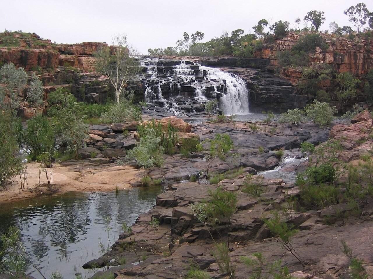
- Manning Gorge: A Kimberley cattle station gorge reached by swimming across the Manning River to the upper waterfall; the most quintessentially Kimberley experience on the Gibb River Road
- El Questro Wilderness Park: A private wilderness station of around 1,000,000 acres (about 400,000 hectares) east of the Gibb; Zebedee Springs (thermal pools in a palm grove), Emma Gorge, and El Questro Gorge offer the easiest-reached Kimberley gorge walks
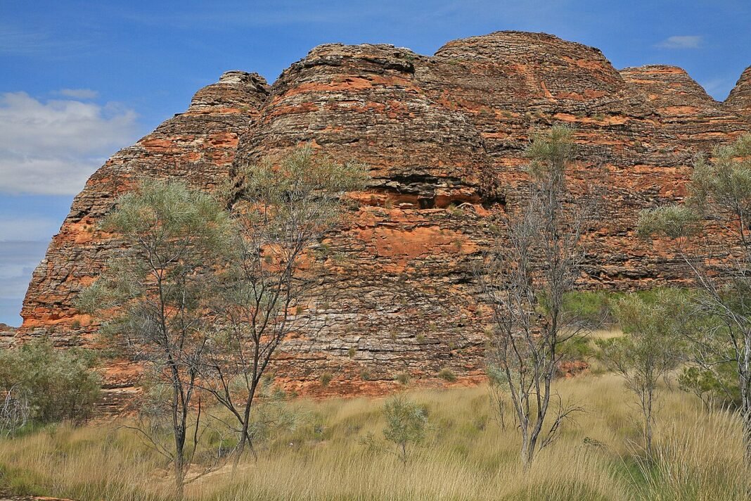
- Purnululu National Park (Bungle Bungles): UNESCO World Heritage Site north-east of Halls Creek; the beehive-striped sandstone domes (orange bands of oxidised iron over darker layers of cyanobacteria) are among the world’s most recognisable geological formations; Cathedral Gorge (2km, palms and echoing acoustics) and Echidna Chasm (the tallest and narrowest gorge) deliver the ground-level walk
- Horizontal Falls: Tidal rapids through two narrow gorges in the Buccaneer Archipelago near Talbot Bay; the horizontal movement of tidal water creates a waterfall effect; seaplane and boat tours from Broome and Derby provide access
Karijini National Park: The Pilbara Gorges
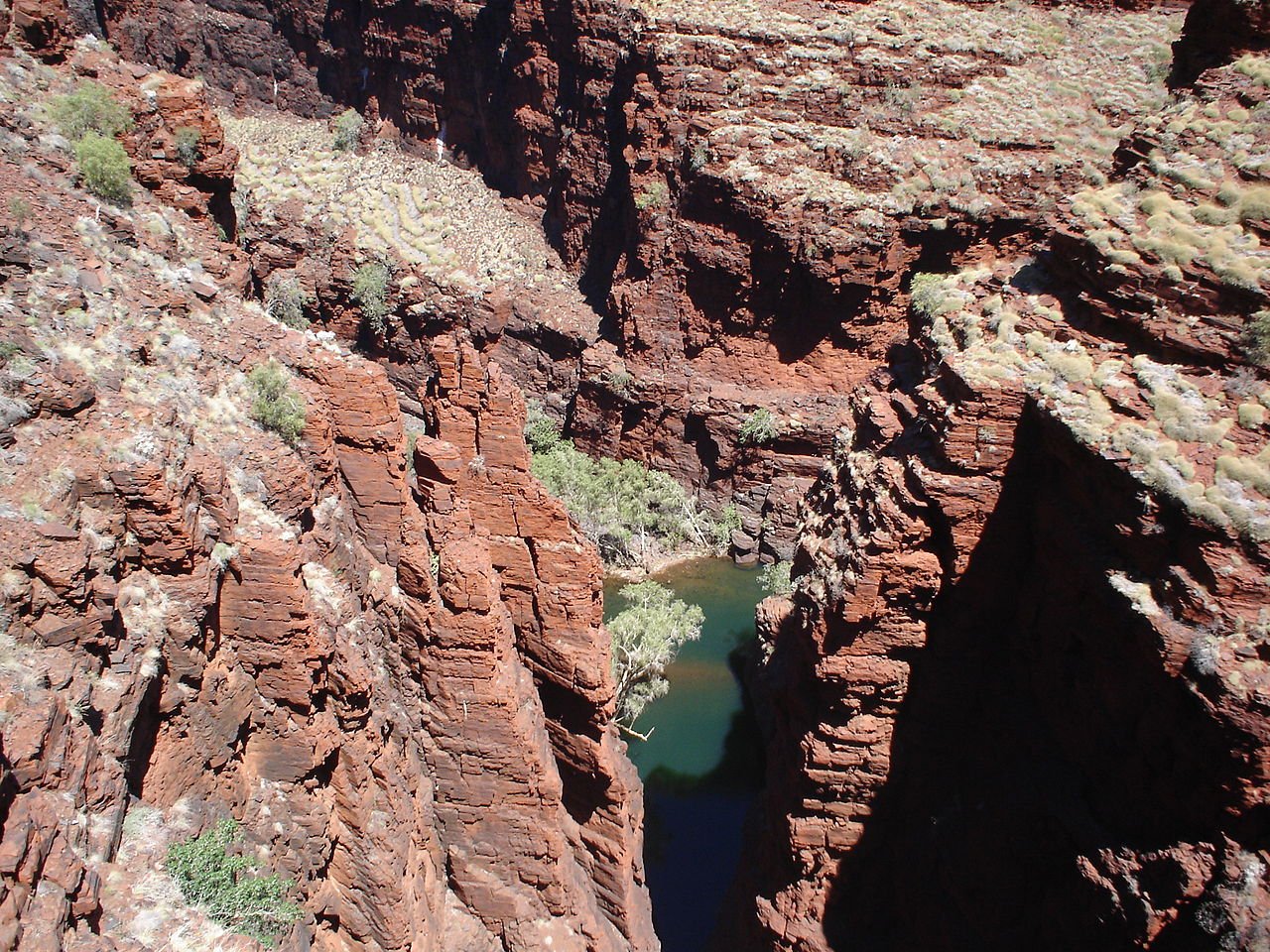
Karijini National Park, roughly 1,055km north of Perth in the Pilbara, holds some of the most striking gorge country in Australia — narrow chasms of 2.5-billion-year-old banded iron formation dropping to clear swimming holes, reached on walks that range from tourist-friendly trails to technical scrambles that call for ropes:
- Hancock Gorge: The most demanding of the walk-in gorges; the Kermit’s Pool section means swimming through chest-deep water in the narrow chasm, iron-red walls dropping to turquoise pools
- Dales Gorge and Fortescue Falls: The easiest-reached Karijini gorge; Fortescue Falls (a permanent waterfall in the gorge) and Fern Pool (a swimming hole below the falls) make for a complete gorge outing on a 4km return walk; the gorge rim walk above sets the overview context
- Weano Gorge and Handrail Pool: A narrow gorge descent to a swimming hole using fixed handrails; the combination of engineered access and genuinely remote-feeling landscape is distinctive
- Knox Gorge: Less visited than Hancock or Weano; one of the deepest walk-in gorges in Karijini; the 4km return walk to the bottom involves rock scrambling
- Oxer Lookout: The confluence of four gorges — Hancock, Joffre, Weano, and Red — seen from one railed platform; the widest single view of Karijini’s geology and the outlook most associated with the region

Ningaloo Reef: The Indian Ocean Marine Experience
Ningaloo Reef, a 260km fringing reef along the Cape Range Peninsula near Exmouth (about 1,200km north of Perth), is UNESCO World Heritage listed and puts a swim-from-the-beach coral reef and big marine animals within reach of the one stretch of coast:
- Whale shark swimming (March–July): Ningaloo’s whale shark aggregation (the world’s largest predictable seasonal gathering of whale sharks) is accessible by boat tour from Exmouth and Coral Bay; guided snorkelling alongside the world’s largest fish, up to 12m in length, is the defining Ningaloo experience
- Manta ray snorkelling (year-round, best May–November): Reef manta rays gather at Ningaloo’s coral bommies; boat tours bring you alongside animals that span 4–5m wing-to-wing
- Humpback whale watching (July–October): Humpback whales use Ningaloo as a nursery and mating ground during their annual migration; boat tours from Coral Bay and Exmouth observe behaviours (breaching, tail-slapping, calf play) at close range
- Cape Range National Park: The limestone ranges of the Cape Range run parallel to the Ningaloo coast; Yardie Creek Gorge (boat tours into the gorge, black-footed rock-wallaby spotting on the clifftops), the Mandu Mandu Gorge walk (3km), and the Badjirrajirra loop hike form the land complement to the reef
- Turquoise Bay and Oyster Stacks snorkelling: Shore-based reef snorkelling you can walk into straight off the beach at Cape Range National Park; Turquoise Bay’s drift snorkel — entering the northern end and drifting south along the reef on the current — is Western Australia’s finest beach-entry reef snorkelling
The South West: Surfing, Cycling, and Tall Timber
Western Australia’s South West (the country south of Perth running down to the Southern Ocean) folds heavy surf, karri forest walks, and coastal cycling into one compact corner:
- Margaret River surf breaks: Surfers Point at Prevelly (Main Break) is the premier Margaret River break — consistent, powerful Indian Ocean swells over a reef that throws both lefts and rights, and the Margaret River Pro (a WSL Championship Tour event) sets the context; Gracetown’s North Point and South Point, and the isolated southern breaks (Guillotine, Gallows, and Box) require local knowledge and are for experienced surfers
- Boranup Karri Forest: The Margaret River region’s karri forest (karri is one of the world’s tallest flowering trees, reaching 60m+) makes a walking and mountain biking landscape of unusual grandeur; the Boranup Karri Walk Trail (2km loop) and the Karri Forest Explorer drive showcase the forest
- Cape to Cape Track: A roughly 125km walk from Cape Naturaliste to Cape Leeuwin along the Leeuwin-Naturaliste National Park coast; the track takes 5–8 days end-to-end and crosses Southern Ocean clifftops, wildflower heath, and karri forest; one of the country’s great long-distance coastal walks
- Jewel Cave and Ngilgi Cave: The Margaret River region’s limestone cave system; Jewel Cave (the most spectacular, with massive stalagmite formations) near Augusta and Ngilgi Cave (adventure caving tours) near Yallingup
- Stirling Range National Park: The Stirling Range, around 400km south-east of Perth, is the only range in southern WA tall enough to make its own cloud; Bluff Knoll (1,099m, the highest peak in southern WA) is a 6km return climb with long Southern Ocean views on a clear day
Frequently Asked Questions
What does the Gibb River Road offer as Western Australia’s great 4WD adventure?
The Gibb River Road — 660km of unsealed track connecting Derby to Kununurra through the heart of the Kimberley — is Australia’s most demanding and rewarding 4WD touring route. The road traverses the Kimberley’s savanna woodland, cattle stations, and ancient Devonian reef limestone ranges, with gorge detours providing the journey’s primary experiences. Windjana Gorge National Park (3.5km return from the car park) follows the Lennard River through a limestone gorge where dozens of freshwater crocodiles bask on the sandbars. Bell Gorge (8km return from Silent Grove campground) passes through Wunaamin Miliwundi Ranges (formerly King Leopold Ranges) sandstone to a tiered waterfall — one of the most rewarding day walks in the Kimberley. El Questro Wilderness Park (a roughly 1,000,000-acre / 400,000-hectare private pastoral station) is the Gibb’s most varied stop: the Emma Gorge trail (2km return) leads to a thermal spring and waterfall; Manning Gorge (long swim across the waterhole from the campground) provides the best overnight gorge camping. Preparation requirements are genuine: minimum two spare tyres, high-clearance 4WD, satellite communication, fuel for 450km without access, and the knowledge to manage river crossings. The Dry Season window (May–October) is the only practical travel time.
What makes Karijini National Park significant, and what can you do there?
Karijini National Park (627,422 hectares, the Pilbara, around 1,055km north of Perth) preserves banded iron formation 2.5 billion years old — among the oldest banded iron formations on Earth — cut by erosion into gorges of unusual depth and drama. The walks run from easy to serious: Dales Gorge, with Fortescue Falls (one of the few permanent Pilbara waterfalls) and Circular Pool for a swim, sits at the gentle end; Hancock Gorge’s narrow wet slot canyon, all scrambling and swimming, sits at the other. Weano Gorge’s Handrail Pool — a narrow water-filled slot with a rope handline on the descent — is one of the most photographed swimming holes in the state. Junction Pool, where Hancock, Weano, and Red Gorges meet, is the park’s single biggest moment, taken in from the Junction Pool Lookout (Oxer Lookout, a short walk on, adds Joffre for the full four-gorge view). That orange-and-red stratigraphy records the Earth’s atmosphere first taking on oxygen 2.5 billion years ago, when cyanobacteria began producing it — a geological pedigree few landscapes can claim. Season: April–September; summer heat of 40°C and above rules out safe gorge walking.
What does Ningaloo Reef offer that the Great Barrier Reef does not?
Ningaloo Marine Park (260km of fringing reef along Western Australia’s North West Cape, from Coral Bay to Exmouth) is about as close and unfussy as a coral reef experience gets in Australia — in places the reef runs right along the shore, so snorkellers wade in from the beach without a boat, unlike the offshore Great Barrier Reef. The headline draw is whale shark season (March to July, often running into August off Exmouth), when the largest fish in the world (up to 12m, docile plankton filter feeders) gather here in numbers that make a snorkel alongside them a fairly dependable outing from Exmouth. There is more besides: manta ray snorkelling (year-round, peaking May to November), humpback whale watching (July–October), and the annual coral spawn. Coral Bay, 150km south of Exmouth, has the easiest beach snorkelling of the lot off a small sheltered bay. Cape Range National Park, next door, adds limestone gorge hiking (Mandu Mandu Gorge) and the Yardie Creek boat tour through a gorge that is the only place the aquifer feeding the reef breaks the surface.
What makes the Kimberley’s Horizontal Falls and ancient rock art world-class experiences?
The Horizontal Falls — a tidal phenomenon in the Talbot Bay section of the Buccaneer Archipelago (accessible only by seaplane from Broome or Derby, or fast boat) — were featured by David Attenborough in his documentary work on the world’s great natural wonders, and rank among the most unusual. The phenomenon occurs when tidal movement forces enormous volumes of water through two narrow gorges in the McLarty Range at different rates, creating a waterfall effect that runs horizontally — the difference in water level on either side of the gorge reaches 4m at peak tidal flow. The Kimberley’s Gwion Gwion (Bradshaw) rock art figures — human-like painted figures of extraordinary fineness, dated by recent research to around 12,000 years old, with the oldest figure dated to roughly 17,000 years — are among the oldest representational art in the world and are found in rock shelters throughout the Kimberley in concentrations accessible from the Gibb River Road and by helicopter tour from Kununurra. The Wandjina figures (white-faced spirit beings with halos, no mouths, and large oval eyes) represent the most distinctive Aboriginal rock art style in the world and are sacred to the Ngarinyin, Wunambal, and Worora peoples of the central Kimberley.
What outdoor recreation does the South West of Western Australia have to offer?
Western Australia’s South West corner — the Margaret River wine and surf region, the karri and jarrah forests, and the cliff-and-bay coast from Dunsborough to Albany — holds the most varied and reachable outdoor recreation in the state outside Perth’s beaches. The Bibbulmun Track (1,000km from Kalamunda near Perth to Albany) ranks among the world’s great long-distance walks, crossing jarrah and marri forest, coastal heath, and the towering karri stands (the tallest of WA’s eucalypts, reaching 60m and more) around Pemberton and Walpole. The Valley of the Giants Tree Top Walk (Walpole-Nornalup National Park) carries you on a 600m elevated walkway through the canopy of ancient red tingle trees (Eucalyptus jacksonii, a karri relative that grows to 75m and is among the world’s largest trees by girth), up to 40m off the ground. Hamelin Bay’s stingrays, which slide right up to waders on the sand, and Canal Rocks, a run of granite outcrops in the Leeuwin-Naturaliste National Park, round out the South West’s easy-to-reach wildlife and coast.