

California: A Travel Destination Unlike Any Other State
California is an argument about geography. The state stretches 770 miles from its Oregon border to its Mexican frontier, encompassing climates that range from subarctic alpine to subtropical coastal to bone-dry desert. It contains the highest point in the contiguous United States (Mount Whitney, 14,505 feet) and the lowest (Badwater Basin in Death Valley, 282 feet below sea level), and the two are separated by just 84 miles of horizontal distance. The Redwood Coast grows trees that are among the oldest and tallest living organisms on Earth. The Central Valley is the most productive agricultural region in North America. Los Angeles anchors the global entertainment industry, San Francisco drives the technology economy, and the wine country of Napa and Sonoma has earned a reputation that competes with Bordeaux and Burgundy.
No single trip encompasses California. The state rewards repeat visits, extended stays, and the discipline to focus on one region at a time rather than racing through a greatest-hits itinerary. Here are the experiences that define each of California’s regions.
San Francisco and the Bay Area
San Francisco sits on a dramatic peninsula where the Pacific fog rolls through the Golden Gate and the city’s famous hills open onto views that have drawn artists and writers for 150 years. Its neighborhoods each carry a distinct character: the Victorian painted ladies of Alamo Square and the Castro, the Mission District’s Mexican murals and taquerias, the modernist Ferry Building with its Saturday farmers’ market, Chinatown (the oldest in North America), and the Haight-Ashbury, where the Summer of Love began in 1967 and the psychedelic history is still palpable in the Victorian storefronts and record shops.
The Golden Gate Bridge is the most photographed structure in California, and rightly so — the 1.7-mile span connecting San Francisco to Marin County is a work of both engineering and aesthetic achievement. Walking or cycling across it (free for pedestrians and cyclists) opens up views of the bay, Alcatraz Island, and the Marin Headlands. Alcatraz itself — served by ferries from Fisherman’s Wharf — makes for an atmospheric, historically rich tour, with audio commentary narrated by former guards and inmates.

An hour north, the Napa and Sonoma valleys rank among the world’s serious wine regions, producing Cabernet Sauvignon, Chardonnay, Pinot Noir, and Zinfandel at prices and competition results that hold up internationally. Tasting in a cave carved into hillside volcanic rock, or on a terrace above vine rows that turn golden in fall, is one of California’s most refined pleasures. Sonoma generally offers more accessible and less crowded tasting than the more commercially developed Napa Valley.
Los Angeles: More Than the Movies
Los Angeles is the most stereotyped and least understood major American city. The car culture, the sprawl, the entertainment industry obsession — these are real characteristics, but they overlay a city of genuine cultural depth and natural beauty that most visitors never reach because they stay on the tourist-pamphlet circuit.
The Getty Center, perched on a Brentwood hillside with gardens designed by Robert Irwin, holds a collection that includes van Gogh’s “Irises,” Rembrandt’s “An Old Man in Military Costume,” and photography of international importance — and it is free to enter (parking is $25). Across town, the Los Angeles County Museum of Art (LACMA) has spent years rebuilding and houses the largest encyclopedic art collection in the western United States, while The Broad, in downtown LA, shows contemporary work by Jeff Koons, Cindy Sherman, and Kara Walker.
The Santa Monica Mountains rise directly from the Pacific between Malibu and the San Fernando Valley, holding 70,000 acres of parkland — the largest urban national recreation area in the United States. The Backbone Trail runs 67 miles across the range, reachable from dozens of trailheads within 30 minutes of downtown LA.
Yosemite National Park
Yosemite Valley is the cathedral of the American West — a glacially carved valley with vertical granite walls rising 3,000 feet above the floor, El Capitan (the largest granite monolith in North America), Half Dome (an instantly recognizable geological icon), and Yosemite Falls (the tallest waterfall in North America at 2,425 feet total drop). The valley floor runs only 7 miles long and 1 mile wide, so all of this is compressed into a landscape you can cross in a single day’s walk.

Beyond the valley, Yosemite climbs into the high Sierra Nevada. Tuolumne Meadows, at 8,600 feet, is the gateway to subalpine wilderness laced with more than 800 miles of trails — glaciated domes, alpine lakes, and meadows that fill with wildflowers in late June and July, scenery that rivals the Alps and surpasses them in solitude. South of Yosemite, Sequoia and Kings Canyon national parks protect the world’s largest trees by volume: the General Sherman Tree is the largest single living organism on Earth by volume.
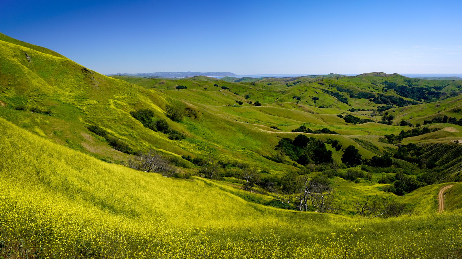
The California Coast: Highway 1 and Beyond
California’s Pacific Coast holds one of the great scenic drives. Highway 1 hugs the coastline through Big Sur, Carmel, and Marin County for 656 miles, passing coastal bluffs, redwood canyons, sea stacks, and beaches of remarkable variety. Big Sur — the 90-mile stretch between San Simeon and Carmel where the Santa Lucia Mountains drop straight into the Pacific — is the most celebrated section: the Bixby Creek Bridge, McWay Falls, and the rocky headlands of Andrew Molera and Garrapata state parks deliver some of the finest coastal scenery anywhere.
Death Valley National Park
Death Valley is the most extreme landscape in the United States — the hottest, driest, and lowest point in North America, contained within a national park that is, paradoxically, beautiful. The badlands of Zabriskie Point, the salt flats of Badwater Basin, the dunes of Mesquite Flat, the volcanic crater of Ubehebe, and the mineral colors of the Artist’s Palette give Death Valley real visual power in the right season (October–April; summer temperatures routinely exceed 120°F and have been recorded as high as 134°F).
California’s range — from the sophistication of San Francisco to the wilderness of the Eastern Sierra to the otherworldly floor of Death Valley to the surf culture of San Diego — sets it apart among American states, and among travel destinations anywhere. The challenge is never finding things to do; it’s accepting that any one trip can cover only a fraction of what the state offers.
Frequently Asked Questions
What are California’s most extreme geographical contrasts?
California encompasses a geographical range found in few other places on Earth. The state stretches 770 miles from its Oregon border to Mexico, containing the highest point in the contiguous United States (Mount Whitney, 14,505 feet) and the lowest (Badwater Basin in Death Valley, 282 feet below sea level) — separated by just 84 miles of horizontal distance. The Redwood Coast grows trees among the oldest and tallest living organisms on Earth. Death Valley holds the record for the hottest temperature ever reliably recorded on Earth (134°F / 56.7°C in 1913). The Central Valley is the most productive agricultural region in North America. This range makes California a destination unlike any other.
What are the must-see experiences in San Francisco?
San Francisco’s essential experiences center on its geography and neighborhoods: walk or cycle across the Golden Gate Bridge (free for pedestrians and cyclists) for views of the bay, Alcatraz Island, and the Marin Headlands. Take the Alcatraz Island ferry tour from Fisherman’s Wharf — an atmospheric, historically rich tour with audio commentary from former guards and inmates. Explore the Mission District’s Mexican murals and taquerias, the Saturday farmers’ market at the Ferry Building, Chinatown (the oldest in North America), and the Victorian painted ladies of Alamo Square. For wine country, Napa and Sonoma valleys are an hour north — Sonoma generally offers more accessible tasting than the more commercially developed Napa.
What makes Yosemite National Park unmissable?
Yosemite Valley is a glacially carved valley only 7 miles long and 1 mile wide, yet it holds some of the most concentrated geological grandeur in the world: El Capitan (the largest granite monolith in North America), Half Dome (an instantly recognizable geological icon), and Yosemite Falls (the tallest waterfall in North America at 2,425 feet total drop). Beyond the valley, Tuolumne Meadows at 8,600 feet elevation gives access to subalpine wilderness with 800+ miles of trails, glaciated domes, alpine lakes, and wildflower meadows. Sequoia and Kings Canyon national parks, south of Yosemite, protect the General Sherman Tree — the largest single living organism on Earth by volume.
What is California’s Highway 1 and what are the best stops?
Highway 1 hugs the California coast for 656 miles, passing through Big Sur, Carmel, and Marin County — one of the great scenic drives in the world. Big Sur is the most celebrated 90-mile stretch, where the Santa Lucia Mountains fall directly into the Pacific: the Bixby Creek Bridge, McWay Falls (an 80-foot waterfall that drops directly onto a beach), and the rocky headlands of Andrew Molera and Garrapata state parks deliver scenery that ranks among the world’s finest coastal landscapes. The drive north through Marin County passes Stinson Beach, the Point Reyes National Seashore, and the towering coastal redwoods of Muir Woods National Monument.
What is Death Valley National Park and when should you visit?
Death Valley is the hottest, driest, and lowest point in North America, yet it is paradoxically a landscape of extraordinary beauty. Key sites include: Badwater Basin (282 feet below sea level, vast salt flats), Zabriskie Point (badland erosion formations, especially beautiful at sunrise), Mesquite Flat Sand Dunes, Ubehebe Crater (volcanic), and the Artist’s Palette (hillsides colored in dozens of mineral hues). Visit October through April only — summer temperatures routinely exceed 120°F (49°C) and have been recorded at 134°F. The Los Angeles Getty Center (on a Brentwood hillside, free admission, houses van Gogh’s “Irises”), LACMA (largest encyclopedic art collection in the western US), and the Santa Monica Mountains National Recreation Area (70,000 acres, largest urban national recreation area in the US) are also essential California experiences.

