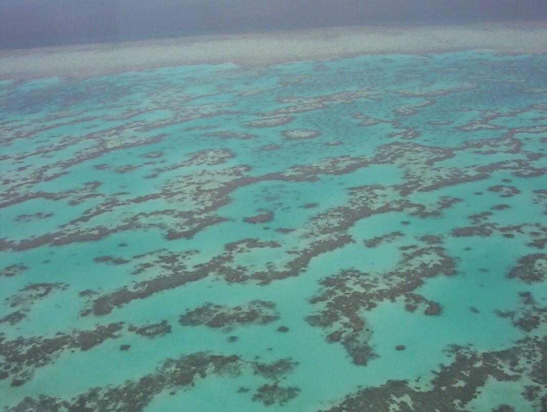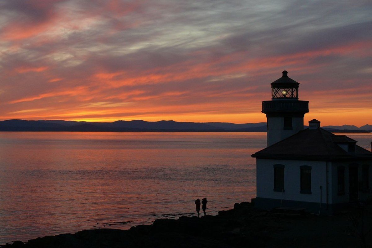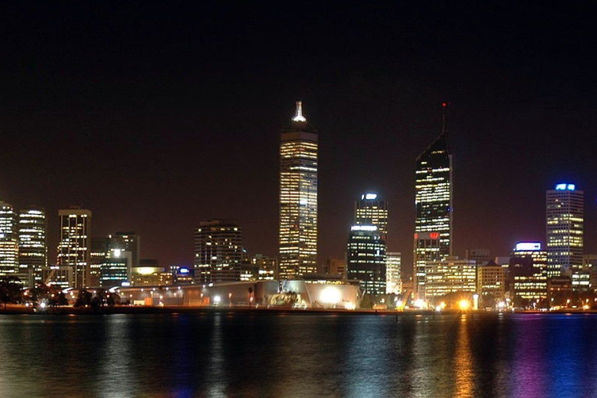
Western Australia is the country’s largest and most isolated state — one-third of the continent’s land area, about 3 million residents (roughly four-fifths of whom live in Greater Perth), and landscapes whose scale and drama tend to defeat description. The Kimberley region in the state’s far north holds gorges, tidal waterfalls, boab trees, and ancient Aboriginal rock art across a wilderness that rivals the world’s great tropical wildernesses. The Pilbara’s iron-ore country surrounds Karijini National Park, where gorges of banded-iron rock drop into swimming holes of clear water. The Margaret River region in the southwest produces wines of international standing and beaches with world-class surf. And Perth itself — roughly 2,100km from the nearest major Australian city, washed by the Indian Ocean, flanked by the Swan Valley wine country and the Darling Scarp — ranks among the most geographically isolated big cities on Earth, and among the more handsome.

Perth: The Isolation Premium
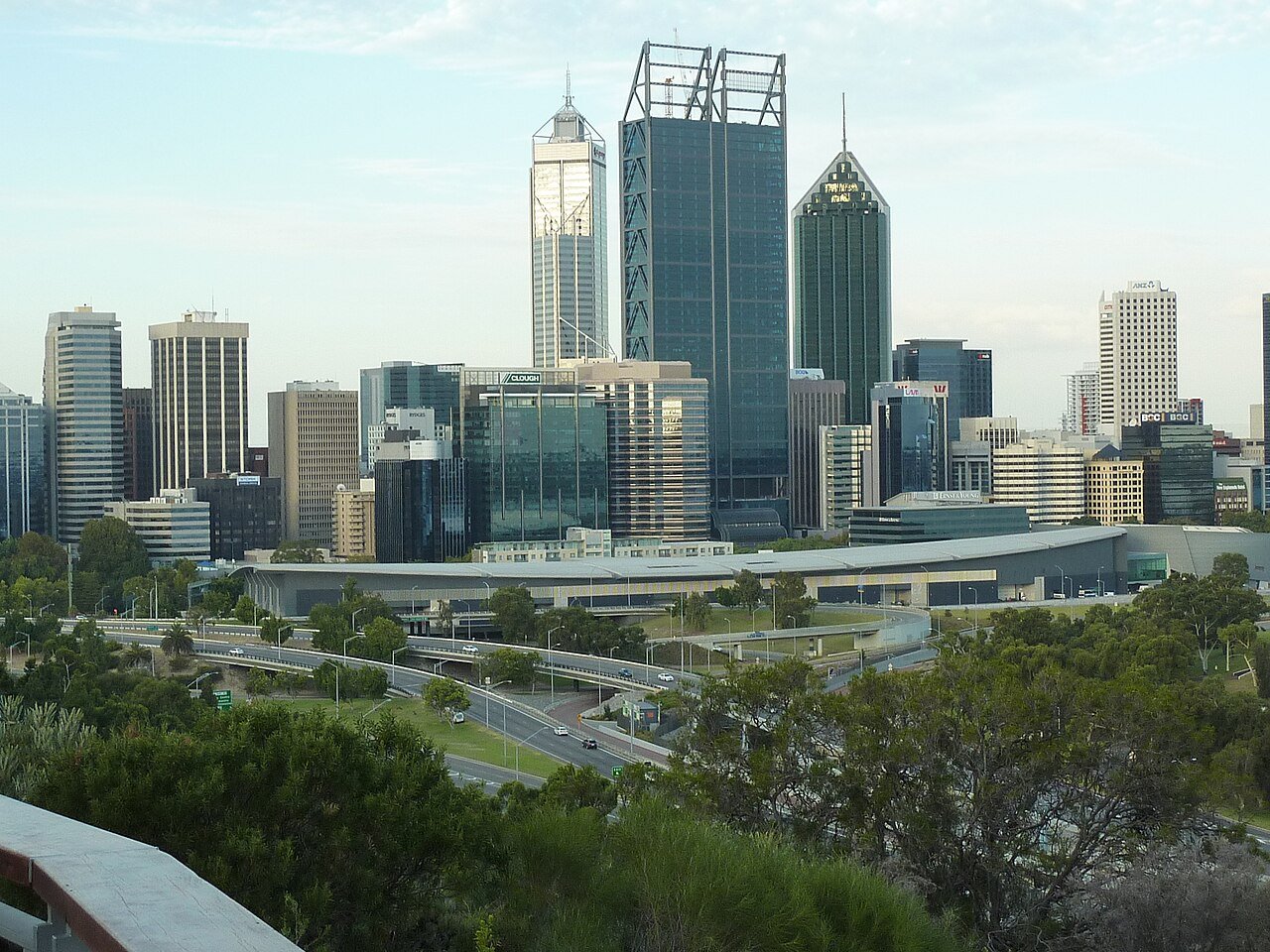
Perth’s character comes from its isolation — a city of 2.2 million that runs as a self-contained world, where the beach is a daily habit rather than a weekend outing, where Indian Ocean sunsets arrive with a regularity few coastal cities can match, and where the mining wealth of the Pilbara and Kimberley has built civic infrastructure (the Elizabeth Quay development, Optus Stadium, the surrounding entertainment precinct) beyond what the population size would normally support. The Mediterranean climate — 300-plus sunshine days, warm dry summers, mild wet winters — is widely rated the best of any major Australian city for outdoor living. The Cottesloe Beach Sunday sunset ritual, the South Perth foreshore cycle path above the Swan River, and the Fremantle fishing-boat harbour’s afternoon seafood sessions are the defining images of Perth life.
Perth Must-Experiences
- Cottesloe Beach: Perth’s best-loved beach, about 14km from the CBD; the Sunday-afternoon ritual of sunset swimming and fish and chips on the beach wall is quintessential Perth
- Rottnest Island (Wadjemup): 18km offshore by ferry; home of the quokka (the world’s happiest-looking marsupial); car-free island cycling, snorkelling, and swimming at the Basin and Little Salmon Bay
- Fremantle: The heritage port city 19km south of Perth; the Fremantle Markets (Friday–Sunday), the Round House (Western Australia’s oldest building), the Fishing Boat Harbour’s seafood restaurants, and the convict-built character of the old port precinct
- Kings Park and Botanic Garden: 400 hectares of native bushland above the Swan River, next to the CBD; the Western Australian Botanic Garden’s wildflower display (August–September) is one of the country’s best
Margaret River: Surf, Wine, and Karri Forest
The Margaret River region, 270km south of Perth, folds world-class surfing, internationally acclaimed wine, and some of Australia’s finest tall-timber forests into a compact area you can reach on a weekend run from Perth. Its Cabernet Sauvignon and Chardonnay have put it among the world’s premier wine regions — Margaret River makes around 2% of Australia’s wine but more than 20% of its premium wine by value — while the breaks of Surfers Point, Gracetown, and the remote southern beaches deliver steady Indian Ocean swells to quality beach and reef. The Boranup karri forest and the Jewel Cave limestone system round out a landscape of unusual ecological range. The Margaret River township’s gallery and restaurant strip, alongside the Voyager Estate, Leeuwin Estate, and Cape Mentelle cellar doors, anchors the visitor economy.
Broome: Pearls, Red Pindan, and Cable Beach
Broome, around 2,000km north of Perth on the Kimberley coast, is the state’s best-known remote destination — a town of about 15,000 where the red pindan (iron-rich) cliffs meeting the turquoise Indian Ocean at Gantheaume Point form one of the most photographed scenes in the country, where Cable Beach’s 22km of white sand carries the famous camel trains into the sunset, and where the pearling trade (Broome remains a leading source of Australia’s South Sea pearls, the largest and finest grown anywhere) shapes both economy and cultural character. The Staircase to the Moon — the reflection of the rising full moon across the mudflats at low tide, March to October — is the town’s signature spectacle.

The Kimberley: Australia’s Last Frontier
The Kimberley, in the state’s far north, is one of the world’s great wilderness regions — 423,000 square kilometres of ancient country crossed by the Gibb River Road (660km of red dirt from Derby to Kununurra) that strings together gorges, waterfalls, cattle stations, and Aboriginal communities on a journey demanding the kind of preparation you would give an overland Africa trip. Purnululu National Park’s Bungle Bungles — the beehive-striped sandstone domes seen from the air and walked through palm-filled gorges on foot — and the Horizontal Falls (tidal rapids forced through two narrow gorges on the Kimberley coast) are the region’s signature features.

Planning Your Western Australia Visit
Western Australia’s sheer scale — the state matches Western Europe in size — makes honest itinerary planning essential. Perth and Margaret River form a self-contained trip of 7–10 days with no internal flights needed: drive south from Perth to the Swan Valley and the Darling Range on day one, carry on to Margaret River for 3–4 days of wine, caves, and surf, and return via the Geographe Bay towns of Dunsborough and Busselton (the Busselton Jetty, at 1.84km the longest timber-piled jetty in the southern hemisphere, is obligatory). Broome and the Kimberley call for separate flights from Perth and a minimum of 4–5 days to justify the transit; the full Gibb River Road is a 7–10 day self-drive in a well-equipped 4WD. The best travel window is April to October — the dry season brings clear skies, manageable temperatures, and the firmest road conditions for the outback legs.
Getting the Most Out of Your Visit
A few practical points will improve any trip to Western Australia. Book accommodation and major attractions — particularly national parks, popular walking trails, and well-known restaurants — as far ahead as you can; the best options fill weeks or months out, especially in peak season. A car gives you the most freedom to explore beyond the main centres, and the state’s most rewarding places are rarely the ones served by public transport. The sharpest local knowledge tends to surface in regional visitor centres, independent bookshops, and conversations with residents — the discoveries that stick are seldom the ones in the guidebooks. Allow more time than you think you need: Western Australia rewards travellers who slow down and go deep over those chasing maximum ground in minimum days.
Frequently Asked Questions
What makes Perth one of the world’s most distinctive major cities?
Perth — roughly 2,100km from the nearest major Australian city, and routinely named among the most remote big cities on the planet — is defined by an unusual mix of natural beauty and urban quality. The city of 2.2 million enjoys 300-plus sunshine days a year, Indian Ocean beaches that rank with the best reachable from any major world city (Cottesloe Beach, City Beach, and Scarborough Beach within 15 minutes of the CBD), and a Mediterranean climate widely rated the best of any major Australian city for outdoor living. Mining wealth from the Pilbara and Kimberley has built civic infrastructure — the Elizabeth Quay development on the Swan River, Optus Stadium (about 60,000 seats), and the surrounding entertainment precinct — beyond what the population size would normally support. The Fremantle fishing-boat harbour and the South Perth foreshore cycle path along the Swan River supply the daily outdoor backbone of Perth life. Kings Park and Botanic Garden (400 hectares, one of the world’s largest inner-city parks, on the escarpment above the CBD) holds Australia’s finest native botanical garden and sweeping views over the city and the Swan.
What makes the Kimberley one of the world’s most extraordinary wilderness destinations?
The Kimberley — the remote northwest of Western Australia, roughly the size of California — holds gorges, tidal waterfalls, boab trees, and ancient Aboriginal rock art across a wilderness that rivals the world’s great tropical wildernesses. The Gibb River Road (660km of unsealed track connecting Derby to Kununurra) is Australia’s most demanding and rewarding 4WD touring route. Its gorges deliver the Kimberley’s most accessible experiences: Windjana Gorge (freshwater crocodiles on the sandbar, limestone walls cut by the Lennard River), Bell Gorge (a tiered waterfall in the King Leopold Ranges), and El Questro Wilderness Park (the region’s largest private pastoral station, with the Emma Gorge hot spring, Manning Gorge, and the Cockburn Range). The Bungle Bungles (Purnululu National Park, three hours south of Kununurra, reached by 4WD or helicopter) — orange-and-black-striped beehive sandstone towers — are the Kimberley’s signature geological feature and one of the country’s strangest landscapes. The Horizontal Falls (marine tidal falls in the Buccaneer Archipelago, reachable only by seaplane or fast boat from Broome or Derby) rank among the strangest tidal phenomena anywhere in the country.
What is Broome like as a travel destination?
Broome — a former pearling port on the Indian Ocean’s Roebuck Bay, around 2,000km north of Perth — has grown into Western Australia’s leading tourism destination outside Perth. Cable Beach (22km of white sand and turquoise water, with Indian Ocean sunsets among the most celebrated anywhere in Australia) is the centrepiece; the camel trains filing along the sand at dusk are perhaps the signature image of Western Australian tourism. Broome’s pearling heritage — the town was a centre of the world’s cultured-pearl industry, and it still produces premium South Sea pearls — survives in Chinatown’s architecture (Japanese, Malay, Chinese, and European pearling communities left a multicultural streetscape) and the luggers preserved in the maritime museum. The Staircase to the Moon (a refracted-light effect over Roebuck Bay’s mudflats as the moon rises at extreme low tides, March–October) is the town’s most photographed natural event.
What does Margaret River offer as wine and outdoor destination?
Margaret River — 270km south of Perth, a region centred on the Margaret River township — is one of the country’s premier wine regions (making around 2% of Australian wine but more than 20% of the premium end) and at the same time one of its finest surf coasts. Its Mediterranean climate (warm dry summers, cool wet winters) produces Cabernet Sauvignon, Chardonnay, and Semillon/Sauvignon Blanc of high quality — Moss Wood, Leeuwin Estate, Cape Mentelle, and Cullen Wines rank among Australia’s most respected labels, all within 30 minutes of the township. The surf coast from Yallingup (a world-class right-hand reef break) through Gracetown (North Point) to the Margaret River mouth (a challenging rivermouth break) packs more quality surf into a short stretch of coast than anywhere else in WA. Caves Road reaches the Leeuwin-Naturaliste National Park’s cave system (Mammoth Cave, Lake Cave, Jewel Cave) — the largest accessible cave network in the state. The Cape to Cape Track (135km, eight days) runs the Leeuwin-Naturaliste Ridge from Cape Naturaliste to Cape Leeuwin.
What does Karijini National Park in the Pilbara offer?
Karijini National Park (627,444 hectares, in the Pilbara’s iron-ore country 1,400km north of Perth) preserves one of the country’s most extraordinary geological landscapes — ancient Precambrian banded-iron-formation rock (2.5 billion years old, some of the oldest exposed rock on Earth) cut by erosion into gorges of unusual depth, colour, and sculptural form. Its gorges — Dales Gorge (Fortescue Falls, the Pilbara’s most accessible waterfall, and the Circular Pool), Hancock Gorge (a narrow slot canyon you swim through), Weano Gorge (Handrail Pool, among WA’s busiest gorge swimming holes), and Knox Gorge — run the gradient from easy to demanding. The point where Hancock, Weano, and Knox gorges converge at the junction pool is the most arresting single spot in the park. Karijini Eco Retreat offers low-impact accommodation on the site, operating on Country with the support of the Banjima Traditional Owners. The Pilbara’s summer (October–March) heat (40°C-plus) leaves April–September as the only practical visiting window; pool levels in the gorges shift with rainfall.