
Outdoor Activities in Texas 2026: Big Bend, Padre Island, and Hill Country Rivers
Texas‘s outdoor recreation spans a geographic range that encompasses five distinct ecological regions — the piney forests of the East Texas Pineywoods, the Gulf Coast’s 367 miles of shoreline and barrier islands, the Hill Country’s cypress-lined rivers and limestone caves, the Chihuahuan Desert’s Big Bend and Guadalupe Mountains national parks, and the Llano Estacado’s canyon country (Palo Duro Canyon, the “Grand Canyon of Texas”). The state’s 80 state parks, three national parks, and the Padre Island National Seashore anchor a recreation network in a state better known for its cities than its wilderness. Yet few states pack this much variety inside their borders, and the payoff for travelers who go looking is well worth the long drives.
Big Bend National Park: Texas’s Wild Heart
Big Bend National Park — 801,163 acres of Chihuahuan Desert, Chisos Mountains, and Rio Grande canyons in extreme southwest Texas — is the most remote and wild of the major lower-48 national parks. The drive from San Antonio (7 hours) or Austin (7.5 hours) is long, but the geological payoff at the end is hard to overstate. Key experiences include:
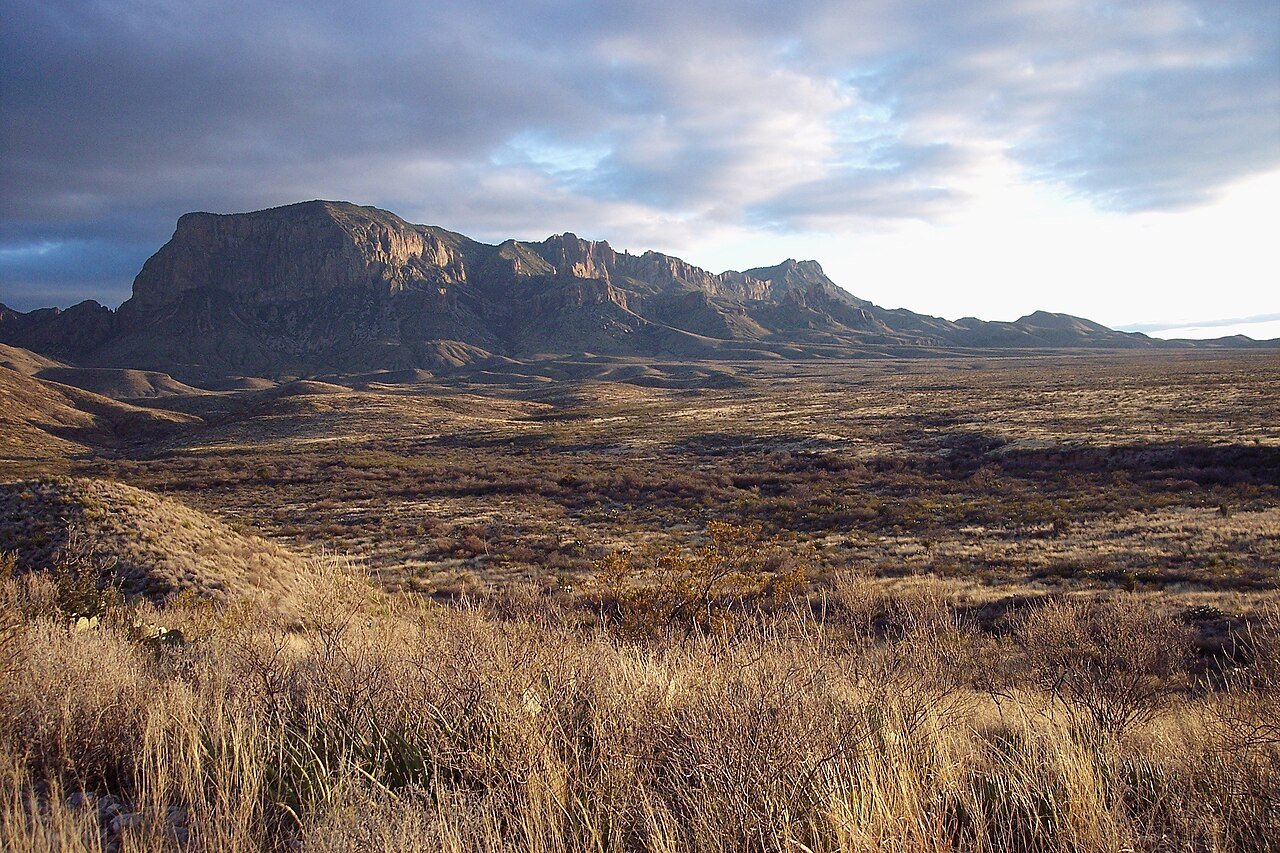
- Santa Elena Canyon hike (1.7 miles RT): Walk between 1,500-foot limestone walls where the Rio Grande cuts through Mesa de Anguila — the narrowest, sheerest canyon section in the park
- Lost Mine Trail (4.8 miles RT): The park’s best day hike; summit views from 6,850 feet over the Chisos Basin and surrounding desert
- The Chisos Basin: A highland enclave at 5,400 feet ringed by desert, and the busiest camping and trailhead hub in the park
- Boquillas Canyon canoe: 33 miles of flatwater paddling through the park’s longest canyon
- Stargazing: Gold Tier International Dark Sky Park — essentially no light pollution; Milky Way core visible on most clear nights from May–August
Guadalupe Mountains National Park: Texas’s High Point
Guadalupe Mountains National Park, 110 miles northeast of El Paso, protects the world’s most extensive Permian fossil reef — an ancient reef system now exposed as a mountain range that climbs straight out of the Chihuahuan Desert. The Guadalupe Peak Trail (8.4 miles RT, 3,000-foot gain) tops out at 8,751 feet — the highest point in Texas — with views that reach into New Mexico and Mexico on clear days. The Devil’s Hall Trail leads to a natural stone staircase tucked inside a limestone canyon. El Capitan, the park’s signature escarpment face visible from 50 miles away, is best seen from the base along the Guadalupe Peak trail approach. The park stays largely undeveloped and draws roughly 226,000 visitors a year, so you can count on having the trails mostly to yourself.
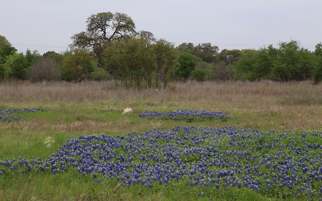
Texas Hill Country: Rivers and Wildflowers
The Hill Country’s limestone plateau northwest of San Antonio and west of Austin is the favorite outdoor backyard for the state’s two largest metros. The spring-fed rivers are the primary draw:
- Barton Springs Pool, Austin: A spring-fed natural swimming hole in Zilker Park, 68°F year-round; one of the best urban swimming spots in the country
- Frio River, Garner State Park: The most popular camping destination in Texas; clear spring-fed water running through limestone canyon country; book campsites 8–12 months ahead for summer weekends
- Guadalupe River, New Braunfels: Tubing the Guadalupe is a Texas rite of passage — rentals from several outfitters, 3-hour to full-day floats, suitable for all ages
- Pedernales Falls State Park: Limestone waterfall staircase on the Pedernales River, 40 miles west of Austin; swimming in the natural pools when water levels allow
Padre Island National Seashore
Padre Island National Seashore — the longest undeveloped stretch of barrier island in the world at 70 miles — offers beach and wildlife on a scale you won’t find along the busier parts of the Gulf Coast. The island’s interior grass flats and wetlands draw strong birding during spring and fall migration. The Kemp’s ridley sea turtle program nests here April through July, and the public hatchling releases that follow (mid-June through August) are a rare wildlife encounter worth planning a trip around. North Padre Island (reachable by paved road) has lifeguarded beaches and camping facilities; South Padre Island (the resort strip) handles the full development. The Malaquite Visitor Center handles interpretive exhibits and beach vehicle permits for the backcountry sections.
Palo Duro Canyon: The Grand Canyon of Texas
Palo Duro Canyon State Park near Amarillo is the second-largest canyon in the United States — 120 miles long, 20 miles wide, and 800 feet deep in places, carved by the Prairie Dog Town Fork of the Red River through the Llano Estacado caprock. The canyon’s red, yellow, and white layered walls form a landscape most Texans have never seen, 800 miles from the rest of the state’s major recreation destinations. The Lighthouse Trail (5.8 miles RT) leads to the park’s signature rock spire; the mountain biking network (36+ miles) ranks among the best in the Texas Panhandle. The canyon hosts the TEXAS outdoor musical (June–August) in an open-air amphitheater, a summer tradition since 1964.
Lake and Reservoir Recreation
Texas’s major reservoirs open up boating, fishing, and water sports across the entire state. Lake Travis (Austin, 65 miles of shoreline), Lake Conroe and Lake Livingston (Houston area), Lake Texoma (DFW, Texas/Oklahoma border — one of the largest Corps of Engineers reservoirs in the country at roughly 89,000 surface acres), Canyon Lake (Hill Country), and Amistad Reservoir (Del Rio, adjacent to Mexico) are the most popular. Bass fishing is excellent across most Texas reservoirs; catfish, crappie, and white bass keep anglers busy year-round. Striped bass fishing on Lake Texoma is nationally recognized, drawing anglers from across the country during fall and spring feeding seasons.
Planning Your Outdoor Adventure
The outdoor experiences described in this guide reward practical preparation. For wilderness and protected areas, check trail conditions, permit requirements, and seasonal access with the relevant land management authority before departure — trail closures, fire restrictions, and entry quotas can change quickly, and many high-demand parks now require advance reservations that were not needed in previous years. Weather in Texas can change rapidly, particularly in mountain terrain and during shoulder seasons; a layered approach with a waterproof outer shell is advisable for most outdoor pursuits regardless of the season. For water-based activities — paddling, snorkeling, diving, surfing — check current conditions with local outfitters who will have the most accurate and up-to-date information. Leave No Trace principles apply throughout: pack out everything you bring in, stay on established trails, give wildlife space, and leave natural features undisturbed for the next visitor.
Frequently Asked Questions
What makes Big Bend National Park one of the most dramatic national park landscapes in the lower 48 states?
Big Bend National Park’s 801,163 acres pack in a rare concentration of geology — the Santa Elena Canyon (1.7 miles round trip), where the Rio Grande cuts between 1,500-foot limestone walls, is one of the great short hikes in any national park; the Lost Mine Trail (4.8 miles round trip) climbs to summit views from 6,850 feet over the Chisos Basin and surrounding Chihuahuan Desert; and the Chisos Basin itself, a highland enclave at 5,400 feet ringed by desert, serves as the park’s main camping and trailhead hub. The Boquillas Canyon canoe trip (33 miles of flatwater) ranks among the most remote river journeys in the lower 48. Big Bend is a Gold Tier International Dark Sky Park with almost no light pollution — the Milky Way core is visible on most clear nights from May through August. The park drew 561,459 visitors in 2024, a fraction of the crowds at the more famous western parks, so solitude is easy to find.
What makes Guadalupe Mountains National Park one of Texas’s least-known great destinations?
Guadalupe Mountains National Park, 110 miles northeast of El Paso, protects the world’s most extensive Permian fossil reef — an ancient marine reef system now exposed as a mountain range that climbs straight out of the Chihuahuan Desert. The Guadalupe Peak Trail (8.4 miles round trip, 3,000-foot gain) tops out at 8,751 feet — the highest point in Texas — with views reaching into New Mexico and Mexico on clear days. El Capitan, the park’s signature escarpment face visible from 50 miles away, is best seen from the base along the trail approach. The park drew 226,134 visitors in 2024, a low figure for the national park system that all but guarantees quiet trails. The McKittrick Canyon trail (4.8 miles round trip to the Grotto) follows a stream through a canyon of Texas madrone and bigtooth maple — the best fall foliage display in the state, with peak color typically in late October and early November.
What does Padre Island National Seashore offer as an outdoor destination?
Padre Island National Seashore — 70 miles of undeveloped barrier island on the Texas Gulf Coast — is the longest undeveloped stretch of barrier island in the world. The island’s interior grass flats and wetlands are excellent for birding during spring and fall migration, as Padre Island lies along the Central Flyway — one of the four major North American bird migration corridors. The park is the most important Kemp’s ridley sea turtle nesting beach in the United States (nesting April through July), and the public hatchling releases at Malaquite Beach (mid-June through August) are one of the most accessible sea turtle conservation experiences in North America. North Padre Island (reachable by paved road) has lifeguarded beaches and camping facilities; the southern backcountry sections are reachable only by high-clearance 4WD with a beach driving permit. Windsurfing and kiteboarding on the laguna side of the island benefit from steady Gulf Coast winds.
What makes Palo Duro Canyon one of Texas’s most surprising outdoor destinations?
Palo Duro Canyon State Park near Amarillo is the second-largest canyon in the United States — 120 miles long, 20 miles wide, and up to 800 feet deep, carved by the Prairie Dog Town Fork of the Red River through the Llano Estacado caprock. The canyon’s red, yellow, and white layered walls form a landscape most Texans have never visited — it sits 800 miles from the state’s major recreation destinations in Central Texas and stays largely unknown outside the Panhandle. The Lighthouse Trail (5.8 miles round trip) leads to the park’s signature rock spire; more than 36 miles of mountain biking trails rank among the best cycling terrain in the Texas Panhandle. The TEXAS outdoor musical, performed in an open-air amphitheater in the canyon since 1964, is one of the longest-running outdoor musicals in the United States.
What do the Texas Hill Country’s rivers and state parks offer for outdoor recreation?
The Texas Hill Country’s spring-fed rivers are the state’s most popular warm-weather outdoor recreation — clear, limestone-filtered water at steady temperatures that make the Guadalupe, Frio, and Pedernales Rivers top destinations for tubing, swimming, and kayaking. Garner State Park on the Frio River is the most-requested camping destination in the Texas state park system, with summer weekend sites booked 8 to 12 months ahead — the spring-fed river running through a limestone canyon delivers some of the best swimming in the Southwest. The Guadalupe River near New Braunfels is Texas’s definitive tubing river, with several outfitters renting tubes for 3-hour to full-day floats suitable for all ages. Pedernales Falls State Park (40 miles west of Austin) has a limestone waterfall staircase and natural pools when water levels allow. Enchanted Rock State Natural Area, a massive pink granite dome rising 425 feet above the surrounding hills, requires timed entry permits during high-demand periods and rewards the climb with summit views across the Hill Country.

