
Canada’s scale is the first thing every visitor needs to internalize: at 9.98 million square kilometers, it’s the second largest country on earth — larger than the contiguous United States, larger than the entire European Union. The distance from Halifax on the Atlantic coast to Vancouver on the Pacific is roughly 6,000 kilometers by road. Getting from Montreal to Banff by train takes four days. This is not a country where you nip between cities in a couple of hours. Transportation planning is one of the most important parts of any Canadian trip, and understanding your options — their costs, their speeds, their advantages — determines whether your itinerary is realistic or wishful thinking.
Domestic Air Travel: The Practical Choice for Long Distances
Flying is the most practical way to cover the long distances between Canada’s major cities, and most Canadians do it as a matter of course. Air Canada is the flag carrier with the broadest network — serving all major cities and many smaller regional airports, with connections through Toronto Pearson and Montreal Trudeau. WestJet is the main low-cost competitor, with strong coverage of western Canada routes and competitive transatlantic fares to the UK and Europe. Flair Airlines and Lynx Air are budget carriers offering very cheap fares on select corridors (typically Calgary–Vancouver, Toronto–Vancouver, and a few eastern routes) when booked well in advance. International arrivals: Toronto Pearson, Vancouver International, and Montreal Trudeau are the three main entry points, handling the majority of international flights. Montreal is particularly well-served by transatlantic routes from France, the UK, and European cities. Flights to Canada from London take 7–8 hours to Toronto or Montreal; from Sydney approximately 18 hours to Vancouver or 22 hours to Toronto.
VIA Rail: The Scenic Alternative
VIA Rail Canada operates the national passenger rail network — not fast, not cheap compared to flying, but in certain cases extraordinary value as an experience in its own right. The key routes:
- The Quebec–Windsor Corridor (Quebec City–Montreal–Ottawa–Toronto) has the most frequent service — multiple daily trains connecting Canada’s most populated cities. Montreal to Toronto takes about 5 hours; Montreal to Ottawa 2 hours. Book 2–3 weeks in advance for the best fares ($65–130 one-way Montreal to Toronto in coach).
- The Canadian (Toronto to Vancouver via Winnipeg, Saskatoon, Edmonton, and Jasper) takes 4 days and is one of the world’s great train journeys. The route crosses the prairies, climbs the Rockies through Jasper National Park, and descends to Vancouver through the Fraser Canyon. A coach seat is included in the base fare; sleeping car berths add significant cost but include all meals in the dining car.
- The Ocean (Montreal to Halifax) takes approximately 21 hours through Quebec and the Maritime provinces — an excellent overnight option for visiting Atlantic Canada.
- The Corridor trains (within Ontario and Quebec) are generally the most cost-effective VIA Rail services for the practical traveler; the transcontinental trains are best approached as experiences rather than efficient transportation.
Renting a Car: Essential for Rural Canada
A rental car is essential for exploring the Canadian Rockies, the Maritimes, the Okanagan Valley, Newfoundland, the Laurentians, and anywhere outside the major cities. Canada drives on the right, the same as the United States. Roads in urban and inter-urban areas are generally excellent and well-signposted in both English and French (in Quebec). Major practical notes:
- Winter tires: Legally required in British Columbia from October 1 to April 30 on most mountain highways; required in Quebec from December 1 to March 15. Most rental companies provide winter-spec vehicles in these seasons — confirm when booking.
- Wildlife hazards: Moose and deer on rural roads at night are a genuine hazard in most provinces. Drive cautiously after dark in rural areas, particularly near wetlands and forests.
- Distances: Even within a single province, distances can be much larger than they appear on maps. Calgary to Banff is 1.5 hours; Calgary to Jasper (via the Icefields Parkway) is 4–5 hours. Factor driving time realistically into itineraries.
- Fuel: Petrol (gasoline) prices vary considerably by province — Quebec and the Maritimes tend to be cheaper; British Columbia and the territories more expensive. Full-service stations are common in populated areas; fill up before entering remote stretches.
Urban Transit: Getting Around Canada’s Cities
Canada’s major cities have functional public transit systems, though car use remains very high by European standards. Montreal’s STM metro (4 lines, 68 stations) is clean, reliable, and serves most of the city effectively — the best urban transit system in Canada. Toronto’s TTC (subway, streetcar, bus) covers the city extensively, though the network is crowded at peak times; the Presto card provides seamless payment across all modes. Vancouver’s TransLink (SkyTrain automated metro, buses, SeaBus, West Coast Express) is generally considered the best-integrated urban transit network in Canada — the Canada Line SkyTrain connects the airport to downtown in 25 minutes. Ottawa’s O-Train LRT covers the central city with good connections to the main tourist areas. Calgary’s CTrain is free to ride in the downtown core (a useful detail). In all cities, transit apps (Google Maps, Transit) provide real-time routing information.
Ferries: Connecting Canada’s Coast and Islands
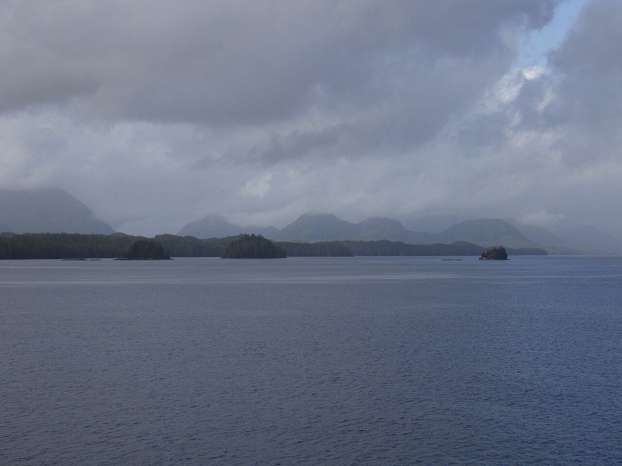
Canada has several important ferry routes that are integral to its transportation network. BC Ferries operates an extensive network on the British Columbia coast: the Tsawwassen–Swartz Bay crossing (to Vancouver Island, 95 minutes) and the Horseshoe Bay–Langdale crossing (to the Sunshine Coast) are used by millions of passengers annually. The Inside Passage ferry (Port Hardy to Prince Rupert, 15 hours) is one of the most spectacular coastal journeys in North America, passing through channels, fjords, and island wilderness — book a cabin for overnight sailings. Marine Atlantic operates ferry service between North Sydney, Nova Scotia, and Port aux Basques, Newfoundland (7 hours) — the essential link to Newfoundland, which cannot be reached by road otherwise. The PEI ferry (Caribou, NS to Wood Islands, PEI, 75 minutes) provides an alternative to the Confederation Bridge for reaching Prince Edward Island. In the St Lawrence, ferries connect the south shore communities to Quebec City and Montreal’s south shore.
The Trans-Canada Highway: A Road Trip for the Ages
The Trans-Canada Highway (Highway 1) stretches 7,821 kilometers from St. John’s, Newfoundland, to Victoria, British Columbia — the longest national highway in the world. Driving the full route is a serious undertaking (minimum 3–4 weeks at a reasonable pace), but specific sections are among the world’s great road trip routes. The stretch through the Canadian Rockies (Calgary to Revelstoke via Banff and Yoho national parks) is world-class mountain driving. The north shore of Lake Superior through Ontario (the longest stretch of freshwater shoreline in the world) is dramatic and largely unspoiled. The Maritime provinces section through New Brunswick and Nova Scotia has beautiful coastline and charming towns. The Trans-Canada connects everything — it’s the spine of the country, and following it reveals Canada’s genuine character in a way that flying between airports never can.


