
Rhode Island trades on a paradox: it is the smallest state in the country, yet few states pack as much outdoor variety into so little ground. Roughly 400 miles of coastline thread through a state just 48 miles wide; Narragansett Bay reaches 28 miles inland to Providence’s doorstep; Block Island guards a wildlife refuge on the Atlantic migration corridor; and the Blackstone River Valley carries an industrial-heritage trail system north toward Massachusetts. The ocean sets the tone. Sailing, kayaking, surfing, fishing, and beach days are woven into daily life here in a way that reflects the state’s maritime identity. Much of that 400-mile shore stays publicly accessible thanks to the Coastal Resources Management Council, which holds some of the strongest public-access protections on the Atlantic coast — a resource residents lean on year-round.
Narragansett Bay: Sailing and Water Recreation
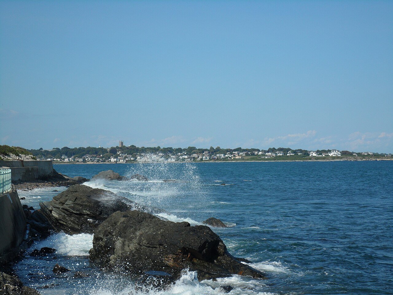
Narragansett Bay is Rhode Island’s defining geographic feature — a 28-mile estuary that pushes all the way to Providence and anchors one of the busiest sailing scenes in the United States. Newport has hosted the America’s Cup more than once, and Sail Newport, New England’s largest public sailing center, runs lessons and rentals out of Fort Adams State Park. Beginners learn in the bay’s sheltered water; experienced crews head for the open swells of Rhode Island Sound. Paddlers work the bay’s islands — Conanicut (Jamestown), Prudence, Patience, and Hope — reaching wildlife refuges and the weathered remnants of the bay’s colonial past. Anglers fish these waters year-round for striped bass, bluefish, and tautog.
Block Island: Wildlife Refuge and Migration Corridor
Sitting 13 miles offshore, a 55-minute traditional ferry ride from Point Judith, Block Island ranks among the most ecologically important pieces of land in the northeastern United States. It is a migratory-bird stopover of international standing, and nearly half of the island — roughly 47 percent — is permanently protected as open space. Some 28 miles of Greenway walking trails cross that protected ground, opening up the Mohegan Bluffs (150-foot clay cliffs carved by the Atlantic), the Great Salt Pond (a sheltered harbor and kayaking hub), and the freshwater ponds that draw birders and anglers alike. Most visitors get around by bike, pedaling the island’s quiet network of paved and dirt roads at an unhurried pace. Come spring and fall — May, then September into October — migration floods the island’s scrub with warblers and other passerines in remarkable numbers.
South County Beaches: Atlantic Ocean Swimming
South County is where Rhode Islanders go to swim. Narragansett Town Beach, Scarborough State Beach, Roger Wheeler State Beach, and East Matunuck State Beach deliver the best Atlantic ocean swimming in the state, their sand backed by the barrier-beach landforms of the South County coast. Narragansett Town Beach, with its stone seawall and historic pavilion, is the most iconic of the bunch. Surfers cluster here too, especially around Point Judith and the South Shore beach breaks, where Atlantic swells throw the most consistent waves in Rhode Island. Summer water hits 68–72°F through July and August — among the warmest in New England, helped along by warm-water influence drifting in from the Gulf Stream offshore.
Cliff Walk and Newport’s Coastal Trail
The Newport Cliff Walk runs 3.5 miles along the rocky Atlantic shore between Bailey’s Beach and Easton’s Beach (First Beach), and it is hard to beat for a coastal walk on this stretch of the Atlantic: open ocean on one side, the back lawns and terraces of the Gilded Age mansions on the other. Designated a National Recreation Trail in 1975, it stays free, public, and open year-round. The terrain shifts as you go — smooth paved walkway through the northern two-thirds, then rougher scrambles over rock in the southern sections, where decent footwear matters. That mix of maritime geology, nineteenth-century grandeur, and wide-open horizon keeps it among the most-visited outdoor spots in New England.
East Bay Bike Path and the Blackstone River Bikeway
For a small state, Rhode Island punches well above its weight on rail trails. The East Bay Bike Path covers 14.5 miles from Providence to Bristol along the old Providence, Warren and Bristol Railroad corridor, hugging the Narragansett Bay shoreline past waterfront parks, salt marshes, and the historic towns of East Providence, Barrington, Warren, and Bristol — about as scenic as rail trails get in New England. North of the city, the Blackstone River Bikeway follows the historic Blackstone Canal corridor toward the Massachusetts line, linking the urban core to the landscape where the American Industrial Revolution began. Together the two routes open up a car-free slice of Rhode Island’s natural and historical terrain.
Fishing: Striped Bass and Freshwater
Fishing runs deep in Rhode Island’s maritime culture. Saltwater striper fishing here is some of the best in the Northeast — the Breachway at Charlestown, the Point Judith Pond inlet, and the rocky shorelines of the Sakonnet River and Narragansett Bay hold strong runs from shore and boat between late May and October. The Narragansett Bay striped bass run pulls anglers from across New England, and the surfcasting culture — spinning, fly, and bait fishing off the beaches and rock jetties of the South County coast — sustains a tight community of shore regulars through every season. Inland, the state’s 30-plus lakes and reservoirs yield largemouth and smallmouth bass, yellow perch, and stocked trout across the North and South County watersheds.
Planning Your Outdoor Adventure
The outings in this guide go better with a little preparation. For protected areas and refuges, check trail conditions, permit rules, and seasonal access with the managing authority before you head out — closures and entry limits shift from year to year, and some high-demand spots now take advance reservations that weren’t needed before. Rhode Island weather turns quickly, especially in the shoulder seasons, so a layered setup with a waterproof shell is a safe bet most days. For anything on the water — paddling, snorkeling, diving, surfing — get current conditions from a local outfitter, who will have the freshest read. And follow Leave No Trace throughout: pack out what you bring in, stick to established trails, give wildlife room, and leave the place as you found it for the next visitor.
Frequently Asked Questions
What is the Newport Cliff Walk and what makes it exceptional?
The Newport Cliff Walk is a 3.5-mile National Recreation Trail (designated in 1975) along the rocky Atlantic shore between Bailey’s Beach and Easton’s Beach (First Beach), with open ocean on one side and the back lawns of Gilded Age mansions — The Breakers, Marble House, Rosecliff — on the other. It is free, public, and open year-round. The northern two-thirds is paved and easy walking; the southern sections cross rocky outcroppings where sturdy footwear helps. The blend of maritime geology, nineteenth-century architecture, and wide Atlantic views keeps it among the most-visited outdoor destinations in New England.
What sailing and water recreation does Narragansett Bay offer?
Narragansett Bay — a 28-mile estuary running up to Providence — anchors one of the busiest sailing scenes in the United States. Newport has hosted the America’s Cup more than once, and Sail Newport, New England’s largest public sailing center, offers lessons and rentals from Fort Adams State Park, with sheltered water for beginners and the open swells of Rhode Island Sound for seasoned crews. Paddlers reach the bay’s islands — Conanicut (Jamestown), Prudence, Patience, and Hope — for wildlife refuges and colonial-era remnants. Anglers fish year-round for striped bass, bluefish, and tautog, and the bay’s striped bass run pulls crowds from across New England between late May and October.
What is Block Island and why is it ecologically significant?
Block Island, 13 miles offshore (a 55-minute traditional ferry from Point Judith), is one of the most ecologically important land areas in the northeastern United States — a migratory-bird stopover of international standing, with nearly half of the island, roughly 47 percent, permanently protected as open space. Its 28 miles of Greenway walking trails reach the Mohegan Bluffs (150-foot clay cliffs), the Great Salt Pond (a sheltered harbor and kayaking hub), and freshwater ponds prized by birders. Spring and fall migration — May, then September into October — fills the island’s scrub with warblers and other passerines. Most people get around by bike, riding the island’s quiet paved and dirt roads.
What beaches and coastal outdoor opportunities does South County offer?
South County’s beaches — Narragansett Town Beach, Scarborough State Beach, Roger Wheeler State Beach, and East Matunuck State Beach — offer the best Atlantic ocean swimming in Rhode Island, backed by the area’s barrier-beach landforms. Summer water runs 68–72°F in July and August, among the warmest in New England thanks to warm-water influence from the Gulf Stream offshore. Surfers gather at Point Judith and the South Shore beach breaks, where Atlantic swells bring the most consistent waves in the state. For shore anglers, the Charlestown Breachway and Point Judith Pond inlet rank among the best striped bass spots in the Northeast.
What cycling trails does Rhode Island offer?
Rhode Island’s rail trails are unusually good for a state this size. The East Bay Bike Path (14.5 miles, Providence to Bristol, on the old Providence, Warren and Bristol Railroad corridor) follows the Narragansett Bay shoreline through Barrington, Warren, and Bristol — among the most scenic rail trails in New England. The Blackstone River Bikeway runs the historic Blackstone Canal corridor north from Providence toward Massachusetts, linking the city to the birthplace of the American Industrial Revolution. Together they open a car-free slice of the state’s natural and historical landscape, and because Rhode Island is just 48 miles wide, most outdoor destinations sit within a 45-minute drive of anywhere in the state.

